
Port Jackson, commonly known as Sydney Harbour, is a natural harbour on the east coast of Australia, around which the city of Sydney is situated. It consists of the waters of Sydney Harbour, Middle Harbour, North Harbour, and the Lane Cove and Parramatta rivers. The harbour is an inlet of the Tasman Sea, which in turn is part of the South Pacific Ocean. It is the location of significant landmarks such as the Sydney Opera House and Sydney Harbour Bridge. As the location of the first permanent European settlement on the Australian mainland, Port Jackson has played a key role in the history of Sydney, as well as its social and economic development.
Port Jackson, in the early days of the colony, was also used as a shorthand for Sydney and its environs. Thus, many botanists, see, e.g., Robert Brown's Prodromus Florae Novae Hollandiae et Insulae Van Diemen, described their specimens as having been collected at Port Jackson.
Many recreational events are based on or around the harbour itself, particularly Sydney New Year's Eve celebrations. The harbour is also the starting point of the Sydney to Hobart Yacht Race.

The waterways of Port Jackson are managed by Transport for NSW. Sydney Harbour National Park protects a number of islands and foreshore areas, swimming spots, bushwalking tracks and picnic areas. The harbour is a global hotspot for marine and estuarine
diversity.
History
At the time of the European arrival and colonisation, the land around Port Jackson was inhabited by the Eora clans, including the Gadigal, Cammeraygal, and Wangal. The Gadigal inhabited the land stretching along the south side of Port Jackson from what is now South Head, in an arc west to the present Darling Harbour. The Cammeraygal lived on the northern side of the harbour. The area along the southern banks of the Parramatta River to Rose Hill belonged to the Wangal. The Eora inhabited Port Jackson (Sydney Harbour), south to the Georges River and west to Parramatta.

Cook's naming of Port Jackson
The first recorded European discovery of Sydney Harbour was by Lieutenant James Cook in 1770. Cook named the inlet after Sir George Jackson, one of the Lords Commissioners of the British Admiralty, and Judge Advocate of the Fleet. As the Endeavour sailed past the entrance at Sydney Heads, Cook wrote in his journal "at noon we were...about 2 or 3 miles from the land and abrest of a bay or harbour within there appeared to be a safe anchorage which I called Port Jackson."
First Fleet
Eighteen years later, Port Jackson saw the arrival of the First Fleet. On 21 January 1788, after arriving at Botany Bay, Governor Arthur Phillip took a longboat and two cutters up the coast to sound the entrance and examine Cook's Port Jackson. Phillip first stayed overnight at Camp Cove, just inside the South Head, then moved up the harbour, landing at Sydney Cove and then Manly Cove, before returning to Botany Bay on the afternoon of 24 January. Phillip returned to Sydney Cove in HM Armed Tender Supply on 26 January 1788, where he established the first colony in Australia, later to become the city of Sydney. In his first dispatch from the colony back to England, Governor Phillip noted that:
We got into Port Jackson early in the Afternoon, and had the satisfaction of finding the finest Harbour in the World, in which a thousand Sail of the line may ride in the most perfect security...I fixed on the one [cove] that had the best spring of Water, and in which the Ships can Anchor so close to the Shore, that at a very small expence...

Port Jackson was described as a "capacious harbour, equal, if not superior to any yet known in the world", that "sheltered anchorage for the ships" and provided "a suitable landing place on rocks on the western side of the cove, relatively level land at the head of the cove, and a run of fresh water", in addition to it being "capable of affording security to a much larger fleet than would probably ever seek for shelter or security in it." Royal Navy officer David Blackburn also described it as a "fine Harbour as Any in the World, with water for any Number of the Largest ships."
Later events
The Great White Fleet, the United States Navy battle fleet, arrived in Port Jackson in August 1908 by order of U.S. President Theodore Roosevelt. From 1938, seaplanes landed in Sydney Harbour on Rose Bay, making this Sydney's first international airport.
Attack on Sydney Harbour
In 1942, to protect Sydney Harbour from a submarine attack, the Sydney Harbour anti-submarine boom net was constructed. It spanned the harbour from Green (Laings) Point, Watsons Bay to the battery at Georges Head, on the other side of the harbour. On the night of 31 May 1942, three Japanese midget submarines entered the harbour, one of which became entangled in the western end of the boom net's central section. Unable to free their submarine, the crew detonated charges, killing themselves in the process. A second midget submarine came to grief in Taylor's Bay, the two crew committing suicide. The third submarine fired two torpedoes at USS Chicago (both missed) before leaving the harbour. In November 2006, this submarine was found off Sydney's Northern Beaches.

The anti-submarine boom net was demolished soon after World War II, and all that remains are the foundations of the old boom net winch house, which can be viewed on Green (Laings) Point, Watsons Bay. Today, the Australian War Memorial has on display a composite of the two midget submarines salvaged from Sydney Harbour. The conning tower of one of the midget submarines is on display at the RAN Heritage Centre, Garden Island, Sydney.
Fortifications
Fort Denison is a former penal site and defensive facility occupying a small island located north-east of the Royal Botanic Garden in Sydney Harbour.
There are fortifications at Sydney Heads and elsewhere, some of which are now heritage listed. The earliest date from the 1830s, and were designed to defend Sydney from seaborn attack or convict uprisings. There are four historical fortifications located between Taronga Zoo and Middle Head, Mosman, they are: the Middle Head Fortifications, the Georges Head Battery, the Lower Georges Heights Commanding Position and a small fort located on Bradleys Head, known as the Bradleys Head Fortification Complex. The forts were built from sandstone quarried on site and consist of various tunnels, underground rooms, open batteries and casemated batteries, shell rooms, gunpowder magazines, barracks and trenches.

Geography
Geologically, Port Jackson is a drowned river valley, or ria. It is 19 km long with an area of 55 km2. The estuary's volume at high tide is 562 million cubic metres. The perimeter of the estuary is 317 kilometres.
According to the Geographical Names Board of New South Wales, Port Jackson is "a harbour which comprises all the waters within an imaginary line joining North Head and South Head. Within this harbour lies North Harbour, Middle Harbour and Sydney Harbour."
Port Jackson extends westward from the single entrance known as Sydney Heads (North and South Heads) and encompasses all tidal waters within North Harbour, Middle Harbour, Sydney Harbour, Darling Harbour, Parramatta River and Lane Cove River.
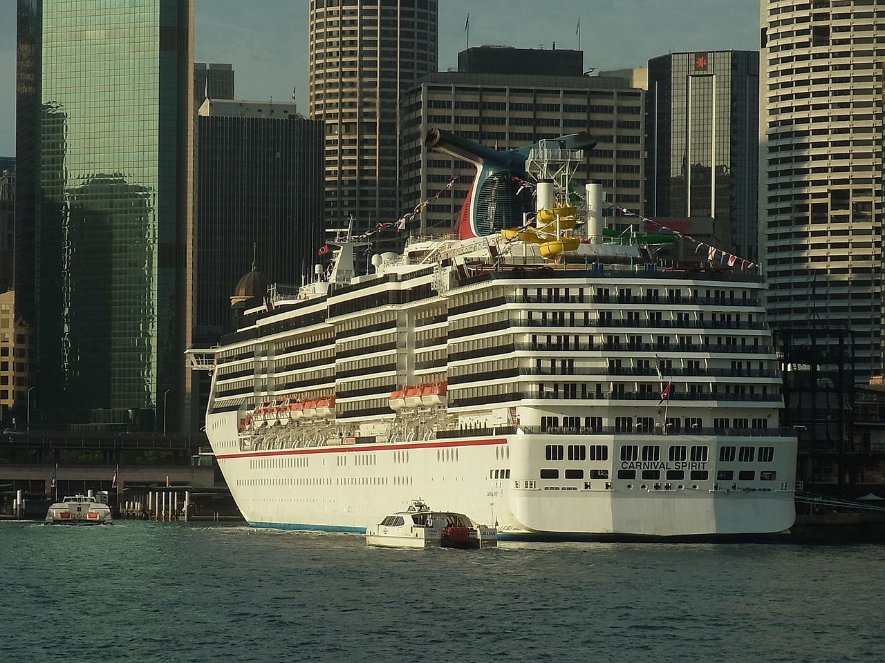
The harbour is heavily embayed. The bays on the south side tend to be wide and rounded, whereas those on the north side are generally narrow inlets. Many of these bays include beaches. The Sydney central business district extends from Circular Quay.
Headlands and peninsulas
East to west, north side:
North Head
Dobroyd Head
Middle Head
Georges Head
Bradleys Head
Cremorne Point
Kurraba Point
Kirribilli
McMahons Point
Balls Head
Berry Island
East to west, south side
South Head
Point Piper
Darling Point
Potts Point
Bennelong Point
Dawes Point
Millers Point
Pyrmont
Balmain
Islands
There are several islands within the harbour, including Shark Island, Clark Island, Fort Denison, Goat Island, Cockatoo Island, Spectacle Island, Snapper Island and Rodd Island. Some other former islands, including Garden Island, Glebe Island and Berry Island, have been linked to the shore by land reclamation, though their names often still contain the word "island". Two other former islands, Bennelong Island and Darling Island, are similarly now linked to the mainland, but rarely mentioned as islands. The former Dawes Island was joined to another small island to create Spectacle Island. Exposed at low tide is Sow and Pigs Reef, a well-known navigation obstacle near the main shipping lane.
Tributaries and waterways
Tank Stream was a freshwater course emptying into Sydney Cove. Today it is little more than a stormwater drain but originally it was the fresh water supply for the fledgling colony of New South Wales. It originated from a swamp to the west of present-day Hyde Park and at high tide entered Sydney Cove at the intersection of Bridge and Pitt Streets.
Middle Harbour is the northern arm of Port Jackson. It begins as a small creek (Middle Harbour Creek) at St Ives. It joins the main waterway between two headlands, Middle Head and Grotto Point Reserve, west of Sydney Heads.
Parramatta River is the western arm of Port Jackson. The river begins at the confluence of Toongabbie Creek and Darling Mills Creek west of Parramatta and joins the main waterway between Greenwich Point, Greenwich, and Robinsons Point, Birchgrove.
Lane Cove River rises near Thornleigh and flows generally south for about 15 kilometres (9.3 mi). Its catchment area is approximately 95.4 square kilometres (36.8 sq mi).
Tarban Creek, a northern tributary of the Parramatta River, enters Port Jackson at Hunters Hill.
Johnstons Creek rises in Stanmore and flows in a generally northward direction, passing through the inner-western suburbs of Forest Lodge, Annandale and Glebe. The creek passes beneath the stands of the now demolished Harold Park Paceway prior to emptying into Rozelle Bay at Bicentennial Park, Glebe. Orphan School Creek is a tributary.
Duck River is a perennial stream and southern tributary of the Parramatta River.
Climate
Port Jackson has a humid subtropical climate (Köppen: Cfa) with warm, somewhat humid summers and mild to cool winters, with moderate rainfall spread throughout the year. Due to its exposed proximity to the Tasman Sea, it is slightly cooler, wetter and windier than Observatory Hill to the west. In addition to featuring the lowest maximum summer temperatures in the Sydney region (averaging just 24.4 °C (75.9 °F)), Port Jackson is also least affected by extreme heat due to frequent sea breezes. Conversely, winter nights are among the warmest in Sydney, and rarely dip below 8.0 °C (46.4 °F), although fog often occurs and may be disruptive.