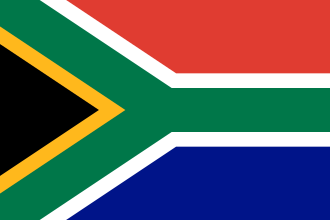
South Africa, officially the Republic of South Africa (RSA), is the southernmost country in Africa. Its nine provinces are bounded to the south by 2,798 kilometres (1,739 miles) of coastline that stretches along the South Atlantic, and Indian Ocean; to the north by the neighbouring countries of Namibia, Botswana, and Zimbabwe
to the east and northeast by Mozambique, and Eswatini, and it encloses Lesotho. Covering an area of 1,221,037 square kilometres (471,445 square miles), the country has a population of over 63 million people, making it the sixth-most populated country in Africa. Pretoria is the administrative capital, while Cape Town, as the seat of Parliament, is the legislative capital, and Bloemfontein is regarded as the judicial capital. The largest and most populous city is Johannesburg, followed by Cape Town and Durban.
Archaeological findings suggest that various hominid species existed in South Africa about 2.5 million years ago, and modern humans inhabited the region over 100,000 years ago. The first known people were the indigenous Khoisan, and Bantu-speaking peoples, who migrated in waves, from west and central Africa to the region 2,000 to 1,000 years ago. In the north, the Kingdom of Mapungubwe formed in the 13th century, and the Venda Kingdom in the 17th century. In 1652, the Dutch established the first European settlement at Table Bay, Dutch Cape Colony. Its invasion in 1795, and the Battle of Blaauwberg in 1806 led to British occupation. The Mfecane, a period of significant upheaval, led to the formation of various African kingdoms, including the Zulu Kingdom. The region was further colonised, and the Mineral Revolution saw a shift towards industrialisation and urbanisation. Following the Second Boer War, the Union of South Africa was created in 1910 after the amalgamation of the Cape, Natal, Transvaal, and Orange River colonies, becoming a republic after the 1961 referendum. The multi-racial Cape Qualified Franchise in the Cape was gradually eroded, and the vast majority of Black South Africans were not enfranchised until 1994.

The National Party imposed apartheid in 1948, institutionalising previous racial segregation. After a struggle by the African National Congress and other anti-apartheid activists, both inside and outside the country, the repeal of discriminatory laws began in the mid-1980s. Universal elections took place in 1994, following which all racial groups have held political representation in the country's liberal democracy, which comprises a parliamentary republic and nine provinces. Recognised as a middle power in international affairs, South Africa maintains significant regional influence and is a member of BRICS+, the African Union (hosting the seat of the Pan-African Parliament), SADC, SACU, the Commonwealth of Nations, and the G20.
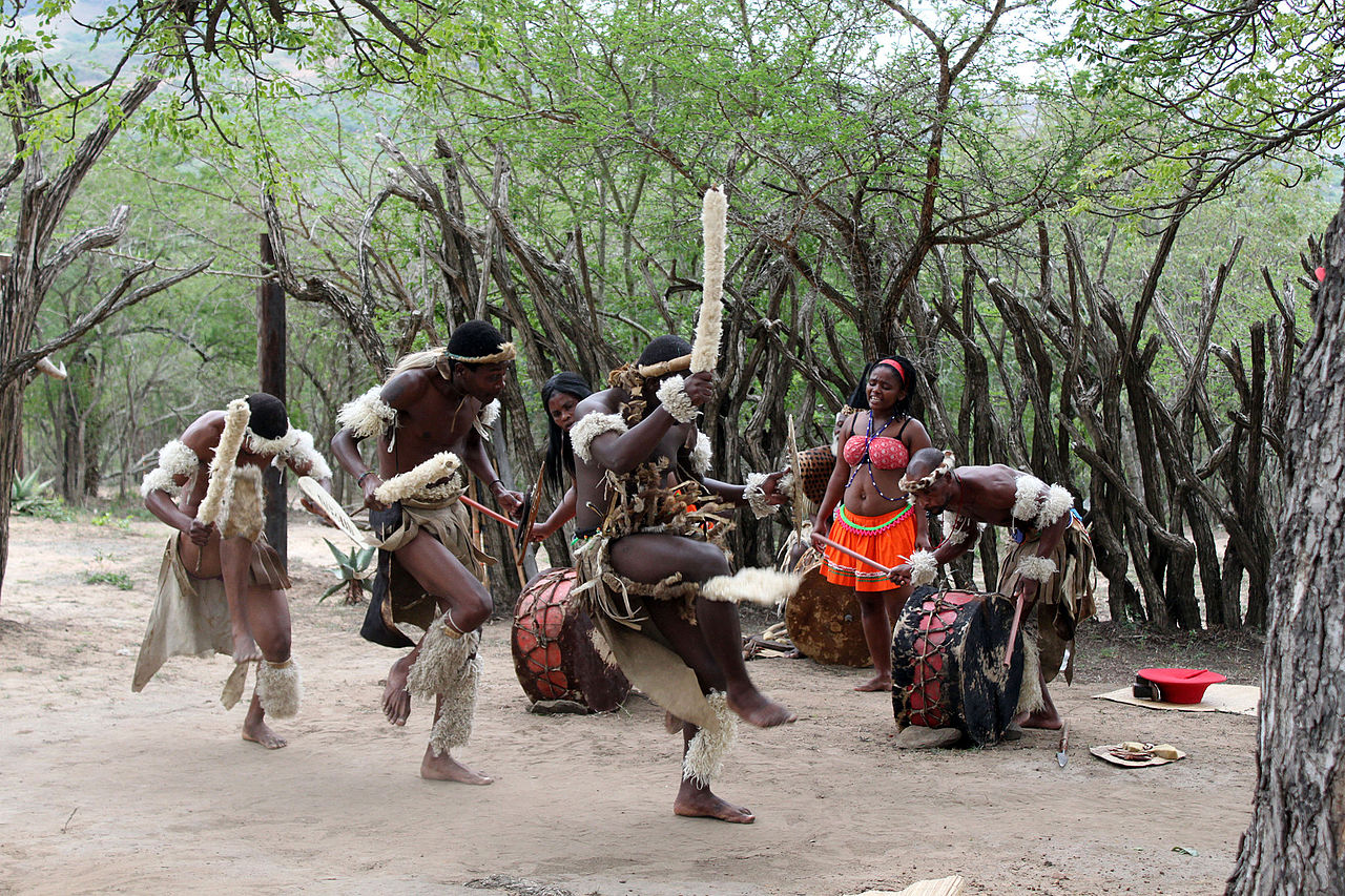
A developing, and newly industrialised country, it has the largest economy in Africa by nominal GDP, is tied with Ethiopia for the most UNESCO World Heritage Sites in Africa, and is a biodiversity hotspot with unique biomes, plant, and animal life. South Africa encompasses a variety of cultures, languages, and religions, and has been called the "rainbow nation", especially in the wake of apartheid, to describe its diversity. Since the end of apartheid, government accountability and quality of life have substantially improved for non-white citizens. However, crime, violence, poverty, and inequality remain widespread, with about 32% of the population unemployed as of 2024, while some 56% lived below the poverty line in 2014. Having the highest Gini coefficient of 0.67, South Africa is considered one of the most economically unequal countries in the world.
Etymology
The name "South Africa" is derived from the country's geographic location at the southern tip of Africa. Upon formation, the country was named the Union of South Africa in English and Unie van Zuid-Afrika in Dutch, reflecting its origin from the unification of four British colonies. Since 1961, the long formal name in English has been the "Republic of South Africa" and Republiek van Suid-Afrika in Afrikaans. The country has an official name in 12 official languages.

Mzansi, derived from the Xhosa noun uMzantsi meaning "south", is a colloquial name for South Africa, while some Pan-Africanist political parties prefer the term "Azania", which is a word originating from Greek, and not an African language.
History
Prehistory
South Africa contains some of the oldest archaeological and human-fossil sites in the world. Archaeologists have recovered extensive fossil remains from a series of caves in Gauteng known as the Cradle of Humankind, which has been declared a UNESCO World Heritage Site. The sites include Sterkfontein, one of the richest sites for hominin fossils in the world, as well as Swartkrans, Gondolin Cave, Kromdraai, Cooper's Cave and Malapa. The first hominin fossil discovered in Africa, the Taung Child, was found near Taung in 1924. Other hominin remains have come from the sites of Makapansgat in Limpopo; Cornelia and Florisbad in the Free State; Border Cave in KwaZulu-Natal; Klasies River Caves in the Eastern Cape; and Pinnacle Point, Elandsfontein and Die Kelders Cave in the Western Cape.
These finds suggest that various hominid species existed in South Africa from about three million years ago, starting with Australopithecus africanus, followed by Australopithecus sediba, Homo ergaster, Homo erectus, Homo rhodesiensis, Homo helmei, Homo naledi and modern humans (Homo sapiens). Modern humans have inhabited Southern Africa for at least 170,000 years. Various researchers have located pebble tools within the Vaal River valley.
Pre-colonial period
The indigenous San and Khoikhoi peoples of Southern Africa were predominantly hunter-gatherers and, in the case of the Khoikhoi, also practised pastoralism. Khoisan peoples may be the descendants of an early dispersal of anatomically modern humans to Southern Africa before 150,000 years ago. They were largely displaced or absorbed by the Bantu expansion which took place between 1,500 and 2,000 years ago.
Bantu settlers expanded from West Africa from approximately 3,000 BCE. Settlements of Bantu-speaking peoples, who were iron-using agriculturists and herdsmen, were present south of the Limpopo River (now the northern border with Botswana and Zimbabwe) by the 4th or 5th century. The earliest ironworks in modern-day KwaZulu-Natal are believed to date from around 1050. The southernmost group was the Xhosa people, whose language incorporates certain linguistic traits from the Khoisan languages, and who eventually reached the Great Fish River in the present-day Eastern Cape. As they migrated, these larger Iron Age populations displaced or assimilated earlier peoples. In Mpumalanga, several stone circles have been found along with a stone arrangement that has been named Adam's Calendar, and the ruins are thought to be created by the Bakone, a Northern Sotho group.
Around 1220, in the Limpopo-Shashe Basin, the elite of K2 moved to settle the flat-topped summit of Mapungubwe Hill, with the population settling below. Rainmaking was crucial to the development of sacral kingship, and several rainmaking sites have been found nearby including Ratho Kroonkop. By 1250, the capital of the Mapungubwe Kingdom had a population of 5,000 and the state covered 30,000 km2 (11,500 square miles), growing wealthy through the Indian Ocean trade. The events around Mapungubwe's collapse circa 1300 are unknown; however, trade routes shifted north from the Limpopo to the Zambezi, precipitating the rise of Great Zimbabwe. The hill was abandoned and Mapungubwe's population scattered.

In the Soutpansberg, interactions between early Shona inhabitants (possible from Mapungubwe), late-comer Shona and Sotho-speakers between the 15th and 17th centuries culminated in the formation of the Venda language and identity. In the late-17th century, a splinter group from the dynasty of the Rozvi Empire migrated south; they were the Singo. The Singo settled at Dzata, which became the capital of the Venda Kingdom, and came to subdue all of the Soutpansberg. In the late-18th century, following trade routes moving south, the state collapsed. The most powerful dynasties that remained were the Ramabulana Singo in the western Soutpansberg, and the Tshivhase Singo and Mphaphuli Singo in the eastern Soutpansberg.
Portuguese exploration
In 1487, the Portuguese explorer Bartolomeu Dias led the first European voyage to land in southern Africa. On 4 December, he landed at Walfisch Bay (now known as Walvis Bay in present-day Namibia). This was south of the furthest point reached in 1485 by his predecessor, the Portuguese navigator Diogo Cão, being Cape Cross, north of the bay. Dias continued down the western coast of southern Africa. After 8 January 1488, prevented by storms from proceeding along the coast, he sailed out of sight of land and passed the southernmost point of Africa without seeing it. He reached as far up the eastern coast of Africa as, what he called, Rio do Infante, probably the present-day Groot River, in May 1488. On his return, he saw the cape, which he named Cabo das Tormentas ('Cape of Storms'). King John II renamed the point Cabo da Boa Esperança, or Cape of Good Hope, as it led to the riches of the East Indies. Dias' feat of navigation was immortalised in Luís de Camões' 1572 epic poem, Os Lusíadas.
In 1497 Vasco Da Gama set sail from Lisbon and became the first European to reach India in 1498 via the Cape of Good Hope, opening up oceanic trade between Europe and Asia. He bypassed the coast of present-day South Africa and made landfall in present-day Mozambique.

Dutch and British colonisation of the Cape
The Dutch first made contact with the coast of Southern Africa in 1595. With Portuguese maritime power declining in the early 17th century, English and Dutch merchants competed to dislodge Portugal's lucrative monopoly on the spice trade. British East India Company representatives sporadically called at the Cape in search of provisions from as early as 1601 but later came to favour Ascension Island and Saint Helena as ports of refuge. Dutch interest was aroused after 1647, when two employees of the Dutch East India Company were shipwrecked at the Cape for several months, and managed to survive by obtaining fresh water and meat from the indigenous peoples, and sowing crops in the fertile soil. Upon their return to Holland, they reported favourably on the Cape's potential as a "warehouse and garden" for provisions to stock passing ships for long voyages.
In 1652, a century and a half after the discovery of the Cape Route, Jan van Riebeeck established a victualling station at the Cape of Good Hope, at what would become Cape Town, on behalf of the Dutch East India Company. In time, the Cape became home to a large population of Free Burghers. Dutch traders also brought thousands of enslaved people to the fledgling colony from present-day Indonesia, Madagascar, and eastern Africa. Some of the earliest mixed race communities in the country were formed between Free Burghers, enslaved people, and indigenous peoples. This led to the development of a new ethnic group, the Cape Coloureds, most of whom adopted the Dutch language and Christian faith. Conflicts over resources between the indigenous Khoisan people and Dutch settlers began in the 17th century and continued for centuries.
Dutch colonists' eastward expansion caused wars with the southwesterly migrating Xhosa nation, as both sides competed for the pastureland near the Great Fish River, which the colonists desired for grazing cattle. Free Burghers who became independent farmers on the frontier were known as Boers, with some (the trekboers) adopting semi-nomadic lifestyles. The Boers formed loose militias, which they termed commandos, and forged alliances with Khoisan peoples to repel Xhosa raids. Both sides launched bloody but inconclusive offensives, and sporadic violence, often accompanied by livestock theft, remained common for several decades.
Great Britain occupied Cape Town between 1795 and 1803 to prevent it from falling under the control of the French First Republic, which had invaded the Low Countries. After briefly returning to Dutch rule under the Batavian Republic in 1803, the Cape was occupied again by the British in 1806. Following the end of the Napoleonic Wars, it was formally ceded to Great Britain and became an integral part of the British Empire. British emigration to South Africa began around 1818, culminating in the arrival of the 1820 Settlers, the purpose of which was primarily to increase the size of the European workforce and bolster frontier regions against Xhosa incursions.
Mfecane and colonial expansion
In the early 1800s, the Mfecane (lit. 'crushing') saw a heightened period of conflict, migration, and state formation among native groups, caused by the complex interplay of international trade, environmental instability, and European colonisation. Chiefdoms grew wealthier and competed over trade routes and grazing land, leading to the formation of the Ndwandwe and Mthethwa Paramountcies in the east of the country. Ndwandwe defeated Mthethwa, which in turn split into several groups, one of which was led by Shaka of the amaZulu. The 1810s saw the fourth and fifth Xhosa Wars as British colonisation expanded. The Ndwandwe Paramountcy splintered amid costly raids, and Shaka's Zulu Kingdom rose to fill the power vacuum. The Gaza Empire concurrently formed, and while the Zulu managed to totally defeat the Ndwandwe, they were repelled by Gaza.
During the early 19th century, many Dutch settlers departed from the Cape Colony, where they had been subjected to British control, in a series of migrant groups who came to be known as Voortrekkers (lit. 'pathfinders' or 'pioneers'). They migrated to the future Natal, Free State, and Transvaal regions, and following their victory over the Zulu Kingdom at the Battle of Blood River on 16 December 1838, founded the Boer republics: the Natalia Republic, the South African Republic and the Orange Free State. In the interior, the Cape Colony expanded at the expense of the Batswana and Griqua, and Boer expansion destabilised the middle Orange River region. The Matabele kingdom came to dominate the eastern interior, and raided the Venda kingdom.
The discovery of diamonds in 1867 and gold in 1884 in the interior initiated the Mineral Revolution, which increased economic growth and immigration and intensified British subjugation of the indigenous peoples. The struggle to control these important economic resources shaped relations between Europeans and the indigenous population, as well as between the Boers and the British.
On 16 May 1876, President Thomas François Burgers of the South African Republic declared war against the Pedi people. King Sekhukhune defeated the army on 1 August 1876, with another attack by the Lydenburg Volunteer Corps being similarly repulsed. On 16 February 1877, the two parties signed a peace treaty at Botshabelo. The Boers' inability to subdue the Pedi led to the departure of Burgers in favour of Paul Kruger and the British annexation of the South African Republic. In 1878 and 1879, three British attacks were successfully repelled until Garnet Wolseley defeated Sekhukhune in November 1879 with an army of 2,000 British soldiers, Boers and 10,000 Swazis.
The Anglo-Zulu War was fought in 1879 between the British and the Zulu Kingdom. Following Lord Carnarvon's successful introduction of federation in Canada, it was thought that similar political effort, coupled with military campaigns, might succeed with the African kingdoms, tribal areas and Boer republics in South Africa. In 1874, Henry Bartle Frere was sent to South Africa as the British High Commissioner to bring such plans into being. Among the obstacles were the presence of the independent states of the Boers, and the Zulu army. The Zulu nation defeated the British at the Battle of Isandlwana but ultimately lost the war, resulting in the termination of its independence.
Boer Wars and independence
The Boer republics successfully resisted British encroachments during the First Boer War (1880–1881) using guerrilla warfare tactics, which were well-suited to local conditions. The British returned with greater numbers, more experience, and new strategy in the Second Boer War (1899–1902) and, although suffering heavy casualties due to Boer attrition warfare, were ultimately successful due in part to scorched earth tactics and concentration camps, in which 27,000 Boer civilians died due to a combination of disease and neglect. South Africa's urban population grew rapidly from the end of the 19th century onward. After the devastation of the wars, Boer farmers fled into Transvaal and Orange Free State cities, many of whom would come to constitute an urban class of "poor whites".
Anti-British policies among white South Africans focused on independence. During the Dutch and British colonial years, racial segregation was mostly informal, though some legislation was enacted to control the settlement and movement of indigenous people, including the Native Location Act of 1879 and the system of pass laws.
Eight years after the end of the Second Boer War, and after four years of negotiation, the South Africa Act 1909 created the Union of South Africa on 31 May 1910, granting the country nominal independence. The union was a dominion that included the former territories of the Cape, Transvaal and Natal colonies, as well as the Orange Free State republic. The Natives Land Act of 1913, which was passed by the British ruling the Parliament of the newly formed Union of South Africa, severely restricted the ownership of land by black South Africans, who at that stage controlled only 7% of the country. The amount of land reserved for indigenous peoples was later marginally increased.
In 1931, the union became fully sovereign from the United Kingdom with the passage of the Statute of Westminster, which abolished the last powers of the Parliament of the United Kingdom to legislate in the country. In 1934, the South African Party and National Party merged to form the United Party, seeking reconciliation between Afrikaners and English-speaking whites. In 1939, the party split over the entry of the Union into World War II as an ally of the United Kingdom, a move which National Party followers opposed.
Apartheid era
In 1948, the National Party was elected to power. It strengthened the racial segregation begun under Dutch and British colonial rule. Taking Canada's Indian Act as a framework, the nationalist government classified all peoples into three races (being "Whites", "Blacks", and "Indians and Coloured people") and developed rights and limitations for each. The white-led minoritarian government instituted a policy of legally institutionalised segregation which came to be known as apartheid. While whites enjoyed a higher standard of living comparable to First World Western nations, the black majority remained disadvantaged by almost every standard, including income, education, housing, and life expectancy. The Freedom Charter, adopted in 1955 by the Congress Alliance, which was multi-racial in makeup, demanded a non-racial society and an end to discrimination.
On 31 May 1961, the country became a republic following a referendum (only open to white voters) which narrowly passed; the British-dominated Natal province largely voted against the proposal. Elizabeth II lost the title Queen of South Africa, and the last Governor-General, Charles Robberts Swart, became state president. As a concession to the Westminster system, the appointment of the president remained by parliament, and the position was virtually powerless until P. W. Botha's Constitution Act of 1983, which eliminated the office of prime minister and instated a unique "strong presidency" responsible to parliament. Pressured by other Commonwealth of Nations countries, South Africa withdrew from the organisation in 1961.
Despite opposition to apartheid both within and outside the country from all racial backgrounds, the government legislated for a continuation of apartheid. The security forces cracked down on internal dissent, and violence became widespread, with anti-apartheid organisations such as the African National Congress (ANC), the Azanian People's Organisation, and the Pan-Africanist Congress carrying out guerrilla warfare, urban sabotage and, according to Oxford Academic, acts of terrorism. The three rival resistance movements also engaged in occasional inter-factional clashes as they jockeyed for domestic influence. Apartheid became increasingly controversial, and several countries began to boycott business with the South African government because of its racial policies. The boycotts and restrictions were later extended to international sanctions and the divestment of holdings by foreign investors.
Post-apartheid
The Mahlabatini Declaration of Faith, signed by Mangosuthu Buthelezi and Harry Schwarz in 1974, enshrined the principles of peaceful transition of power and equality for all, the first of such agreements by black and white political leaders in South Africa. Ultimately, F.W. de Klerk opened bilateral discussions with Nelson Mandela in 1993 for a transition of policies and government.
In 1990, the National Party government took the first step towards dismantling apartheid when it lifted the ban on the ANC and other political organisations. It released Nelson Mandela from prison after 27 years of serving a sentence for sabotage and treason. A negotiation process followed. With approval from the white electorate in a 1992 referendum, the government continued negotiations to end apartheid. South Africa held its first universal elections in 1994, which the ANC won by an overwhelming majority. The country rejoined the Commonwealth of Nations and became a member of the Southern African Development Community.
The post-apartheid period, whilst plagued by high unemployment and increasing income inequality, has been characterised by relative political stability. The country has, however, seen periodic outbreaks of violence, most notably the 2008 xenophobic riots — during which over 60 people were killed, and an estimated 100,000 people were driven from their homes — and the Marikana massacre, which constituted the most lethal use of force by South African security forces against civilians since the Soweto uprising. Widespread political corruption and state capture took place under the presidency of Jacob Zuma, whose brief imprisonment for contempt of court during the course of his trial for corruption in 2021 led to widespread unrest which left 354 people dead.
The electoral dominance of the ANC has gradually declined since the early 2000s, with the party failing to secure a parliamentary majority for the first time in the 2024 general election. President Cyril Ramaphosa subsequently formed the Government of National Unity with, amongst others, the Democratic Alliance.
Geography
South Africa is in southern Africa, with a coastline that stretches more than 2,500 km (1,553 mi) and along two oceans — the South Atlantic and the Indian Ocean. At 1,219,912 km2 (471,011 sq mi) in area, South Africa is the 24th-largest country in the world. Excluding the Prince Edward Islands, the country lies between latitudes 22° and 35°S, and longitudes 16° and 33°E. The interior of South Africa consists of a large, and in most places almost flat, plateau with an altitude of between 1,000 m (3,300 ft) and 2,100 m (6,900 ft). It is highest in the east and slopes gently downwards towards the west and north, and slightly to the south and south-west. This plateau is surrounded by the Great Escarpment whose eastern, and highest, stretch is known as the Drakensberg. Mafadi in the Drakensberg is the highest peak in the country at 3,450 m (11,320 ft) above sea level. The KwaZulu-Natal–Lesotho international border is formed by the highest portion of the Great Escarpment which reaches an altitude of over 3,000 m (9,800 ft).
The south and south-western parts of the plateau (at approximately 1,100–1,800 m above sea level) and the adjoining plain below (at approximately 700–800 m above sea level – see map on the right) are together known as the Great Karoo, which consists of sparsely populated shrubland. To the north, the Great Karoo fades into the more arid Bushmanland, which eventually becomes the Kalahari Desert in the north-west of the country. The mid-eastern and highest part of the plateau is known as the Highveld. This relatively well-watered area is home to a great proportion of the country's commercial farmlands and contains its largest conurbation, Gauteng. To the north of the Highveld, from about the 25° 30' S line of latitude, the plateau slopes downwards into the Bushveld, which ultimately gives way to the Limpopo River lowlands, the Lowveld.
The coastal belt, below the Great Escarpment, moving clockwise from the northeast, consists of the Limpopo Lowveld, which merges into the Mpumalanga Lowveld, below the Mpumalanga Drakensberg (the eastern portion of the Great Escarpment). This is hotter, drier and less intensely cultivated than the Highveld above the escarpment. The Kruger National Park, located in the provinces of Limpopo and Mpumalanga in north-eastern South Africa, occupies a large portion of the Lowveld, covering 19,633 square kilometres (7,580 sq mi)
The coastal belt below the south and south-western stretches of the Great Escarpment contains several ranges of Cape Fold Mountains which run parallel to the coast, separating the Great Escarpment from the ocean. The land between the Outeniqua and Langeberg ranges to the south and the Swartberg range to the north is known as the Little Karoo, which consists of semi-desert shrubland similar to that of the Great Karoo, except that its northern strip along the foothills of the Swartberg Mountains has a somewhat higher rainfall and is, therefore, more cultivated than the Great Karoo.
The Little Karoo is famous for its ostrich farming around Oudtshoorn. The lowland area to the north of the Swartberg range up to the Great Escarpment is the lowland part of the Great Karoo, which is climatically and botanically almost indistinguishable from the Karoo above the Great Escarpment. The narrow coastal strip between the Outeniqua and Langeberg ranges and the ocean, known as the Garden Route, has a moderately high year-round rainfall, and hosts the most extensive area of forest in the country.
In the south-west corner of the country, the Cape Peninsula forms the southernmost tip of the coastal strip which borders the Atlantic Ocean and ultimately terminates at the country's border with Namibia at the Orange River. The Cape Peninsula has a Mediterranean climate, making it and its immediate surrounds the only portion of Sub-Saharan Africa which receives most of its rainfall in winter.
The coastal belt to the north of the Cape Peninsula is bounded on the west by the Atlantic Ocean and the first row of north–south running Cape Fold Mountains to the east. The Cape Fold Mountains peter out at about the 32° S line of latitude, after which the Great Escarpment bounds the coastal plain. The most southerly portion of this coastal belt is known as the Swartland and Malmesbury Plain, which is an important wheat-growing region, relying on winter rains. The region further north is known as Namaqualand, which becomes more arid near the Orange River. The little rain that falls tends to fall in winter, which results in one of the world's most spectacular displays of flowers carpeting huge stretches of veld in spring (August–September).
South Africa also has one offshore possession, the small sub-Antarctic archipelago of the Prince Edward Islands, consisting of Marion Island (290 km2 or 110 sq mi) and Prince Edward Island (45 km2 or 17 sq mi).
Climate
South Africa has a generally temperate climate because it is surrounded by the Atlantic and Indian Oceans on three sides, because it is located in the climatically milder Southern Hemisphere, and because its average elevation rises steadily toward the north (toward the equator) and further inland. This varied topography and oceanic influence result in a great variety of climatic zones. The climatic zones range from the extreme desert of the southern Namib in the farthest northwest to the lush subtropical climate in the east along the border with Mozambique and the Indian Ocean. Winters in South Africa occur between June and August. The extreme southwest has a climate similar to that of the Mediterranean with wet winters and hot, dry summers, hosting the famous fynbos biome of shrubland and thicket. This area produces much of the wine in South Africa and is known for its wind, which blows intermittently almost all year. The severity of this wind made passing around the Cape of Good Hope particularly treacherous for sailors, causing many shipwrecks. Further east on the south coast, rainfall is distributed more evenly throughout the year, producing a green landscape. The annual rainfall increases south of the Lowveld, especially near the coast, which is subtropical. The Free State is particularly flat because it lies centrally on the high plateau. North of the Vaal River, the Highveld becomes better watered and does not experience subtropical extremes of heat. Johannesburg, in the centre of the Highveld, is at 1,740 m (5,709 ft) above sea level and receives an annual rainfall of 760 mm (29.9 in). Winters in this region are cold, although snow is rare.
The coldest place on mainland South Africa is Buffelsfontein in the Eastern Cape, where a temperature of −20.1 °C (−4.2 °F) was recorded in 2013. The Prince Edward Islands have colder average annual temperatures, but Buffelsfontein has colder extremes. The deep interior of mainland South Africa has the hottest temperatures: a temperature of 51.7 °C (125.06 °F) was recorded in 1948 in the Northern Cape Kalahari near Upington, but this temperature is unofficial and was not recorded with standard equipment; the official highest temperature is 48.8 °C (119.84 °F) at Vioolsdrif in January 1993.
Climate change in South Africa is leading to increased temperatures and rainfall variability. Extreme weather events are becoming more prominent. This is a critical concern for South Africans as climate change will affect the overall status and wellbeing of the country, for example with regards to water resources. Speedy environmental changes are resulting in clear effects on the community and environmental level in different ways and aspects, starting with air quality, to temperature and weather patterns, reaching out to food security and disease burden. According to computer-generated climate modelling produced by the South African National Biodiversity Institute, parts of southern Africa will see an increase in temperature by about 1 °C (1.8 °F) along the coast to more than 4 °C (7.2 °F) in the already hot hinterland such as the Northern Cape in late spring and summertime by 2050. The Cape Floral Region is predicted to be hit very hard by climate change. Drought, increased intensity and frequency of fire, and climbing temperatures are expected to push many rare species towards extinction. South Africa has published two national climate change reports in 2011 and 2016. South Africa contributes considerable carbon dioxide emissions, being the 14th largest emitter of carbon dioxide, primarily from its heavy reliance on coal and oil for energy production. As part of its international commitments, South Africa has pledged to peak emissions between 2020 and 2025.
Biodiversity
South Africa signed the Rio Convention on Biological Diversity on 4 June 1994 and became a party to the convention on 2 November 1995. It has subsequently produced a National Biodiversity Strategy and Action Plan, which was received by the convention on 7 June 2006. The country is ranked sixth out of the world's seventeen megadiverse countries. Ecotourism in South Africa has become more prevalent in recent years, as a possible method of maintaining and improving biodiversity.