
Kansas City, abbreviated KC or KCMO, is the largest city in the U.S. state of Missouri by both population and area. It is located on the Missouri River at its confluence with the Kansas River, within Jackson, Clay, Platte and Cass counties. It is the 37th-most populous city in the United States and sixth-most populous city in the Midwest, with a population of 508,090 at the 2020 census. The Kansas City metropolitan area, which straddles the Missouri–Kansas state line, is the 31st-most populous metropolitan area in the nation, at 2.25 million residents.
Kansas City was founded in the 1830s as a port on the Missouri and Kansas rivers. On June 1, 1850, the town of Kansas was incorporated; soon afterwards, a region designated as the Kansas Territory was established. Confusion between the city and the territory of Kansas ensued, so the name Kansas City was assigned to distinguish the city from the territory. The city's growth was closely tied to westward expansion, as railroads and the Kansas City Stockyards established it as a major transportation and livestock center.
Situated along Missouri's western border with Kansas, Kansas City encompasses 319.03 square miles (826.3 km2), making it the 25th-largest U.S. city by area. It is one of the two county seats of Jackson County, alongside Independence. The city is known for landmarks and districts including the River Market, 18th and Vine, and Country Club Plaza. It is internationally recognized for Kansas City jazz, its extensive system of fountains, the Kansas City Chiefs and Kansas City Royals sports franchises, and regional cuisine including Kansas City–style barbecue and strip steak.

History
The town of Kansas, Missouri, was incorporated on June 1, 1850, reincorporated and renamed "City of Kansas" on March 28, 1853, and renamed "Kansas City" in 1889. The Kansas City metropolitan area straddles the border between Missouri and Kansas at Kaw Point, and was considered a good place to settle. The Antioch Christian Church, Dr. James Compton House, and Woodneath are listed on the National Register of Historic Places.
Indigenous peoples and settlement
In past centuries, the area's tribal inhabitants include the Hopewell tradition, Mississippian culture, Kansa, Osage, Otoe, and Missouri. The first documented European visitor to the eventual site of Kansas City was French military officer Étienne de Veniard, Sieur de Bourgmont, who was also the first European to explore the lower Missouri River. Criticized for his response to the Native American attack on Fort Détroit, he had deserted his post as fort commander and was avoiding French authorities. Bourgmont lived with a Native American wife in a village about 90 miles (140 km) east near Brunswick, Missouri, where he illegally traded furs.
To clear his name, he wrote Exact Description of Louisiana, of Its Harbors, Lands and Rivers, and Names of the Indian Tribes That Occupy It, and the Commerce and Advantages to Be Derived Therefrom for the Establishment of a Colony in 1713 and The Route to Be Taken to Ascend the Missouri River in 1714. In the documents, he describes the junction of the "Grande Riv[ière] des Cansez" and Missouri River, as the first adoption of those names. French cartographer Guillaume Delisle used the descriptions to make the area's first reasonably accurate map.

The Spanish took over the region in the Treaty of Paris in 1763, but were not to play a major role other than taxing and licensing Missouri River ship traffic. The French continued their fur trade under Spanish license, before France reclaimed the territory in 1800. Then, after the 1803 Louisiana Purchase, explorers Lewis and Clark visited the confluence of the Kansas and Missouri rivers on their way to the Pacific West, in June 1804, and on their return, in September 1806. Clark noted it had "a Commanding Situation" to build a fort.
In 1821, the French Chouteau fur-trading family, active in St. Louis as early as 1765, reached the location of what would become Kansas City. There, François Chouteau established a trading post consisting of warehouses and dwellings, dubbed "Chouteau's Landing", the first permanent settlement of the site. The settlement changed locations several times due to floods but the Chouteau family, along with the French Canadian trappers, traders and voyageurs that had come with them, remained in the area.
With successive treaties and the 1830 national Indian Removal Act, tribes originally living in Missouri were progressively forced to move west, to Kansas and further, accelerating the settlement of the Kansas City area by whites.
In 1831, a group of Mormons from New York state led by Joseph Smith settled in the area. They built the first school within what became Kansas City, but were forced out by mob violence in 1833. In 1831, Gabriel Prudhomme Sr., a Canadian trapper and partner of François Chouteau, purchased 257 acres (104 ha) fronting the Missouri River. He established a home for his wife, Josephine, and six children, and operated a ferry on the river.
In 1833, John Calvin McCoy, son of Baptist missionary Isaac McCoy and brother-in-law of Johnston Lykins, established West Port along the Santa Fe, Oregon and California trails, three miles (4.8 kilometers) south of the river. In 1834, McCoy established Westport Landing on a rocky ledge situated on a bend in the Missouri, to serve as a landing point for West Port, with Lykins as the first postmaster. He found it more convenient to have his goods offloaded at the Prudhomme landing, next to Chouteau's landing, than in Independence. Following the same route as emigrants and gold seekers headed toward the Pacific Coast, Sante Fe traders shipped goods up the Missouri river by steamboat to Westport before continuing West by land.
On the year of Gabriel Prudhomme's death, a group of fourteen investors purchased his land at auction on November 14, 1838, for $4,220. By 1839, the investors divided the property and the first lots were sold in 1846, after legal complications were settled. The remaining lots were sold by February 1850.
Founding and westward expansion
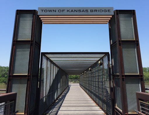
On June 3, 1850, the landing area was incorporated as the town of Kansas, Missouri, named after the nearby native tribe. By that time, the towns of Kansas, Westport, and nearby Independence, had become critical points in the westward expansion of the United States. Three major trails – the Santa Fe, California, and Oregon – all passed through Jackson County.
On February 22, 1853, Kansas was reincorporated and renamed the City of Kansas with its first elected mayor, William Samuel Gregory. Due to a legal discovery of living outside city boundaries, he was soon succeeded by Johnston Lykins as the second (but first legally elected) mayor. The city had an area of 0.70 square miles (1.8 km2) and a population of 2,500. The boundary lines extended from the middle of the Missouri River south to what is now Ninth Street, and from Bluff Street on the west to a point between Holmes Road and Charlotte Street on the east.
During the American Civil War, the city and its immediate surroundings were the focus of intense military activity. Although the First Battle of Independence in August 1862 resulted in a Confederate States Army victory, the Confederates were unable to leverage their win in any significant fashion, as Kansas City was occupied by Union troops and proved too heavily fortified to assault. The Second Battle of Independence, which occurred on October 21–22, 1864, as part of Sterling Price's Missouri expedition of 1864, also resulted in a Confederate triumph. Once again their victory proved hollow, as Price was decisively defeated in the pivotal Battle of Westport the next day, effectively ending Confederate efforts to regain Missouri.

General Thomas Ewing, Jr., in response to a successful raid on nearby Lawrence, Kansas, led by William Quantrill, issued General Order No. 11, forcing the eviction of residents in four western Missouri counties – including Jackson – except those living in the city and nearby communities and those whose allegiance to the Union was certified by Ewing.
Late 19th and early 20th centuries
After the Civil War, Kansas City grew rapidly. The selection of the city over Leavenworth, Kansas, for the Hannibal and St. Joseph Railroad bridge over the Missouri River brought significant growth. The population exploding after 1869, when Hannibal Bridge, designed by Octave Chanute, opened. The boom prompted a name change to Kansas City in 1889, and the city limits to be extended south and east. Westport became part of Kansas City on December 2, 1897. In 1900, Kansas City was the 22nd largest city in the country, with a population of 163,752 residents.
Landscape architect George Kessler shaped Kansas City into a leading example of the City Beautiful movement, with a network of boulevards and parks. New neighborhoods like Southmoreland and the Rockhill District were conceived to accommodate the city's largest residencies of palatial proportions.

The obsolescence of Union Depot in West Bottoms in favor of the new Union Station in 1914, and the opening of the Liberty Memorial in 1923, provided two of the city's most identifiable landmarks. Robert A. Long, president of the Liberty Memorial Association, was a driving force in the funding for construction. Long was a longtime resident and wealthy businessman. He built the R. A. Long Building for the Long-Bell Lumber Company, his home, Corinthian Hall (now the Kansas City Museum) and Longview Farm. Further spurring Kansas City's growth was the opening of the innovative Country Club Plaza development by J. C. Nichols in 1925, as part of his Country Club District plan.
In 1911, Elias Disney moved his family from Marceline to Kansas City. They lived in a new home at 3028 Bellefontaine with a garage he built, in which Walt Disney made his first animation. In 1919, Walt returned from France where he had served as a Red Cross ambulance driver in World War I. He started the first animation company in Kansas City, Laugh-O-Gram Studio, in which he designed Mickey Mouse. When the company went bankrupt, Walt Disney moved to Hollywood and started The Walt Disney Company on October 16, 1923.
The Kansas City streetcar system once had hundreds of miles of streetcars running through the city and was one of the largest systems in the country. In 1903 the 8th Street Tunnel was built as an underground streetcar system through the city. The last run of the streetcar was on June 23, 1957, but the tunnel still exists.
Pendergast political machine
At the start of the 20th century, political machines gained clout in the city, with the one led by Tom Pendergast dominating the city by 1925. Several important buildings and structures were built during this time, including the Kansas City City Hall and the Jackson County Courthouse. During this time, he aided one of his nephew's friends, Harry S. Truman, in a political career. Truman eventually became a senator, then vice president, then president. The machine fell in 1939 when Pendergast, riddled with health problems, pleaded guilty to tax evasion after long federal investigations. His biographers have summed up his uniqueness:
Pendergast may bear comparison to various big-city bosses, but his open alliance with hardened criminals, his cynical subversion of the democratic process, his monarchistic style of living, his increasingly insatiable gambling habit, his grasping for a business empire, and his promotion of Kansas City as a wide-open town with every kind of vice imaginable, combined with his professed compassion for the poor and very real role as city builder, made him bigger than life, difficult to characterize.
Mid- to late 20th century
Troost Avenue was once the eastern edge of Kansas City, Missouri and a residential corridor nicknamed Millionaire Row. It is now widely seen as one of the city's most prominent racial and economic dividing lines due to urban decay, which was caused by white flight. During the civil rights era the city blocked people of color from moving to homes west of Troost Avenue, causing the areas east of Troost to have one of the worst murder rates in the country. This led to the dominating economic success of neighboring Johnson County.
In 1950, African Americans represented 12.2% of Kansas City's population. The city's most populous ethnic group, non-Hispanic whites, declined from 89.5% in 1930 to 54.9% in 2010.
In 1940, the city had about 400,000 residents; by 2000, it had about 440,000. From 1940 to 1960, the city more than doubled its physical size, while increasing its population by only about 75,000. By 1970, the city covered approximately 316 square miles (820 km2), more than five times its size in 1940. Aggressively annexing the surrounding suburbs and undeveloped land spared Kansas City from the severe population loss suffered by cities like St. Louis and Detroit, similar cities which both lost over 50% of their population in the postwar era. In the most neglected neighborhoods, however, the same pattern of abandonment occurred and left behind massive numbers of vacant lots and abandoned homes, especially in the areas east of Troost.
The Hyatt Regency walkway collapse was a major disaster that occurred on July 17, 1981, killing 114 people and injuring more than 200 others during a tea dance in the 45-story Hyatt Regency hotel in Crown Center. It is the deadliest structural collapse in US history other than the September 11 attacks. In 2015 a memorial called the Skywalk Memorial Plaza was built for the families of the victims of the disaster, across the street from the hotel which is now a Sheraton.
21st century
In the 21st century, the Kansas City area has undergone extensive redevelopment, with more than $6 billion in improvements to the downtown area on the Missouri side. One of the main goals is to attract convention and tourist dollars, office workers, and residents to downtown KCMO. Among the projects include the redevelopment of the Power & Light District into a retail and entertainment district; and the Sprint Center, an 18,500-seat arena that opened in 2007, funded by a 2004 ballot initiative involving a tax on car rentals and hotels, designed to meet the stadium specifications for a possible future NBA or NHL franchise, and was renamed T-Mobile Center in 2020; Kemper Arena, which was functionally superseded by Sprint Center, fell into disrepair and was sold to private developers. By 2018, the arena was being converted to a sports complex under the name Hy-Vee Arena. The Kauffman Performing Arts Center opened in 2011 providing a new, modern home to the KC Orchestra and Ballet. In 2015, an 800-room Hyatt Convention Center Hotel was announced for a site next to the Performance Arts Center & Bartle Hall. Construction was scheduled to start in early 2018 with Loews as the operator.
From 2007 to 2017, downtown residential population in Kansas City quadrupled and continues to grow. The area has grown from almost 4,000 residents in the early 2000s to nearly 30,000 as of 2017. Kansas City's downtown ranks as the sixth-fastest-growing downtown in America with the population expected to grow by more than 40% by 2022. Conversions of office buildings such as the Power & Light Building and the Commerce Bank Tower into residential and hotel space has helped to fulfill the demand. New apartment complexes like One, Two, and Three Lights, River Market West, and 503 Main have begun to reshape Kansas City's skyline. Strong demand has led to occupancy rates in the upper 90%.
The residential population of downtown has boomed, and the office population has dropped significantly from the early 2000s to the mid-2010s. Top employers like AMC moved their operations to modern office buildings in the suburbs. High office vacancy plagued downtown, leading to the neglect of many office buildings. By the mid-2010s, many office buildings were converted to residential uses and the Class A vacancy rate plunged to 12% in 2017. Swiss Re, Virgin Mobile, AutoAlert, and others have begun to move operations to downtown Kansas City from the suburbs and expensive coastal cities.
The area has seen additional development through various transportation projects, including improvements to the Grandview Triangle, which intersects Interstates 435 and 470, and U.S. Route 71. In July 2005, the Kansas City Area Transportation Authority (KCATA) launched Kansas City's first bus rapid transit line, the Metro Area Express (MAX), which links the River Market, downtown, Union Station, Crown Center and the Country Club Plaza. The KCATA continues to expand MAX with additional routes on Prospect Avenue, Troost Avenue, and Independence Avenue.
In 2013, construction began on a two-mile streetcar line in downtown Kansas City (funded by a $102 million ballot initiative that was passed in 2012) that runs between the River Market and Union Station, it began operation in May 2016. In 2017, voters approved the formation of a TDD to expand the streetcar line south 3.5 miles from Union Station to UMKC's Volker Campus. Additionally in 2017, the KC Port Authority began engineering studies for a Port Authority funded streetcar expansion north to Berkley Riverfront Park. Citywide, voter support for rail projects continues to grow with numerous light rail projects in the works.
In 2016, Jackson County, Missouri, acquired unused rail lines as part of a long-term commuter rail plan. For the time being, the line is being converted to a trail while county officials negotiate with railroads for access to tracks in downtown Kansas City. On November 7, 2017, Kansas City voters overwhelmingly approved a new single terminal at Kansas City International Airport by a 75% to 25% margin. The new single terminal replaced the three existing "Clover Leafs" at KCI Airport on February 28, 2023.
Geography
The city has an area of 319.03 square miles (826.28 km2), of which, 314.95 square miles (815.72 km2) is land and 4.08 square miles (10.57 km2) is water. Bluffs overlook the rivers and river bottom areas. Kansas City proper is bowl-shaped and is surrounded to the north and south by glacier-carved limestone and bedrock cliffs. Kansas City is at the confluence between the Dakota and Minnesota ice lobes during the maximum late Independence glaciation of the Pleistocene epoch. The Kansas and Missouri rivers cut wide valleys into the terrain when the glaciers melted and drained. A partially filled spillway valley crosses the central city. This valley is an eastward continuation of the Turkey Creek Valley. It is the closest major city to the geographic center of the contiguous United States, or "Lower 48".
Cityscape
Kansas City comprises more than 240 neighborhoods, some with histories as independent cities or as the sites of major events.
Architecture
The Nelson-Atkins Museum of Art opened its Euro-Style Bloch addition in 2007, and the Safdie-designed Kauffman Center for the Performing Arts opened in 2011. The Power and Light Building is influenced by the Art Deco style and sports a glowing sky beacon. The new world headquarters of H&R Block is a 20-story all-glass oval bathed in a soft green light. The four industrial artworks atop the support towers of the Kansas City Convention Center (Bartle Hall) were once the subject of ridicule, but now define the night skyline near the T-Mobile Center along with One Kansas City Place (Missouri's tallest office tower), the KCTV-Tower (Missouri's tallest freestanding structure) and the Liberty Memorial, a World War I memorial and museum that flaunts simulated flames and smoke billowing into the night skyline. It was designated as the National World War I Museum and Memorial in 2004 by the United States Congress. Kansas City is home to significant national and international architecture firms including ACI Boland, BNIM, 360 Architecture, HNTB, Populous. Frank Lloyd Wright designed two private residences and Community Christian Church there.
Kansas City hosts more than 200 working fountains, especially on the Country Club Plaza. Designs range from French-inspired traditional to modern. Highlights include the Black Marble H&R Block fountain in front of Union Station, which features synchronized water jets; the Nichols Bronze Horses at the corner of Main and J.C. Nichols Parkway at the entrance to the Plaza Shopping District; and the fountain at Hallmark Cards World Headquarters in Crown Center.
City Market
Since its inception in 1857, City Market has been one of the largest and most enduring public farmers' markets in the American Midwest, linking growers and small businesses to the community. More than 30 full-time merchants operate year-round and offer specialty foods, fresh meats and seafood, restaurants and cafes, floral, and home accessories. The City Market has the Arabia Steamboat Museum, which houses artifacts from a steamboat that sank near Kansas City in 1856.
Downtown
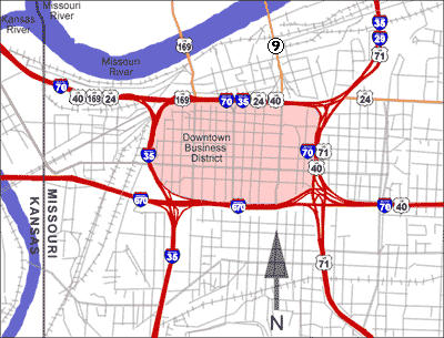
Downtown Kansas City is 2.9 square miles (7.5 km2) bounded by the Missouri River to the north, 31st Street to the south, Troost Avenue to the east, and State Line Road to the west. Areas near Downtown Kansas City include the 39th Street District, which is known as Restaurant Row, and features one of Kansas City's largest selections of independently owned restaurants and boutique shops. It is a center of literary and visual arts, and bohemian culture. Crown Center is the headquarters of Hallmark Cards and a major downtown shopping and entertainment complex. It is connected to Union Station by a series of covered walkways. The Country Club Plaza, or "the Plaza", is an upscale, outdoor shopping, and entertainment district. It is the first suburban shopping district in the United States, designed to accommodate shoppers arriving by automobile, and is surrounded by apartments and condominiums, including several high rise buildings. The associated Country Club District to the south includes the Sunset Hill and Brookside neighborhoods, and is traversed by Ward Parkway, a landscaped boulevard known for its statuary, fountains, and large, historic homes. Union Station is home to Science City, restaurants, shopping, theaters, and the city's Amtrak facility.
After years of neglect and seas of parking lots, Downtown Kansas City is undergoing a period of change with over $6 billion in development since 2000. Many residential properties recently have been or are under redevelopment in three surrounding warehouse loft districts and the Central Business District. The Power & Light District, a new, nine-block entertainment district comprising numerous restaurants, bars, and retail shops, was developed by the Cordish Company of Baltimore. Its first tenant opened on November 9, 2007. It is anchored by the T-Mobile Center, a 19,000-seat sports and entertainment complex.
Climate
Kansas City is in the Midwestern United States, near the geographic center of the country, at the confluence of the Missouri and Kansas rivers. The city lies in either the humid continental zone when using the 32 °F (0 °C) isotherm, or in the humid subtropical zone when using the 27 °F (−3 °C) isotherm. The city experiences roughly 104 air frosts on average per annum. The city is part of USDA plant hardiness zones 5b and 6a. In the center of North America, far removed from a significant body of water, there is significant potential for extreme hot and cold swings throughout the year. The warmest month is July, with a 24-hour average temperature of 81.0 °F (27.2 °C). The summer months are hot and humid, with moist air riding up from the Gulf of Mexico, and high temperatures surpass 100 °F (38 °C) on 5.6 days of the year, and 90 °F (32 °C) on 47 days. The coldest month of the year is January, with an average temperature of 31.0 °F (−0.6 °C). Winters are cold, with 22 days where the high temperature is at or below 32 °F (0 °C) and 2.5 nights with a low at or below 0 °F (−18 °C). The official record highest temperature is 113 °F (45 °C), set on August 14, 1936, at Downtown Airport, while the official record lowest is −23 °F (−31 °C), set on December 22 and 23, 1989. Normal seasonal snowfall is 13.4 inches (34 cm) at Downtown Airport and 18.8 in (48 cm) at Kansas City International Airport. The average window for freezing temperatures is October 31 to April 4, while for measurable (0.1 in or 0.25 cm) snowfall, it is November 27 to March 16 as measured at Kansas City International Airport. Precipitation, both in frequency and total accumulation, shows a marked uptick in late spring and summer.
Kansas City is located in Tornado Alley, a broad region where cold air from Canada collides with warm air from the Gulf of Mexico, leading to the formation of powerful storms, especially during the spring. The Kansas City metropolitan area has experienced several significant outbreaks of tornadoes in the past, including the 1957 Ruskin Heights tornado, the 2019 Lawrence–Linwood tornado and the May 2003 tornado outbreak sequence. The region can also experience ice storms during the winter, such as the 2002 ice storm during which hundreds of thousands of residents lost power for days or weeks. Kansas City and its outlying areas are also subject to flooding, including the Great Floods of 1844, 1951, and 1993.
Demographics
The Latino/Hispanic population of Kansas City, which is heavily Mexican and Central American, is spread throughout the metropolitan area, with some concentration in the northeast part of the city and southwest of downtown. The Asian population, mostly Southeast Asian, is partly concentrated within the northeast side to the Columbus Park neighborhood in the Greater Downtown area, a historically Italian American neighborhood, the UMKC area and in River Market, in northern Kansas City.
The historic (pre-World War II) city of Kansas City contains roughly 58 square miles (150 km2) and has a population density of about 5,000 inhabitants per square mile (1,900/km2). Its borders are the Missouri River on the north (save for a small community named Harlem and Charles B. Wheeler Downtown Airport on the river's north bank), 79th Street on the south, the Blue River on the east, and State Line Road on the west. From the 1950s to the 1970s, Kansas City annexed large amounts of land, most of which remain largely undeveloped.
Between the 2000 and 2010 census counts, the urban core of Kansas City continued to drop significantly in population. The areas of Greater Downtown in the center city, and sections near I-435 and I-470 in the south, and Highway 152 in the north are the only areas of Kansas City, Missouri, to have an increase in population, with the Northland population growing the most. Even so, the population of Kansas City as a whole from 2000 to 2010 increased by 4.1%.
In February 2022, the city had an estimated 3,000 homeless people.