
Java is one of the Greater Sunda Islands in the South East Asian country of Indonesia. It is bordered by the Indian Ocean to the south and the Java Sea (a part of Pacific Ocean) to the north. With a population of 158.08 million people (including Madura) in mid 2025, projected to have risen to 159.2 million by mid 2026, Java is the world's most populous island, home to approximately 56% of the Indonesian population while constituting only 7% of its land area. Indonesia's capital city, Jakarta, is on Java's northwestern coast.
Many of the best known events in Indonesian history took place on Java. It was the centre of powerful Hindu-Buddhist empires, the Islamic sultanates, and the core of the colonial Dutch East Indies. Java was also the center of the Indonesian struggle for independence during the 1930s and 1940s. Java dominates Indonesia politically, economically, and culturally. Four of Indonesia's eight UNESCO world heritage sites are located in Java: Ujung Kulon National Park, Borobudur Temple, Prambanan Temple, and Sangiran Early Man Site.
Java was formed by volcanic eruptions due to geologic subduction of the Australian Plate under the Sunda Plate. It is the 13th largest island in the world and the fifth largest in Indonesia by landmass, at about 132,644.29 square kilometres (51,214.25 mi2) (including Madura's 5,408.35 square kilometres (2,088.18 mi2) and smaller offshore islands). A chain of volcanic mountains is the east–west spine of the island.
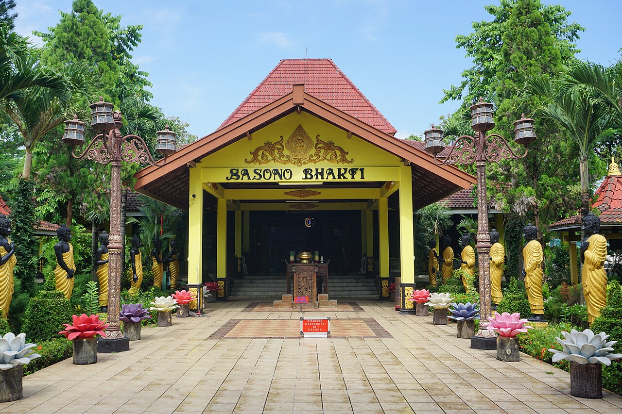
Four main languages are spoken on the island: Javanese, Sundanese, Madurese, and Betawi. Javanese and Sundanese are the most spoken. The ethnic groups native to the island are the Javanese in the central and eastern parts and Sundanese in the western parts. The Madurese in the Eastern salient of Java are migrants from Madura Island (which is part of East Java Province in administrative terms), while the Betawi in the capital city of Jakarta are hybrids from various ethnic groups in Indonesia.
Most residents are bilingual, speaking Indonesian (the official language of Indonesia) as their first or second language. While the majority of the people of Java are Muslim, Java's population comprises people of diverse religious beliefs, ethnicities, and cultures.
Java is divided into four administrative provinces: Banten, West Java, Central Java, and East Java, and two special regions, Jakarta and Yogyakarta.

Etymology
The origins of the name "Java" are not clear. Java may have been named after the jawa (foxtail millet) plant, derived from the Proto-Austronesian root *zawa. The historian Michael Laffan argued that the vernacular form jawa is more likely to have derived from an older form *yaba, based on the directionality of sound changes.
In the early nineteenth century, the British scholar Stamford Raffles suggested that another possible source for Java's name is the word jauh (which he spelled jaú), a Malay word meaning "beyond" or "distant". It has been suggested that another possible root is *awa or *yawa, meaning "home", related to the Polynesian words awaʻi (awaiki) or hawaʻi (hawaiki), but these roots are not universally accepted as Proto-Austronesian. None of these alternative hypotheses has found broad support among scholars, so the jawa (millet) theory remains the generally accepted one.
The toponym Java first appears in foreign literary works around the turn of the Common Era. In Sanskrit texts like the Ramayana, Java is referred to as Yavadvīpa, with dvīpa meaning "island" and yava meaning "barley". Java is mentioned in the ancient Tamil epic Maṇimēkalai (spelled Shavakam) and also in the Pāli scripture Mahāniddesa (likely pre-1st century BCE) as a place to be reached by boats.

The Greek term Iabadiu mentioned in Claudius Ptolemy's Geographia (150 CE), composed during the height of the Roman Empire, possibly derives from a Middle Indo-Aryan language and seems to be a synonym of the Sanskrit Yāvadvīpa.
Chinese sources render the toponym Java, as 葉調 Yèdiào (Late Middle Chinese pronunciation: [jiap dɛwh]) and 耶婆提 Yépótí (Late Middle Chinese pronunciation: [jia ba dɛj]) in the early first millennium CE. Subsequently, there emerged a new Chinese toponym 闍婆 Shépó (Late Middle Chinese pronunciation: [d͡ʑia bwa]), as found in the court chronicles Book of Song (late 5th century) and Book of Liang (7th century). From the Yuan Dynasty (1271–1368) onwards, Java began to be called 爪哇 (Zhǎowā), the present-day name in Mandarin Chinese.
In the later Middle Ages, Muslim writers began to refer to the islands of Indonesia by the term al-Zabaj (Arabic: الزابج). The Arabic usage of the word Zabaj was very broad, often incorporating either Sumatra or Java or both. It is the Arabic term Zabaj, rather than the ancient Greek term Iabadiu, that had the greater influence on late medieval Europeans.

Geography
Java lies between Sumatra to the west and Bali to the east. Borneo lies to the north, and Christmas Island is to the south. It is the world's 13th largest island. Java is surrounded by the Java Sea to the north, the Sunda Strait to the west, the Indian Ocean to the south and Bali Strait and Madura Strait in the east.
Java is almost entirely of volcanic origin; it contains 38 mountains forming an east–west spine that have at one time or another been active volcanoes. There are 112 volcanoes in all, 35 of which are active. The highest volcano in Java is Mount Semeru, 3,676 metres (12,060 ft). The most active volcano in Java and also in Indonesia is Mount Merapi, 2,930 metres (9,610 ft). In total, Java has more than 150 mountains.
Java's mountains and highlands split the interior into a series of relatively isolated regions suitable for wet-rice cultivation; the rice lands of Java are among the richest in the world. Java was the first place where Indonesian coffee was grown, starting in 1699. Today, coffea arabica is grown on the Ijen Plateau by small-holders and larger plantations.
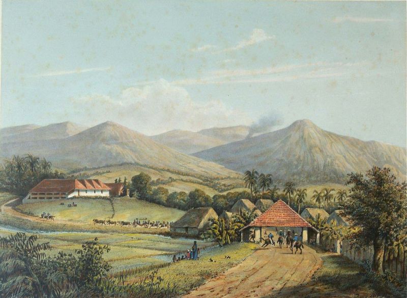
The area of Java is about 132,598.77 square kilometres (51,196.67 mi2) (including Madura's 5,408.45 square kilometres (2,088.21 mi2) and minor offshore islands). It is about 1,000 km (620 mi) long and up to 210 km (130 mi) wide. The island's longest river is the 600 km long Solo River. The river rises from its source in central Java at the Lawu volcano, then flows north and eastward to its mouth in the Java Sea near the city of Surabaya. Other major rivers are Brantas, Citarum, Cimanuk and Serayu.
The average temperature ranges from 22 °C (72 °F) to 29 °C (84 °F); average humidity is 75%. The northern coastal plains are normally hotter, averaging 34 °C (93 °F) during the day in the dry season. The south coast is generally cooler than the north, and highland areas inland are even cooler. The wet season begins in November and ends in April. During that time, rain falls mostly in the afternoons and intermittently during other parts of the year. The wettest months are January and February.
West Java is wetter than East Java, and mountainous regions receive much higher rainfall. The Parahyangan highlands of West Java receive over 4,000 millimetres (160 in) annually, while the north coast of East Java receives 900 millimetres (35 in) annually.

Natural environment
Java is an island with a large amount of biodiversity. The natural environment of Java is tropical rainforest, with ecosystems ranging from coastal mangrove forest on the north coast, rocky coastal cliffs on the southern coast, and low-lying tropical forest to high altitude rainforest on the slopes of mountainous volcanic regions in the interior. The Javan environment and climate gradually alters from west to east; from wet and humid dense rainforest in western parts, to a dry savanna environment in the east, corresponding to the climate and rainfall in these regions.
Javan wildlife originally supported a rich biodiversity, where numbers of endemic species of flora and fauna flourished; such as the Javan rhinoceros, Javan banteng, Javan warty pig, Javan silvery gibbon, Javan lutung, Java mouse-deer, Javan rusa, and Javan leopard. With over 450 bird species and 37 endemic species including the Javan green magpie, Java sparrow, Javan hawk-eagle, Javan peafowl, and Javan blue-banded kingfisher, Java is a birdwatcher's paradise. There are about 130 freshwater fish species in Java. There are also several endemic amphibian species in Java, including 5 species of tree frogs.
Since ancient times, people have opened the rainforest, altered the ecosystem, shaped the landscapes and created rice paddy and terraces to support the growing population. Javan rice terraces have existed for more than a millennium and had supported ancient agricultural kingdoms. The growing human population has put severe pressure on Java's wildlife, as rainforests were diminished and confined to highland slopes or isolated peninsulas. Some of Java's endemic species are now critically endangered, with some already extinct; Java used to have Javan tigers and Javan elephants, but both have been rendered extinct. Today, several national parks exist in Java that protect the remnants of its fragile wildlife, such as Ujung Kulon, Mount Halimun-Salak, Gede Pangrango, Baluran, Meru Betiri, Bromo Tengger Semeru and Alas Purwo.
History
Homo erectus presence
Fossilised remains of Homo erectus, popularly known as the "Java Man", dating back 1.3 million years were found along the banks of the Bengawan Solo River.
H. erectus arrived in Eurasia approximately 1.8 million years ago, in an event considered to be the first African exodus. There is evidence that the Java population of H. erectus lived in an ever-wet forest habitat. More specifically the environment resembled a savannah, but was likely regularly inundated ("hydromorphic savanna"). The plants found at the Trinil excavation site included grass (Poaceae), ferns, Ficus, and Indigofera, which are typical of lowland rainforest.
H. e. soloensis was the last population of a long occupation history of the island of Java by H. erectus, beginning 1.51 to 0.93 million years ago at the Sangiran site, continuing 540 to 430 thousand years ago at the Trinil site, and finally 117 to 108 thousand years ago at Ngandong. If the date is correct for Solo Man, then they would represent a terminal population of H. erectus which sheltered in the last open-habitat refuges of East Asia before the rainforest takeover. Before the immigration of modern humans, Late Pleistocene Southeast Asia was also home to H. floresiensis endemic to the island of Flores, Indonesia, and H. luzonensis endemic to the island of Luzon, the Philippines. Genetic analysis of present-day Southeast Asian populations indicates the widespread dispersal of the Denisovans (a species currently recognisable only by their genetic signature) across Southeast Asia, whereupon they interbred with immigrating modern humans 45.7 and 29.8 thousand years ago. A 2021 genomic study indicates that, aside from the Denisovans, modern humans never interbred with any of these endemic human species, unless the offspring were unviable or the hybrid lineages have since died out.
Judging by the sheer number of specimens deposited at Ngandong at the same time, there may have been a sizeable population of H. e soloensis before the volcanic eruption which resulted in their interment, but population is difficult to approximate with certainty. This site is quite far from the north coast of Java Island, and it is not always easy to determine the position of the coastline in prehistoric times because of significant geographical changes.
The southern coastline and estuary of the Bengawan Solo River at that time may have been different from what it is today, due to geological factors such as sedimentation, erosion, and changes in sea level over time. Currently, the estuary of the Bengawan Solo is in the Java Sea, but in prehistoric times, the river flow and estuary location may have changed. Geological and paleogeographic studies are often used to understand these changes.
After the arrival of modern humans
The island's exceptional fertility and rainfall allowed the development of wet-field rice cultivation, which required sophisticated levels of cooperation between villages. Out of these village alliances, small kingdoms developed. The chain of volcanic mountains and associated highlands running the length of Java kept its interior regions and peoples separate and relatively isolated. Before the advent of Islamic states and European colonialism, the rivers provided the main means of communication, although Java's many rivers are mostly short. Only the Brantas river and Solo river could provide long-distance communication and this way their valleys supported the centers of major kingdoms. A system of roads, permanent bridges, and toll gates is thought to have been established in Java by at least the mid-17th century. Local powers could disrupt the routes as could the wet season and road use was highly dependent on constant maintenance. Consequently, communication between Java's population was difficult.
According to Javanese legends circulating from the 18th century onwards, the emergence of civilization on the island of Java is associated with the arrival of Aji Saka ("the Saka king") in 78 AD. Aji Saka, as a "mythic founder of the social and religious order", is credited with establishing the key elements of Javanese civilization, such as eliminating demons, establishing the first kingdom, and introducing literacy.
Foreign sources around the beginning of the Common Era (see Names of Java), such as Valmiki's Ramayana, attest to Java's wealth and political organization at that time:"Yavadvipa is decorated with seven kingdoms, gold and silver islands, rich in gold mines, and there is Śiśira (cold) Mountain that touches the sky with its peak."
The Greek geographer Ptolemy called the island Iabadiu or Sabadibai (Ancient Greek: Ιαβαδίου or Σαβαδίβαι). Ptolemy said that the name meant the "Island of Barley" and produced a lot of grain and gold, adding that its metropolis was called Argyre (Ἀργυρῆ) meaning silver in Greek.
According to Chinese record Míng Shǐ, the Javanese kingdom was founded in 65 BC.
Hindu-Buddhist (Classic) period
The period between the 5th and 15th century in Java is often referred to as the Hindu-Buddhist period, while in the broader context of Southeast Asia it is also referred to as the Classic period. The Taruma kingdom of western Java existed from the 5th to the 7th centuries, while the Heling kingdom sent embassies to China starting in 640.
The first state to leave a substantial historical record was the Mataram kingdom that was founded in central Java at the beginning of the 8th century. The rulers of Mataram patronised both Hindu and Buddhist institutions, including Java's earliest Hindu temples on the Dieng Plateau. In the second half of the 8th century, these rulers described themselves as members of the Sailendra dynasty, which strongly supported Mahayana Buddhism. Monumental temple complexes such as Borobudur (late 8th century) and Prambanan (mid-9th century) in central Java were constructed at this time.
In the late 920s, the center of power shifted from central to eastern Java. The eastern Javanese kingdoms of Kediri (c. 1100–1222), Singhasari (1222–1292) and Majapahit (1293–c. 1520s) were mainly dependent on rice agriculture, yet also pursued trade within the Indonesian archipelago, and with China and India. Majapahit was established by King Wijaya in 1293, and by the end of the reign of Hayam Wuruk (c. 1390s) it claimed suzerainty over most of the present-day Indonesian archipelago, although its direct control was likely limited to Java, Bali, and Madura. Hayam Wuruk's prime minister, Gajah Mada, led many of the kingdom's territorial conquests. For most of the 15th century, Majapahit continued to be the dominant power in eastern Java. This last period of Majapahit history coincides with the first emergence of Islamic kingdoms in Java.
Spread of Islam and rise of Islamic sultanates
Islam gradually became the dominant religion in Java throughout the 16th century. The port-cities of the north coast like Surabaya, Gresik, Demak and Cirebon were the first Javanese polities to adopt Islam, thanks to their interactions with foreign Muslim traders and clerics. Demak was the first Muslim kingdom to achieve a degree of hegemony Java during the early 16th century, extending the reach of Muslim kingdoms westward to Cirebon and defeating the remnants of the Majapahit kingdom. After the mid-16th century, Demak gave way to other Muslim coastal kingdoms such as Cirebon and Banten in the west, and Surabaya in the east.
At the turn of the 17th century, the inland kingdom of Mataram became the dominant power of central and eastern Java. The rule of Sultan Agung of Mataram (r. 1613–1646) was crucial in establishing military hegemony and a "mystic synthesis" that harmonised Islam with pre-existing Javanese cultural attitudes. The coastal principalities of Surabaya and Cirebon were subjugated in the course of the early 17th century, leaving Mataram and Banten to face the emerging Dutch colonial power in Batavia.
Colonial periods
Java's contact with the European colonial powers began in 1522 with a treaty between the Sunda kingdom and the Portuguese in Malacca. After its failure, the Portuguese presence was confined to Malacca and to the eastern islands.
In 1596, a four-ship expedition led by Cornelis de Houtman was the first Dutch contact with Indonesia. By the end of the 18th century the Dutch had extended their influence over the sultanates of the interior through the Dutch East India Company in Indonesia. The Dutch repeatedly intervened in wars between rival Mataram claimants to the Javanese throne. When the side they supported inevitably won due to their industrialised weapons, the Dutch forced land concessions from the side they supported. The Dutch whittled down the Mataram kingdoms until most of the island was conquered. Internal conflict prevented the Javanese from forming effective alliances against the Dutch. In the 1750s, the Javanese Sultan Mangkubumi tried to restore Mataram's control, but the Dutch divided the kingdom. Remnants of the Mataram survived as the Surakarta (Solo) and Yogyakarta principalities. Javanese kings claimed to rule with divine authority and the Dutch helped them to preserve remnants of a Javanese aristocracy by confirming them as regents or district officials within the colonial administration.
Java's major role during the early part of the colonial period was as a producer of rice. In spice-producing islands like Banda, rice was regularly imported from Java, to supply the deficiency in means of subsistence.
During the Napoleonic Wars in Europe, the Netherlands fell to France, as did its colony in the East Indies. During the short-lived Daendels administration, as French proxy rule on Java, the construction of the Great Post Road was commenced in 1808. The road, spanning from Anyer in Western Java to Panarukan in East Java, served as a military supply route and was used in defending Java from British invasion. In 1811, Java was captured by the British, becoming a possession of the British Empire, and Sir Stamford Raffles was appointed as the island's governor. In 1816, under the governorship of John Fendall, Java was returned to the Dutch by the Treaty of Paris.
In 1815, there may have been five million people in Java. In the second half of the 18th century, population spurts began in districts along the north-central coast of Java, and in the 19th century population grew rapidly across the island. Factors for the great population growth include the impact of Dutch colonial rule including the imposed end to civil war in Java, the increase in the area under rice cultivation, and the introduction of food plants such as cassava and maize that could sustain populations that could not afford rice. Others attribute the growth to the taxation burdens and increased expansion of employment under the Cultivation System to which couples responded by having more children in the hope of increasing their families’ ability to pay tax and buy goods. Cholera claimed 100,000 lives in Java in 1820.
The advent of trucks and railways where there had previously only been buffalo and carts, telegraph systems, and more coordinated distribution systems under the colonial government all contributed to famine elimination in Java, and in turn, population growth. There were no significant famines in Java from the 1840s through to the Japanese occupation in the 1940s. However, other sources claimed the Dutch cultivation system was linked to famines and epidemics in the 1840s, first in Cirebon and then in Central Java, as cash crops (indigo, sugar, etc.) were grown instead of rice.
Independence
Indonesian nationalism first took hold in Java in the early 20th century, and the struggle to secure the country's independence following World War II was centered in Java. In 1949, Indonesian independence was recognized.
Administration
Java is divided into four provinces and two special regions:
Banten, capital: Serang
Special Region of Jakarta(a), capital: Central Jakarta (de facto)
West Java, capital: Bandung
Central Java, capital: Semarang
Special Region of Yogyakarta, capital: Yogyakarta