
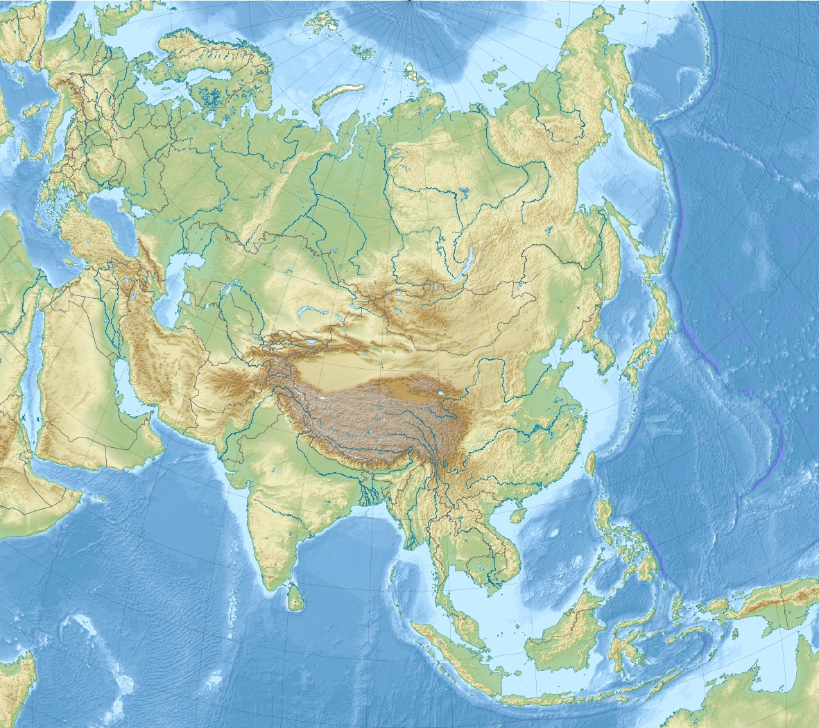
The Caspian Sea is the world's largest inland body of water, described as the world's largest lake and usually referred to as a full-fledged sea. An endorheic basin, it is situated in both Europe and Asia: east of the Caucasus, west of the broad steppe of Central Asia, south of the fertile plains of Southern Russia in Eastern Europe, and north of the mountainous Iranian Plateau. It covers a surface area of 371,000 km2 (143,244 sq mi) (excluding the highly saline lagoon of Garabogazköl to its east), an area similar to Japan, with a volume of 78,200 km3 (19,000 cu mi). It has a salinity of approximately 1.2% (12 g/L), about a third of the salinity of average seawater. It is bounded by Kazakhstan to the northeast, Russia to the northwest, Azerbaijan to the southwest, Iran to the south, and Turkmenistan to the southeast. The name of the Caspian Sea is derived from the ancient Iranic Caspi people.
The lake stretches 1,200 km (750 mi) from north to south, with an average width of 320 km (200 mi). Its gross coverage is 386,400 km2 (149,200 sq mi) and the surface is about 27 m (89 ft) below sea level. Its main freshwater inflow, Europe's longest river, the Volga, enters at the shallow north end. Two deep basins form its central and southern zones. These lead to horizontal differences in temperature, salinity, and ecology. The seabed in the south reaches 1,023 m (3,356 ft) below sea level, which is the third-lowest natural non-oceanic depression on Earth after Baikal and Tanganyika lakes.
The Caspian Sea is nearly five times as big as Lake Superior and is home to a wide range of animal species. It is famous for its caviar and oil industries. Pollution from the oil industry and dams on rivers that drain into it have harmed its ecology. It is predicted that during the 21st century, the depth of the sea will decrease by 9–18 m (30–60 ft) due to global warming and the process of desertification, leading to an ecocide.

Etymology
The sea's name stems from Caspi, the ancient people who lived to the southwest of the sea in Transcaucasia. Strabo (died circa AD 24) wrote that "to the country of the Albanians (Caucasian Albania, not to be confused with the country of Albania) belongs also the territory called Caspiane, which was named after the Caspian tribe, as was also the sea; but the tribe has now disappeared". Moreover, the Caspian Gates, part of Iran's Tehran province, may evince such people migrated to the south. The Iranian city of Qazvin shares the root of its name with this common name for the sea. The traditional and medieval Arabic name for the sea was Baḥr al-Khazar ("sea of the Khazars"), but in recent centuries the common and standard name in the Arabic language has become بحر قزوين Baḥr Qazvin, the Arabized form of Caspian. In modern Russian: Каспи́йское мо́ре, Kaspiyskoye more.
Some Turkic ethnic groups refer to it with the Caspi(an) descriptor; in Kazakh it is called Каспий теңізі, Kaspiy teñizi, Kyrgyz: Каспий деңизи, romanized: Kaspiy deñizi, Uzbek: Kaspiy dengizi. Others refer to it as the Khazar sea: Turkmen: Hazar deňzi; Azerbaijani: Xəzər dənizi, Turkish: Hazar Denizi. In all these the first word refers to the historical Khazar Khaganate, a large empire based to the north of the Caspian Sea between the 7th–10th centuries.
In Iran, the lake is referred to as the Mazandaran Sea (Persian: دریای مازندران), after the historic Mazandaran Province at its southern shores.
Old Russian sources use the Khvalyn or Khvalis Sea (Хвалынское море / Хвалисское море) after the name of Khwarezmia.
Among Greeks and Persians in classical antiquity it was the Hyrcanian Sea (Hyrcanium Mare).
Renaissance European maps labelled it as the Abbacuch Sea (Oronce Fine's 1531 world map), Mar de Bachu (Ortellius' 1570 map), or Mar de Sala (the Mercator 1569 world map).

It was also sometimes called the Kumyk Sea and Tarki Sea (derived from the name of the Kumyks and their historical capital Tarki).
Basin countries
Border countries
North
Kazakhstan
Russia
East
Turkmenistan
West
Azerbaijan
South
Iran

Former border countries
North
Soviet Union
South
Pahlavi Iran

Safavid Iran
West
Physical characteristics
Formation
The Caspian Sea is at its South Caspian Basin, like the Black Sea, a remnant of the ancient Paratethys Sea. Its seafloor is, therefore, a standard oceanic basalt and not a continental granite body. It is estimated to be about 30 million years old, and became landlocked in the Late Miocene, about 5.5 million years ago, due to tectonic uplift and a fall in sea level. The Caspian Sea was a comparatively small endorheic lake during the Pliocene, but its surface area increased fivefold around the time of the Pliocene-Pleistocene transition. During warm and dry climatic periods, the landlocked sea almost dried up, depositing evaporitic sediments like halite that were covered by wind-blown deposits and were sealed off as an evaporite sink when cool, wet climates refilled the basin. (Comparable evaporite beds underlie the Mediterranean.) Due to the current inflow of fresh water in the north, the Caspian Sea water is almost fresh in its northern portions, getting more brackish toward the south. It is most saline on the Iranian shore, where the catchment basin contributes little flow. Currently, the mean salinity of the Caspian is one third that of Earth's oceans. The Garabogazköl lagoon, which dried up when water flow from the main body of the Caspian was blocked in the 1980s but has since been restored, routinely exceeds oceanic salinity by a factor of 10.
Geography
The Caspian Sea is the largest inland body of water in the world by area and accounts for 40–44% of the total lake waters of the world, and covers an area larger than Germany. The coastlines of the Caspian are shared by Azerbaijan, Iran, Kazakhstan, Russia, and Turkmenistan. The Caspian is divided into three distinct physical regions: the Northern, Middle, and Southern Caspian. The Northern–Middle boundary is the Mangyshlak Threshold, which runs through Chechen Island and Cape Tiub-Karagan. The Middle–Southern boundary is the Apsheron Threshold, a sill of tectonic origin between the Eurasian continent and an oceanic remnant, that runs through Chilov Island and Cape Kuuli. The Garabogazköl Bay is the saline eastern inlet of the Caspian, which is part of Turkmenistan and at times has been a lake in its own right due to the isthmus that cuts it off from the Caspian.
Differences between the three regions are dramatic. The Northern Caspian only includes the Caspian shelf, and is very shallow; it accounts for less than 1% of the total water volume with an average depth of only 5–6 m (16–20 ft). The sea noticeably drops off towards the Middle Caspian, where the average depth is 190 m (620 ft). The Southern Caspian is the deepest, with oceanic depths of over 1,000 m (3,300 ft), greatly exceeding the depth of other regional seas, such as the Persian Gulf. The Middle and Southern Caspian account for 33% and 66% of the total water volume, respectively. The northern portion of the Caspian Sea typically freezes in the winter, and in the coldest winters ice forms in the south as well.
Over 130 rivers provide inflow to the Caspian, the Volga River being the largest. A second affluent, the Ural River, flows in from the north, and the Kura River from the west. In the past, the Amu Darya (Oxus) of Central Asia in the east often changed course to empty into the Caspian through a now-desiccated riverbed called the Uzboy River, as did the Syr Darya farther north. The Caspian has several small islands, primarily located in the north with a collective land area of roughly 2,000 km2 (770 mi2). Adjacent to the North Caspian is the Caspian Depression, a low-lying region 27 m (89 ft) below sea level. The Central Asian steppes stretch across the northeast coast, while the Caucasus Mountains hug the western shore. The biomes to both the north and east are characterized by cold, continental deserts. Conversely, the climate to the southwest and south are generally warm with uneven elevation due to a mix of highlands and mountain ranges; the drastic changes in climate alongside the Caspian have led to a great deal of biodiversity in the region.
The Caspian Sea has numerous islands near the coasts, but none in the deeper parts of the sea. Ogurja Ada is the largest island. The island is 37 km (23 mi) long, with Goitered gazelles roaming freely on it. In the North Caspian, the majority of the islands are small and uninhabited, like the Tyuleniy Archipelago, an Important Bird Area (IBA).
Climate
The climate of the Caspian Sea is variable, with the cold desert climate (BWk), cold semi-arid climate (BSk), and humid continental climate (Dsa, Dfa) being present in the northern portions of the Caspian Sea, while the Mediterranean climate (Csa) and humid subtropical climate (Cfa) are present in the southern portions of the Caspian Sea.
Hydrology
The Caspian has characteristics common to both seas and lakes. It is often listed as the world's largest lake, although it is not freshwater: the 1.2% salinity classes it with brackish water bodies.
It contains about 3.5 times as much water, by volume, as all five of North America's Great Lakes combined. The Volga River (about 80% of the inflow) and the Ural River discharge into the Caspian Sea, but it has no natural outflow other than by evaporation. Thus the Caspian ecosystem is a closed basin, with its own sea level history that is independent of the eustatic level of the world's oceans.
The sea level of the Caspian has fallen and risen, often rapidly, many times over the centuries. Some Russian historians, such as Lev Gumilev, claim that the rising of the Caspian in the 10th century caused the coastal towns of Khazaria to flood, resulting in the Khazars losing approximately two-thirds of their territory.
Over the centuries, Caspian Sea levels have changed in synchrony with the estimated discharge of the Volga, which in turn depends on rainfall levels in its vast catchment basin. Precipitation is related to variations in the amount of North Atlantic depressions that reach the interior, and they in turn are affected by cycles of the North Atlantic oscillation. Thus levels in the Caspian Sea relate to atmospheric conditions in the North Atlantic, thousands of kilometres to the northwest.
The last short-term sea-level cycle started with a sea-level fall of 3 m (10 ft) from 1929 to 1977, followed by a rise of 3 m (10 ft) from 1977 until 1995. Since then smaller oscillations have taken place.
The current projection is that climate change will cause water levels to decline by up to 21 m by 2100.
Environmental degradation
The Volga River, the longest river in Europe, drains 20% of the European land area and is the source of 80% of the Caspian's inflow. Heavy development in its lower reaches has caused numerous unregulated releases of chemical and biological pollutants. The UN Environment Programme warns that the Caspian "suffers from an enormous burden of pollution from oil extraction and refining, offshore oil fields, radioactive wastes from nuclear power plants and huge volumes of untreated sewage and industrial waste introduced mainly by the Volga River".
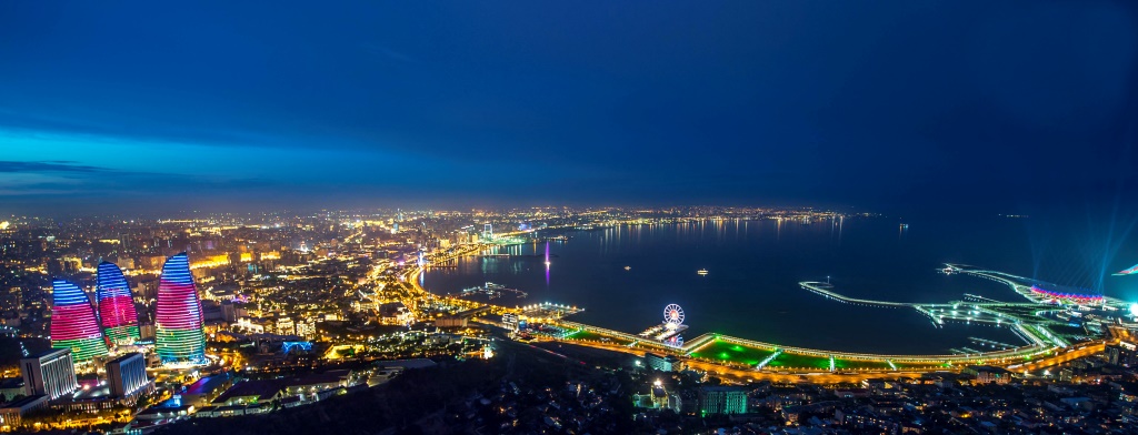
The magnitude of fossil fuel extraction and transport activity in the Caspian also poses a risk to the environment. The island of Vulf off Baku, for example, has suffered ecological damage as a result of the petrochemical industry; this has significantly decreased the number of species of marine birds in the area. Existing and planned oil and gas pipelines under the sea further increase the potential threat to the environment.
The high concentration of mud volcanoes under the Caspian Sea was thought to be the cause of a fire that broke out 75 kilometers from Baku on July 5, 2021. The State oil company of Azerbaijan SOCAR said preliminary information indicated it was a mud volcano which spewed both mud and flammable gas.
It is calculated that during the 21st century, the water level of the Caspian Sea will decrease by 9–18 m (30–60 ft) due to the acceleration of evaporation due to global warming and the process of desertification, causing an ecocide.
Under medium to high emission scenarios, a decline towards the high end, of 18 m (60 ft), could mean an area of up to 143,000 km2 (55,000 sq mi) converting to land, a 37% reduction to current water area. Under such a scenario all ecologically significant areas of the Caspian Sea would experience a large reduction in sea level.
On October 23, 2021, Kazakhstan President Kassym-Jomart Tokayev signed the Protocol for the Protection of the Caspian Sea against Pollution from Land-based Sources in order to ensure better protection for the biodiversity of the Caspian Sea.
In July 2025, the Caspian Sea reached its lowest recorded level, falling lower than 29 m (95 ft) below sea level.
Flora and fauna
Flora
The rising level of the Caspian Sea between 1995 and 1996 reduced the number of habitats for rare species of aquatic vegetation. This has been attributed to a general lack of seeding material in newly formed coastal lagoons and water bodies.
Many rare and endemic plant species of Russia are associated with the tidal areas of the Volga Delta and riparian forests of the Samur River delta. The shoreline is also a unique refuge for plants adapted to the loose sands of the Central Asian Deserts. The principal limiting factors to successful establishment of plant species are hydrological imbalances within the surrounding deltas, water pollution, and various land reclamation activities. The water level change within the Caspian Sea is an indirect reason for which plants may not get established.