
Thunder Bay is a city in and the seat of Thunder Bay District, Ontario, Canada. It is the most populous municipality in Northwestern Ontario and the second most populous (after Greater Sudbury) municipality in Northern Ontario. Its population is 108,843 according to the 2021 Canadian census.
Located on Lake Superior, the census metropolitan area of Thunder Bay has a population of 123,258. It consists of the city of Thunder Bay, the municipalities of Oliver Paipoonge and Neebing, the townships of Shuniah, Conmee, O'Connor, and Gillies, and the Fort William First Nation.
European settlement in the region began in the late 17th century with a French fur trading outpost on the banks of the Kaministiquia River. It grew into an important transportation hub with its port forming an important link in the shipping of grain and other products from western Canada, through the Great Lakes and the Saint Lawrence Seaway, to the east coast. Forestry and manufacturing played important roles in the city's economy. They have declined in recent years, but have been replaced by a "knowledge economy" based on medical research and education. Thunder Bay is the site of the Thunder Bay Regional Health Research Institute.

On 1 January 1970, the City of Thunder Bay was formed through the merger of the cities of Fort William, Port Arthur, and the geographic townships of Neebing and McIntyre. The city takes this name from the immense Thunder Bay at the head of Lake Superior, known on 18th-century French maps as Baie du Tonnerre (Bay of Thunder). The city is often referred to as the "Lakehead", or "Canadian Lakehead", because of its location at the end of Great Lakes navigation on the Canadian side of the border.
History
Before 1900
Various Anishinaabe peoples such as the Ojibwa are indigenous to the Thunder Bay Area. European settlement at Thunder Bay began with two French fur trading posts (in 1683 and 1717) which were subsequently abandoned (see Fort William, Ontario). In 1803, the Montreal-based North West Company established Fort William as its mid-continent entrepôt.
By the 1850s, the Province of Canada began to take an interest in its western extremity. The discovery of copper in the Keweenaw Peninsula of Michigan had prompted a national interest in potential mining locations on the Canadian shores of Lake Superior. In 1849, French-speaking Jesuits established the Mission de l'Immaculée-Conception (Mission of the Immaculate Conception) on the Kaministiquia to evangelize the Ojibwe. The Province of Canada negotiated the Robinson Treaty in 1850 with the Ojibwa of Lake Superior. As a result, an Indian reserve was set aside for them south of the Kaministiquia River.

Another settlement developed a few miles to the north of Fort William after construction by the federal Department of Public Works of a road connecting Lake Superior with the Red River Colony. The work was directed by Simon James Dawson (see Port Arthur, Ontario). This public works depot or construction headquarters acquired its first name in May 1870 when Colonel Garnet Wolseley named it Prince Arthur's Landing. It was renamed Port Arthur by the Canadian Pacific Railway (CPR) in May 1883.
The arrival of the CPR sparked a long rivalry between the towns, which did not end until their amalgamation in 1970. Until the 1880s, Port Arthur was a much larger community. The CPR, in collaboration with the Hudson's Bay Company, preferred east Fort William, located on the lower Kaministiquia River, where the fur trade posts were. Provoked by a prolonged tax dispute with Port Arthur and its seizure of a locomotive in 1889, the CPR relocated all its employees and facilities to Fort William. The collapse of silver mining after 1890 undermined the economy of Port Arthur. It had an economic depression, while Fort William thrived.
20th century
In the era of Sir Wilfrid Laurier, Thunder Bay began a period of extraordinary growth, based on improved access to markets via the transcontinental railway and development of the western wheat boom. The CPR double-tracked its Winnipeg–Thunder Bay line. The Canadian Northern Railway established facilities at Port Arthur. The Grand Trunk Pacific Railway began construction of its facilities at the Fort William Mission in 1905, and the federal government began construction of the National Transcontinental Railway. Grain elevator construction boomed as the volume of grain shipped to Europe increased. Both cities incurred debt to grant bonuses to manufacturing industries.

Thunder Bay was the first city in the world to enact daylight saving time on 1 July 1908.
By 1914, the twin cities had modern infrastructures (sewers, potable water supply, street lighting, electric light, etc.) Both Fort William and Port Arthur were proponents of municipal ownership. As early as 1892, Port Arthur built Canada's first municipally owned electric street railway. Both cities spurned Bell Telephone Company of Canada to establish their municipally owned telephone systems in 1902.
The boom came to an end in 1913–1914, aggravated by the outbreak of the First World War. A wartime economy emerged with the making of munitions and shipbuilding. Men from the cities joined the 52nd, 94th, and 141st Battalions of the Canadian Expeditionary Force.

Railway employment was hurt when the federal government took over the National Transcontinental Railway and Lake Superior Division from the Grand Trunk in 1915, and the Canadian Northern Railway in 1918. These were amalgamated with other government-owned railways in 1923 to form the Canadian National Railways. The CNR closed many of the Canadian Northern Railway facilities in Port Arthur. It opened the Neebing yards in Neebing Township in 1922. By 1929, the population of the two cities had recovered to pre-war levels.
The forest products industry has played an important role in the Thunder Bay economy since the 1870s. In the 1880s, Herman Finger established the Pigeon River Lumber Company in the area, and also built the Gunflint and Lake Superior Railroad, but he dissolved the lumber company and moved his operations to The Pas by 1919. Logs and lumber were shipped primarily to the United States. In 1917, the first pulp and paper mill was established in Port Arthur. It was followed by a mill at Fort William in 1920. Eventually, four mills were operating.
Manufacturing resumed in 1937 when the Canada Car and Foundry Company plant (opened for the manufacture of naval ships and railcars during the late World War I) re-opened to build British aircraft. Now run by Alstom, the plant has remained a mainstay of the post-war economy. It has produced forestry equipment and transportation equipment for urban transit systems, such as the Toronto Transit Commission and GO Transit.

Amalgamation
On 1 January 1970, the City of Thunder Bay was formed through the merger of the cities of Fort William, Port Arthur, and the geographic townships of Neebing and McIntyre. Its name was the result of a referendum held previously on 23 June 1969, to determine the new name of the amalgamated Fort William and Port Arthur. Officials debated over the names to be put on the ballot, taking suggestions from residents, including "Lakehead" and "The Lakehead". Because the vote split between the two similar names, "Thunder Bay" prevailed with a narrow plurality. The final tally was "Thunder Bay" with 15,870, "Lakehead" with 15,302, and "The Lakehead" with 8,377.
There was more controversy over the selection of a name for the amalgamated city than over whether to amalgamate. A vocal minority of the population preferred "The Lakehead". There was much discussion about other cities in the world that use a definite article in their names. The area was often referred to as "The Lakehead" before and after amalgamation based on its geographic location. It was seen as the "head" of shipping on the Great Lakes and the "rail head".
The expansion of highways, beginning with the Trans-Canada Highway and culminating with the opening of Highway 17 (linking Sault Ste Marie to Thunder Bay in 1960), has significantly diminished railway and shipping activity since the 1970s and 80s. Shipping on the Saint Lawrence Seaway was superseded by trucking on highways. Grain shipping on the Great Lakes to the East has declined substantially in favour of transport to Pacific Coast ports. As a result, many grain elevators have been closed and demolished. The Kaministiquia River was abandoned by industry and shipping.
Today
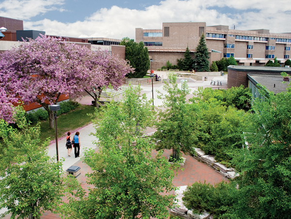
Thunder Bay has become the regional services centre for Northwestern Ontario with most provincial departments represented. Lakehead University, established through the lobbying of local businesspeople and professionals, has proven to be a major asset. Another post-secondary institution is Confederation College.
Geography
The city has an area of 328.48 square kilometres (126.83 mi2), which includes the former cities of Fort William and Port Arthur, as well as the former townships of Neebing and McIntyre. The city reflects the settlement patterns of the 19th century and sprawls. Anchoring the west end of the city, the Fort William Town Plot, surveyed in 1859–60, was named West Fort William (or Westfort) in 1888 by the CPR. The land adjoining the lower Kaministiquia River became the residential and central business district of the town and city of Fort William. A large uninhabited area adjoining the Neebing and McIntyre rivers, which became known as Intercity, separated Fort William from the residential and central business district of Port Arthur. At the extreme east of the city, a part of McIntyre Township was annexed to the town of Port Arthur in 1892, forming what later became known as the Current River area.
The former Port Arthur section is more typical of the Canadian Shield, with gently sloping hills and very thin soil lying on top of bedrock with many bare outcrops. Thunder Bay, which gives the city its name, is about 22.5 kilometres (14.0 mi) from the Port Arthur downtown to Thunder Cape at the tip of the Sleeping Giant. The former Fort William section occupies flat alluvial land along the Kaministiquia River. In the river delta are two large islands: Mission Island and McKellar Island. Since 1970, the central business districts of Fort William and Port Arthur have suffered a serious decline. Business and government relocated to new developments in the Intercity area. There has also been substantial residential growth in adjacent areas of the former Neebing and McIntyre townships.
Neighbourhoods
Thunder Bay is composed of two formerly separate cities: Port Arthur and Fort William. Both still retain much of their distinct civic identities, reinforced by the buffering effect of the Intercity area between them. Port Arthur and Fort William each have their own central business districts and suburban areas. Neighbourhoods include: Downtown Fort William, Westfort, Northwood, McKeller Park, Mariday Park, Jumbo Gardens, County Park and Current River. Newer neighbourhoods include River Terrace, Parkdale, and Sherwood Park.
Climate
The Thunder Bay area experiences a warm-summer humid continental climate (Köppen: Dfb) with a subarctic (Dfc) influence in northeastern areas of the city (including that affected by Lake Superior), but not necessarily falling in this zone. This results in cooler summer temperatures and warmer winter temperatures for an area extending inland as far as 16 km. The average daily temperatures range from 18.0 °C (64.4 °F) in July to −13.4 °C (7.9 °F) in January. The average daily high in July is 24.9 °C (76.8 °F) and the average daily high in January is −7.6 °C (18.3 °F). On 10 January 1982, the local temperature in Thunder Bay dropped to −36.3 °C (−33.3 °F), with a wind speed of 54 km (34 mi) per hour for a wind chill temperature that dipped to −58 °C (−72.4 °F). As a result, it holds Ontario's record for coldest day with wind chill. The highest temperature ever recorded in Thunder Bay was 40.3 °C (104.5 °F) on 7 August 1983. The coldest temperature ever recorded was −43.2 °C (−45.8 °F) on 31 January 1996.
Relatively recently, however, records for both the latest first freeze and the longest growing season were set on October 17, 2021; the previous record of October 8, 2016, was beaten by 9 days, and the previous record for the longest growing season of 139 days (also set in 2016) was beaten by a day.
The city is quite sunny, with an average of 2,121 hours of bright sunshine each year, ranging from 268.1 hours in July to 86.2 hours in November. Winters are comparatively dry with the snowfall being somewhat limited and temperatures much colder than in Houghton, Michigan, on the U.S. side of the lake, where the climate is marked by heavy lake-effect snow. Thunder Bay has more of a continental climate in comparison.
Demographics
In the 2021 Census of Population conducted by Statistics Canada, Thunder Bay had a population of 108,843 living in 48,405 of its 50,995 total private dwellings, a change of 0.9% from its 2016 population of 107,909. With a land area of 327.77 km2 (126.55 sq mi), it had a population density of 332.1/km2 (860.1/sq mi) in 2021.
At the census metropolitan area (CMA) level in the 2021 census, the Thunder Bay CMA had a population of 123,258 living in 54,212 of its 57,877 total private dwellings, a change of 1.3% from its 2016 population of 121,621. With a land area of 2,550.79 km2 (984.87 sq mi), it had a population density of 48.3/km2 (125.2/sq mi) in 2021.
According to the 2016 Census, 48.8% of Thunder Bay's residents were male and 51.2% were female. Residents 19 years of age or younger accounted for approximately 19.9% of the population. People aged between 20 and 39 years accounted for 25.0%, while those between 40 and 64 made up 35.1% of the population. The average age of a Thunder Bayer in May 2016 was 43.3, compared to the average of 41.0 for Canada as a whole.
A further 13,712 people lived in Thunder Bay's Census Metropolitan Area, which apart from Thunder Bay includes the municipalities of Neebing and Oliver Paipoonge, the townships of Conmee, Gillies, O'Connor and Shuniah, and the aboriginal community of Fort William First Nation.
Ethnicity
According to the census, Thunder Bay was home to 13,565 people of Finnish descent, the highest concentration of people of Finnish origin in Canada. Thunder Bay has a large Indigenous population, representing 14.1% of the population; visible minorities represent 7.5% of the population. However, the Indigenous population is likely underestimated, with a substantial proportion unreported in Thunder Bay. It is estimated that there were between 23,080 and 42,641 Indigenous adults in Thunder Bay, approximately two to four times higher than the 9,780 individuals reported in the 2016 Census.
Note: Totals greater than 100% due to multiple origin responses.
Language
Mother-tongue language (2016)
Religion
In the 2021 census, 56.0% of Thunder Bay residents belonged to a Christian denomination, down from 72.0% in 2011: 30.4% of the total population affiliated with the Roman Catholic Church, 17.6% were Protestant, 4.9% were Christians of unspecified denomination and 3.2% followed other Christian denominations, largely Eastern Orthodox. People of no religion were 39.9%, up from 26.2% in 2011. Of non-Christian religions, the largest were Hinduism (1.1%) and Islam (0.9%). 0.6% of residents adhered to traditional (North American Indigenous) spirituality. All other religions and/or spiritual beliefs made up 1.4% of the population.
Crime
From 2012 to 2014, and again from 2016 to 2019, Thunder Bay had the highest per-capita rate of homicide among Canadian cities. Winnipeg had previously held this distinction between 2007 and 2011. In 2014, the per-capita rate of homicides in Thunder Bay was more than double the 2012 rate, and was over 2.5 times higher than the city with the next highest rate, with the city having a homicide rate of 10.1 per 100,000 people. However, between 2014 and 2015, the crime rate decreased by 6%. This was the second-highest decrease in any major Canadian city, behind only Moncton, New Brunswick. In 2022, Thunder Bay set a new homicide record with 15, giving the city a homicide rate of 13.7 homicides per 100,000 people, a rate which was comparable to cities such as Charlotte, Dallas, Denver, Phoenix, and Portland in the same year.
Economy
As the largest city in Northwestern Ontario, Thunder Bay is the region's commercial, administrative and medical centre. Many of the city's largest single employers are in the public sector. The City of Thunder Bay, the Thunder Bay Regional Health Sciences Centre, the Lakehead District School Board and the Government of Ontario each employ over 1,500 people. Resolute Forest Products is the largest private employer, employing over 1,500 people.
Alstom operates a 553,000 square feet (51,400 m2) plant in Thunder Bay which manufactures mass transit vehicles and equipment, employing approximately 500 people. The plant was built by Canadian Car and Foundry to build railway box cars in 1912, began building passenger railcars and transit cars from 1963 onwards Alstom acquired the facility from Bombardier in 2021, which had acquired it from UTDC in 1992, and from Cancar in 1984.
Lack of innovation by traditional industries, such as forest products, combined with high labour costs, has reduced the industrial base of Thunder Bay by close to 60%. The grain trade has declined because of the loss of grain transportation subsidies and the loss of European markets. The gradual transition from shipping by train and boat to shipping by truck, and the Canada–United States Free Trade Agreement have ended Thunder Bay's privileged position as a linchpin in Canadian east–west freight-handling trade. As a result, the city has lost its traditional raison d'être as a break-bulk point. However, in recent years shipments through the port of Thunder Bay have stabilized, and it remains an important part of the Saint Lawrence Seaway.
To rejuvenate its economy, the city has been actively working to attract quaternary or "knowledge-based" industries, primarily in the fields of molecular medicine and genomics. The city is home to the western campus of the Northern Ontario School of Medicine, the first medical school to open in Canada in a generation. The city also has a law school.
Government and politics
The city is governed by a mayor and twelve councillors. The mayor and five of the councillors are elected at large by the whole city. In addition, seven ward councillors are elected by their respective constituencies. The current mayor is Ken Boshcoff and the five councillors at large are: Mark Bentz, Shelby Ch’ng, Trevor Giertuga, Rajni Agarwal, and Kasey (Taylor) Etreni.
Thunder Bay is represented in the Ontario Legislature by two provincial ridings, also split along the Harbour Expressway. North of the expressway is Thunder Bay-Superior North, served by Lise Vaugeois of the Ontario New Democratic Party since 2018. On the south side of the city is Thunder Bay-Atikokan, served by Kevin Holland of the Ontario Progressive Conservative Party since 2022.
Thunder Bay is represented in the Canadian Parliament with two federal ridings, split at the Harbour Expressway. South of the expressway is the Thunder Bay-Rainy River riding, currently served by Marcus Powlowski since 2019. The north side of the city is in the Thunder Bay-Superior North riding, served by Patty Hajdu since 2015. Both incumbent member of parliament are members of the Liberal Party of Canada.
City Wards
Thunder Bay can be divided into seven wards, each of which has one councillor:
Currently, the city is studying possibilities for reducing the size of the city council from 13 to a smaller number. These changes, if successful, would be implemented from the 2026 Municipal election. In September 2024, two ideas were presented:
No wards: All wards will be abolished, eliminating the positions of all ward councillors effective the 2026 election. Five new councillor-at-large positions will be created for a total of 10 councillors at large. This system allows all members of the city council to be elected by all citizens of Thunder Bay, regardless of where they live.