
South Tyrol (German: Südtirol [ˈzyːtːiˌʁoːl] , locally [ˈsyːtiˌroːl]; Italian: Alto Adige [ˈalto ˈaːdidʒe]; Ladin: Südtirol), officially the Autonomous Province of Bolzano/Bozen – South Tyrol, is an autonomous province in northern Italy. Together with Trentino, South Tyrol forms the autonomous region of Trentino-Alto Adige/Südtirol. The province is Italy's northernmost, with an area of 7,400 square kilometres (2,857 sq mi), and has a population of about 534,000 as of 2021. Its capital and largest city is Bolzano.
South Tyrol has a considerable level of self-government, consisting of a large range of exclusive legislative and executive powers and a fiscal regime that allows it to retain 90% of revenue, while remaining a net contributor to the national budget. As of 2023, it is Italy's wealthiest province and among the wealthiest in the European Union. As of 2024, South Tyrol was also the region with the lowest number of persons at risk of poverty or social exclusion in the EU, with 6.6% of the population compared to the EU mean of 21.4%.
In the wider context of the EU, the province is one of the three members of the Tyrol–South Tyrol–Trentino Euroregion, which corresponds almost exactly to the historical region of Tyrol.

According to the 2024 census, 57.6% of the population used German as its first language; 22.6% of the population spoke Italian, mainly in and around the two largest cities (Bolzano and Merano); 3.7% spoke Ladin, a Rhaeto-Romance language; and 16.1% of the population (mainly recent immigrants) spoke another language in addition to Italian and German. Of 116 South Tyrolean municipalities, 102 have a German-speaking, eight a Ladin-speaking, and six an Italian-speaking majority. The Italianization of South Tyrol and the settlement of Italians from the rest of Italy after 1918 significantly modified local demographics.
Name
South Tyrol (occasionally South Tirol) is the term most commonly used in English for the province, and its usage reflects that it was created from a portion of the southern part of the historic County of Tyrol, a former state of the Holy Roman Empire and crown land of the Austrian Empire of the Habsburgs. German and Ladin speakers usually refer to the area as Südtirol; the Italian equivalent Sudtirolo (sometimes parsed Sud Tirolo) is becoming increasingly common.
Alto Adige (literally translated in English: "Upper Adige"), one of the Italian names for the province, is also used in English. The term had been the name of political subdivisions along the Adige River in the time of Napoleon Bonaparte, who created the Department of Alto Adige, part of the Napoleonic Kingdom of Italy. It was reused as the Italian name of the current province after its post-World War I creation, and was a symbol of the subsequent forced Italianization of South Tyrol.
The official name of the province today in German is Autonome Provinz Bozen — Südtirol. German speakers usually refer to it not as a Provinz, but as a Land (like the Länder of Germany and Austria). Provincial institutions are referred to using the prefix Landes-, such as Landesregierung (state government) and Landeshauptmann (governor).
The official name in Italian is Provincia autonoma di Bolzano — Alto Adige, in Ladin Provinzia autonoma Bulsan — Südtirol.
History
Annexation by Italy
South Tyrol as an administrative entity originated during the First World War. The Allies promised the area to Italy in the Treaty of London of 1915 as an incentive to enter the war on their side. Until 1918, it was part of the Austro-Hungarian princely County of Tyrol, but this almost completely German-speaking territory was occupied by Italy at the end of the war in November 1918 and was annexed to the Kingdom of Italy in 1919. The province as it exists today was created in 1926 after an administrative reorganization of the Kingdom of Italy, and was incorporated together with the province of Trento into the newly created region of Venezia Tridentina ("Trentine Venetia").

With the rise of Italian Fascism, the new regime made efforts to bring forward the Italianization of South Tyrol. The German language was banished from public service, German teaching was officially forbidden, and German newspapers were censored (with the exception of the fascistic Alpenzeitung). The regime also favoured immigration from other Italian regions.
The subsequent alliance between Adolf Hitler and Benito Mussolini declared that South Tyrol would not follow the destiny of Austria, which had been annexed by Nazi Germany. Instead the dictators agreed that the German-speaking population be transferred to German-ruled territory or dispersed around Italy, but the outbreak of the Second World War prevented them from fully carrying out their plans. Every citizen was given the choice to give up their German cultural identity and stay in fascist Italy, or to leave their homeland for Nazi Germany to retain their cultural identity. This resulted in the division of South Tyrolean families.
In this tense relationship for the population, Walter Caldonazzi from Mals was part of the resistance group around the priest Heinrich Maier, which passed plans and information about production facilities for V-1 rockets, V-2 rockets, Tiger tanks, Messerschmitt Bf 109, and Messerschmitt Me 163 Komet and other aircraft to the Allies. The group planned for an independent Austria with a monarchical form of government after the war, which would include Austria, Bavaria and South Tyrol.

In 1943, when the Italian government signed an armistice with the Allies, the region was occupied by Nazi Germany, which reorganised it as the Operation Zone of the Alpine Foothills and put it under the administration of Gauleiter Franz Hofer. The region was de facto annexed to the German Reich (with the addition of the province of Belluno) until the end of the war. Italian rule was restored in 1945 as the Nazi regime ended.
Gruber–De Gasperi Agreement
After the war, the Allies decided that the province would remain a part of Italy, under the condition that the German-speaking population be granted a significant level of self-government. Italy and Austria negotiated an agreement in 1946, recognizing the rights of the German minority. Alcide De Gasperi, Italy's prime minister, a native of Trentino, wanted to extend the autonomy to his fellow citizens. This led to the creation of the region called Trentino-Alto Adige/Tiroler Etschland. The Gruber–De Gasperi Agreement of September 1946 was signed by the Italian and Austrian Foreign Ministers, creating the autonomous region of Trentino-Alto Adige/Südtirol, consisting of the autonomous provinces of Trentino and South Tyrol. German and Italian were both made official languages, and German-language education was permitted once more. Still Italians were the majority in the combined region.
This, together with the arrival of new Italian-speaking immigrants, led to strong dissatisfaction among South Tyroleans, which culminated in terrorist acts perpetrated by the Befreiungsausschuss Südtirol (BAS – Liberation Committee of South Tyrol). In the first phase, only public edifices and fascist monuments were targeted. The second phase was bloodier, costing 21 lives (15 members of Italian security forces, two civilians, and four terrorists).
Südtirolfrage
The South Tyrolean Question (Südtirolfrage) became an international issue. As the implementation of the post-war agreement was deemed unsatisfactory by the Austrian government, it became a cause of significant friction with Italy and was taken up by the United Nations in 1960. A fresh round of negotiations took place in 1961 but proved unsuccessful, partly because of the campaign of terrorism.
The issue was resolved in 1971, when a new Austro-Italian treaty was signed and ratified. It stipulated that disputes in South Tyrol would be submitted for settlement to the International Court of Justice in The Hague, that the province would receive greater autonomy within Italy, and that Austria would not interfere in South Tyrol's internal affairs. The new agreement proved broadly satisfactory to the parties involved, and the separatist tensions soon eased.
The autonomous status granted in 1972 has resulted in a considerable level of self-government, and also allows the entity to retain almost 90% of all levied taxes.
Autonomy
In 1992, Italy and Austria officially ended their dispute over the autonomy issue on the basis of the agreement of 1972.
The extensive self-government provided by the current institutional framework has been advanced as a model for settling interethnic disputes and for the successful protection of linguistic minorities. This is among the reasons why the Ladin municipalities of Cortina d'Ampezzo/Anpezo, Livinallongo del Col di Lana/Fodom and Colle Santa Lucia/Col have asked in a referendum to be detached from Veneto and reannexed to the province, from which they were separated under the fascist government.
During the COVID-19 pandemic in 2020, South Tyrol maintained regular cross-border activities. It passed a law to reopen early from lockdown, and supplied face masks (via Austria) to the rest of Italy during a national shortage.
Euroregion
In 1996, the Euroregion Tyrol-South Tyrol-Trentino was formed. As well as South Tyrol, the other members are the Austrian federal state Tyrol to the north and east and the Italian autonomous province of Trento to the south. The boundaries of the association correspond to the old County of Tyrol. The aim is to promote regional peace, understanding and cooperation in many areas. The region's assemblies meet together as one on various occasions, and have set up a common liaison office with the European Union in Brussels.
Geography
South Tyrol is located at the northernmost point in Italy. The province is bordered by Austria to the east and north, specifically by the Austrian states Tyrol and Salzburg, and by the Swiss canton of Graubünden to the west. The Italian provinces of Belluno, Trentino, and Sondrio border to the southeast, south, and southwest, respectively.
The landscape itself is mostly cultivated with different types of shrubs and forests and is highly mountainous.
Entirely located in the Alps, the province's landscape is dominated by mountains. The highest peak is the Ortler (3,905 metres, 12,812 ft) in the far west, which is also the highest peak in the Eastern Alps outside the Bernina Range. Even more famous are the craggy peaks of the Dolomites in the eastern part of the region.
The following mountain groups are (partially) in South Tyrol. All but the Sarntal Alps are on the border with Austria, Switzerland, or other Italian provinces. The ranges are clockwise from the west and for each the highest peak is given that is within the province or on its border.
Located between the mountains are many valleys, where the majority of the population lives.
Administrative divisions
The province is divided into eight districts (German: Bezirksgemeinschaften, Italian: comunità comprensoriali), one of them being the chief city of Bolzano. Each district is headed by a president and two bodies called the district committee and the district council. The districts are responsible for resolving intermunicipal disputes and providing roads, schools, and social services such as retirement homes.
The province is further divided into 116 Gemeinden or comuni.
Districts
Largest municipalities
Climate
Climatically, South Tyrol may be divided into five distinct groups:
The Adige valley area, with cold winters (24-hour averages in January of about 0 °C (32 °F)) and warm summers (24-hour averages in July of about 23 °C (73 °F)), usually classified as humid subtropical climate — Cfa. It has the driest and sunniest climate of the province. The main city in this area is Bolzano.
The midlands, between 300 and 900 metres (980 and 2,950 ft), with cold winters (24-hour averages in January between −3 and 1 °C (27 and 34 °F)) and mild summers (24-hour averages in July between 15 and 21 °C (59 and 70 °F)). This is a typical oceanic climate, classified as Cfb. It is usually wetter than the subtropical climate, and very snowy during the winters. During the spring and autumn, there is an extended foggy season, but fog may occur even on summer mornings. Main towns in this area are Meran, Bruneck, Sterzing, and Brixen. Near the lakes in higher lands (between 1,000 and 1,400 metres (3,300 and 4,600 ft)) the humidity may make the climate in these regions milder during winter, but also cooler in summer, making it more similar to a subpolar oceanic climate, Cfc.
The alpine valleys between 900 and 1,400 metres (3,000 and 4,600 ft), with a typically humid continental climate — Dfb, covering the largest part of the province. The winters are usually very cold (24-hour averages in January between −8 and −3 °C (18 and 27 °F)), and the summers, mild with averages between 14 and 19 °C (57 and 66 °F). It is a very snowy climate; snow may occur from early October to April or even May. Main municipalities in this area are Urtijëi, Badia, Sexten, Toblach, Stilfs, Vöran, and Mühlwald.
The alpine valleys between 1,400 and 1,700 metres (4,600 and 5,600 ft), with a subarctic climate — Dfc, with harsh winters (24-hour averages in January between −9 and −5 °C (16 and 23 °F)) and cool, short, rainy and foggy summers (24-hour averages in July of about 12 °C (54 °F)). These areas usually have five months below the freezing point, and snow sometimes occurs even during the summer, in September. This climate is the wettest of the province, with large rainfalls during the summer, heavy snowfalls during spring and fall. The winter is usually a little drier, marked by freezing and dry weeks, although not sufficiently dry to be classified as a Dwc climate. Main municipalities in this area are Corvara, Sëlva, Santa Cristina Gherdëina.
The highlands above 1,700 metres (5,600 ft), with an alpine tundra climate, ET, which becomes an ice cap climate, EF, above 3,000 metres (9,800 ft). The winters are cold, but sometimes not as cold as the higher valleys' winters. In January, most of the areas at 2,000 metres (6,600 ft) have an average temperature of about −5 °C (23 °F), while in the valleys at about 1,600 metres (5,200 ft), the mean temperature may be as low as −8 or −9 °C (18 or 16 °F). The higher lands, above 3,000 metres (9,800 ft) are usually extremely cold, with averages of about −14 °C (7 °F) during the coldest month, January.
Geology
The periadriatic seam, which separates the Southern Alps from the Central Alps, runs through South Tyrol in a southwest–northeast direction. In South Tyrol at least three of the four main structural elements of the Alps come to light: the Southern Alpine comes to light south of the periadriatic suture, the Eastern Alpine north of it, and in the northern part of the country, east of the Brenner Pass, the Tauern window, in which the Peninsular and, according to some authors, the Helvetic are visible.
In South Tyrol, the following structure can be roughly recognized: The lowest floor forms the crystalline basement. About 280 million years ago, in the Lower Permian, multiple magmatic events occurred. At that time the Brixen granite was formed at the northern boundary of the Southern Alps, and at about the same time, further south in the Bolzano area, there was strong volcanic activity that formed the Adige Valley volcanic complex. In the Upper Permian a period began in which sedimentary rocks were formed. At first, these were partly clastic sediments, among which the Gröden sandstone is found. In the Triassic, massive carbonate platforms of dolomitic rocks then formed; this process was interrupted in the Middle Triassic by a brief but violent phase of volcanic activity.
In South Tyrol, the Eastern Alps consist mainly of metamorphic rocks, such as gneisses or mica schists, with occasional intercalations of marble and Mesozoic sedimentary rocks with metamorphic overprint (e.g., in the Ortler or southwest of the Brenner). Various metamorphic rocks are found in the Tauern Window, such as Hochstegen marble (as in Wolfendorn), Grünschiefer (as in Hochfeiler), or rocks of the Zentralgneiss (predominantly in the area of the Zillertal Main Ridge).
The province of South Tyrol has placed numerous geological natural monuments under protection. Among the best known are the Bletterbach Gorge, a 12 km (7½ mile) long canyon in the municipality of Aldein, and the Ritten Earth Pyramids, which are the largest in Europe with a height of up to 30 metres (98 ft).
Mountains
According to the Alpine Association, South Tyrol is home to 13 mountain groups of the Eastern Alps, of which only the Sarntal Alps are entirely within national borders. The remaining twelve are (clockwise, starting from the west): Sesvenna Group, Ötztal Alps, Stubai Alps, Zillertal Alps, Venediger Group, Rieserferner Group, Villgratner Mountains, Carnic Alps, Dolomites, Fleimstal Alps, Nonsberg Group and Ortler Alps. Of particular note are the Dolomites, parts of which were recognized by UNESCO in 2009 as a "Dolomite World Heritage Site".
Although some isolated massifs approach 4,000 metres (13,000 ft) and show strong glaciation (especially in the Ortler Alps and on the main ridge of the Alps), South Tyrol is by far dominated by mountains with altitudes of between 2,000 and 3,000 metres (6,600 and 9,800 ft). Among the multitude of peaks, the Dolomites are the highest in the Alps. Among the large number of peaks, three stand out for their alpine or cultural importance: the Ortler (3,905 metres, 12,812 ft) as the highest mountain in South Tyrol, the Schlern (2,563 metres, 8,409 ft) as the country's "landmark" and the Drei Zinnen (2,999 metres, 9,839 ft) as the center of alpine climbing. Other well-known mountains are the Königspitze (3,851 metres, 12,635 ft), the Weißkugel (3,739 metres, 12,267 ft), the Similaun (3,599 metres, 11,808 ft), the Hochwilde (3,480 metres, 11,417 ft), the Sarner Weißhorn (2,705 metres, 8,875 ft), the Hochfeiler (3,509 metres, 11,512 ft), the Dreiherrnspitze (3,499 metres, 11,480 ft), the Hochgall (3,436 metres, 11,273 ft), the Peitlerkofel (2,875 metres, 9,432 ft), the Langkofel (3,181 metres, 10,436 ft) and the Rosengartenspitze (2,981 metres, 9,780 ft).
The extensive mountain landscapes, about 34% of the total area of South Tyrol, are alpine pastures (including the 57 square kilometres (22 sq mi) of the great Alpe di Siusi). Along the main valleys, the mountain ranges descend in many places to valley bottoms over gently terraced landscapes, which are geological remains of former valley systems; situated between inhospitable high mountains and formerly boggy or deeply incised valley bottoms, these areas known as the "Mittelgebirge" (including, for example, the Schlern area) are of particular importance in terms of settlement history.
Valleys
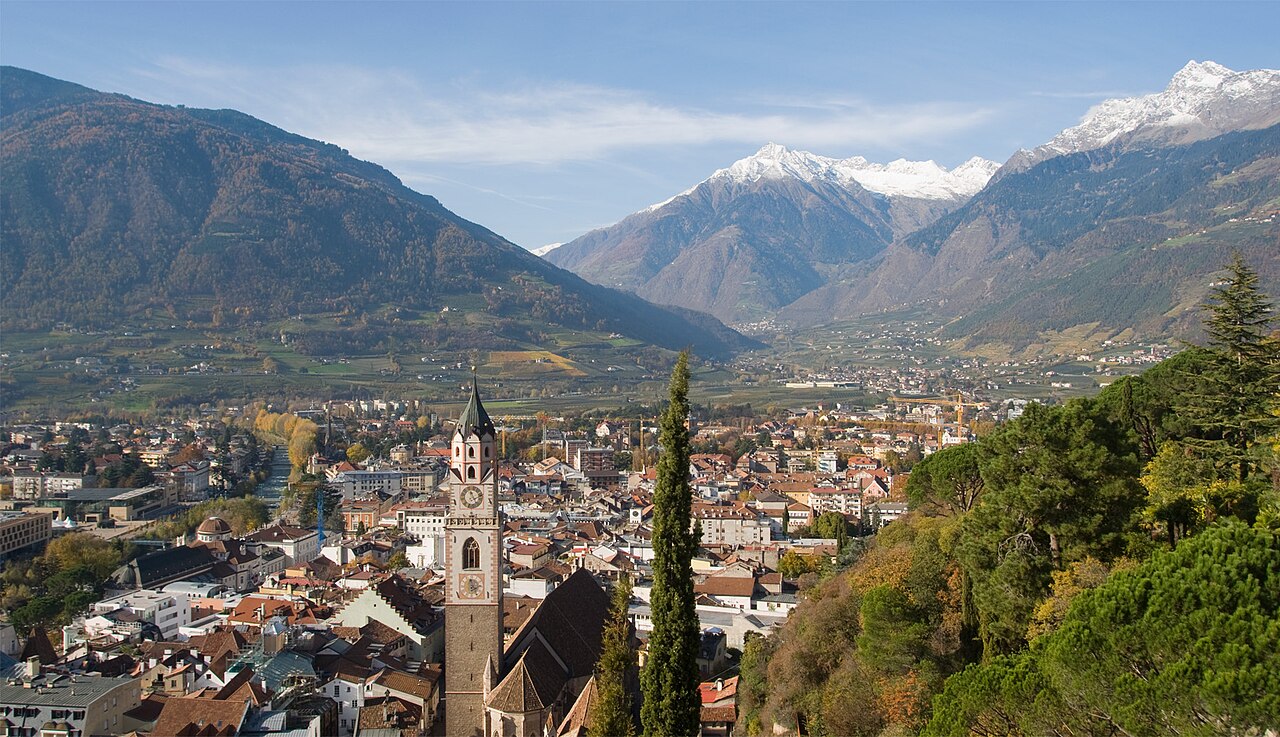
The three main valleys of South Tyrol are the Adige Valley, the Eisack Valley and the Puster Valley, formed by the Ice Age Adige glacier and its tributaries. The highest part of the Adige valley in western South Tyrol, from Reschen (1,507 metres or 4,944 feet) to Töll (approx. 500 metres or 1,600 feet) near Merano, is called Vinschgau; the southernmost section, from Bolzano to Salurner Klause (207 metres or 679 feet), is divided into Überetsch and Unterland. From there, the Adige Valley continues in a southerly direction until it merges with the Po plain at Verona.
At Bolzano, the Eisack Valley merges into the Adige Valley. The Eisack Valley runs from Bolzano northeastward to Franzensfeste, where it merges with the Wipp Valley, which runs first northwestward and then northward over the Brenner Pass to Innsbruck. In the town of Brixen, the Eisack Valley meets the Puster Valley, which passes through Bruneck and reaches Lienz via the Toblacher Sattel (1,210 metres or 3,970 feet). In addition to the three main valleys, South Tyrol has a large number of side valleys. The most important and populated side valleys are (from west to east) Sulden, Schnals, Ulten, Passeier, Ridnaun, the Sarntal, Pfitsch, Gröden, the Gadertal, the Tauferer Ahrntal and Antholz.
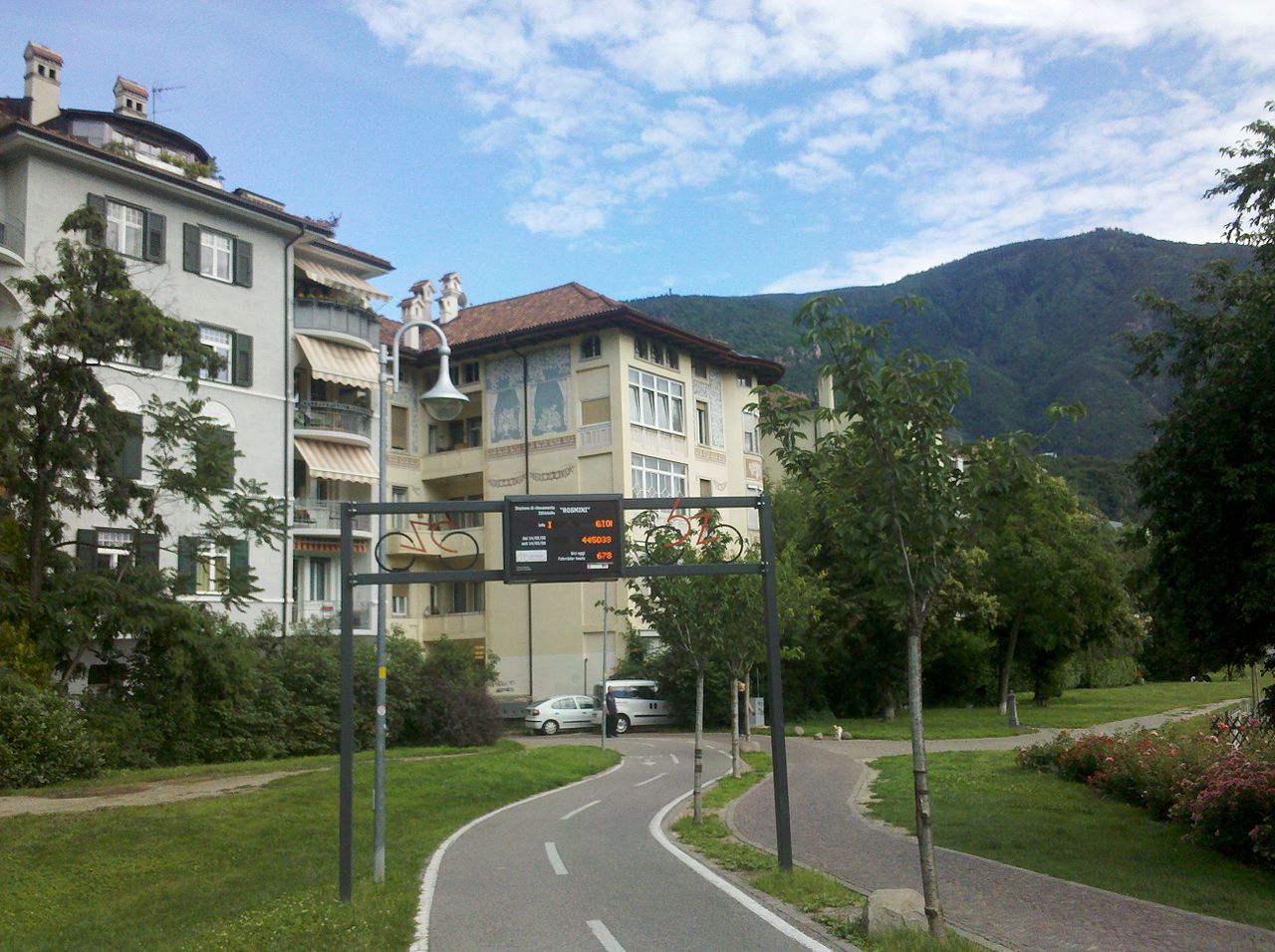
In mountainous South Tyrol, about 64.5% of the total land area is above 1,500 metres (4,900 ft) above sea level and only 14% below 1,000 metres (3,300 ft). Therefore, a large part of the population is concentrated in relatively small areas in the valleys at an altitude of between 100 and 1,200 metres (330 and 3,940 ft), mainly in the area of the extensive alluvial cones and broad basins. The most densely populated areas are in the Adige valley, where three of the four largest cities, Bolzano, Merano and Laives, are located. The flat valley bottoms are mainly used for agriculture.