
Sint Maarten (Dutch pronunciation: [sɪntˈmaːrtə(n)] ; Spanish: San Martín, French: Saint-Martin) is a constituent country of the Kingdom of the Netherlands located in the Caribbean region of North America. With a population of 58,477 as of June 2023 on an area of 34 km2 (13 sq mi), it encompasses the southern 44% of the divided island of Saint Martin, while the northern 56% of the island constitutes the French overseas collectivity of Saint Martin. Sint Maarten's capital is Philipsburg. Collectively, Sint Maarten and the other Dutch islands in the Caribbean are often called the Dutch Caribbean.
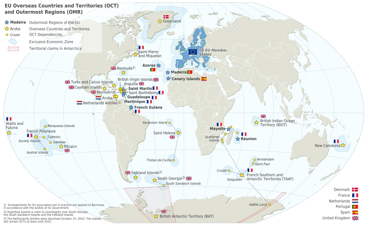
Before 10 October 2010, Sint Maarten was known as the Island Territory of Sint Maarten (Dutch: Eilandgebied Sint Maarten), and was one of six (and from 1986 onwards, five) island territories (eilandgebieden) that constituted the Netherlands Antilles. Sint Maarten has the status of an EU overseas country; it is not part of the European Union, but is a member of the Overseas Countries and Territories Association.
On 6 and 7 September 2017, the island was hit by Category 5 Hurricane Irma, which caused widespread and significant damage to buildings and infrastructure.
Etymology
Due to confusion on early maps, the island was accidentally confused with Nevis and given the name Christopher Columbus had originally given that island in honor of Saint Martin of Tours, when he first sighted Nevis on the saint's feast day on 11 November 1493.
"Sint Maarten" is Saint Martin in Dutch.
History
Pre-colonial
Sint Maarten had been inhabited by the Indigenous peoples for many centuries, with archaeological finds pointing to a human presence on the island as early as 2000 BC. These people most likely migrated from South America. The earliest identified group were the Arawak people who are thought to have settled around the period 800 BC – 300 BC. Circa 1300–1400 AD they began to be displaced with the arrival of the Kalinago people.

Arrival of Europeans
It is commonly believed that Christopher Columbus named the island in honor of Saint Martin of Tours when he encountered it on his second voyage of discovery. However, he actually applied the name to the island now called Nevis when he anchored offshore on 11 November 1493, the feast day of Saint Martin. The confusion of numerous poorly charted small islands in the Leeward Islands meant that this name was accidentally transferred to the island now known as Saint-Martin/Sint Maarten.
Nominally Spanish territory, the island became the focus of the competing interests of the European powers, notably the French and Dutch. While the French wanted to colonize the islands between Trinidad and Bermuda, the Dutch found San Martín a convenient halfway point between their colonies in New Amsterdam (present day New York) and New Holland. Meanwhile, the Amerindian population began to decline precipitously, dying from introduced diseases to which they had no immunity.
The Dutch built a fort (Fort Amsterdam) on the island in 1631; Jan Claeszen van Campen became its first governor and the Dutch West India Company began mining salt on the island. Tensions between the Netherlands and Spain were already high due to the ongoing Eighty Years' War, and in 1633 the Spanish captured St. Martin and drove off the Dutch colonists. At Point Blanche, they built what is now Old Spanish Fort to secure the territory. The Dutch under Peter Stuyvesant attempted to wrest back control in 1644, but were repulsed. However, in 1648 the Eighty Years' War ended and the Spanish, no longer seeing any strategic or economic value in the island, simply abandoned it.
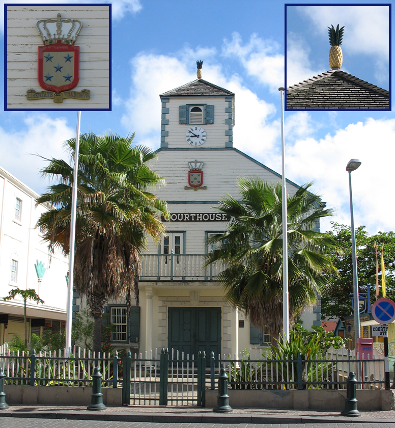
With Saint Martin free again, both the Dutch and the French jumped at the chance to re-establish their settlements. Dutch colonists came from St. Eustatius, while the French came from St. Kitts. After some initial conflict, both sides realized that neither would yield easily. Preferring to avoid an all-out war, they signed the Treaty of Concordia in 1648, which divided the island in two. During the treaty's negotiation, the French had a fleet of naval ships off shore, which they used as a threat to bargain more land for themselves. In spite of the treaty, relations between the two sides were not always cordial. Between 1648 and 1816, conflicts changed the border sixteen times. The entire island came under effective French control from 1795 when Netherlands became a puppet state under the French Empire until 1815. In the end, the French came out ahead with 53 km2 (20 sq mi; 61%) against 34 km2 (13 sq mi; 39%) on the Dutch side.
18th–19th centuries
To work the new cotton, tobacco, and sugarcane plantations, the French and Dutch began importing large numbers of African slaves, who soon came to outnumber the Europeans. The slave population quickly grew larger than that of the land owners. Subjected to cruel treatment, slaves staged rebellions, and their overwhelming numbers made it impossible to ignore their concerns. In 1848, the French abolished slavery in their colonies including the French side of St. Martin. Slaves on the Dutch side of the island protested and threatened to flee to the French side to seek asylum. The local Dutch authorities then freed the colonies' slaves. While this decree was respected locally, it was not until 1863 when the Dutch abolished slavery in all of their island colonies that the slaves became legally free.
20th century
After the abolition of slavery, plantation culture declined and the island's economy suffered. In 1939, Sint Maarten received a major boost when it was declared a duty-free port. In 1941, the island was shelled by a German U-boat as part of the Battle of the Atlantic.

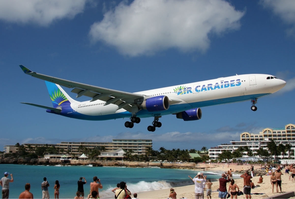
Tourism began growing from the 1950s onward, and Princess Juliana International Airport became one of the busiest in the Eastern Caribbean. For much of this period, Sint Maarten was governed by business tycoon Claude Wathey of the Democratic Party. The island's demographics changed dramatically during this period as well, with the population increasing from a mere 5,000 people to around 60,000 people by the mid-1990s. Immigration from the neighbouring Lesser Antilles, Curaçao, Haiti, the Dominican Republic, the United States, Europe, and Asia turned the native population into a minority.
Sint Maarten became an "island territory" (eilandgebied in Dutch) of the Netherlands Antilles in 1983. Before that date, Sint Maarten was part of the island territory of the Windward Islands, together with Saba and Sint Eustatius. The status of an island territory entails considerable autonomy summed up in the Island Regulation of the Netherlands Antilles. During this period Sint Maarten was ruled by an island council, an executive council, and a lieutenant governor (Dutch: gezaghebber) appointed by the Dutch Crown.
Hurricane Luis in late August and early September 1995 hit the island, causing immense destruction and resulting in 12 deaths.
21st century
In 1994, the Kingdom of the Netherlands and France had signed the Franco-Dutch treaty on Saint Martin border controls, which allows for joint Franco-Dutch border controls on so-called "risk flights". After some delay, the treaty was ratified in November 2006 in the Netherlands and subsequently entered into force on 1 August 2007. Though the treaty is now in force, its provisions are not yet implemented as the working group specified in the treaty is not yet installed.
On 10 October 2010 Sint Maarten became a constituent country (Dutch: Land Sint Maarten) within the Kingdom of the Netherlands, making it a constitutional equal partner with Aruba, Curaçao, and the Netherlands proper. Constitution Day (10 October) is celebrated annually as a public holiday.
Sint Maarten has been assigned the ISO 3166-1 alpha-2 country codes of SXM and SX, and the .sx Internet ccTLD became available to register on 15 November 2012.

Effects of Hurricane Irma
Hurricane Irma made landfall on 6 September 2017, causing extensive damage. Four deaths were ultimately reported, and there were 11 serious injuries out of a total of 34. Princess Juliana Airport was extensively damaged but reopened on a partial basis in two days to allow incoming relief flights and for flights to take evacuees to other islands. By 8 September, "many inhabitants [were] devoid of basic necessities" and looting had become a serious problem. Reports on 9 September indicated that 70% of the infrastructure on the Dutch part had been destroyed. A survey by the Dutch Red Cross estimated that nearly a third of the buildings in Sint Maarten had been destroyed and that over 90% of structures on the island had been damaged.
The prime minister of the Netherlands, Mark Rutte, told the news media on 8 September that the airport in Sint Maarten was ready to receive emergency flights and that aid, as well as police officers and military personnel, were on their way. The prime minister of Sint Maarten, William Marlin, had already asked the Dutch government for extended relief assistance which began to arrive on 8 September. The government issued a tropical storm warning on 8 September since the category four Hurricane Jose was approaching.
In the aftermath of the hurricane, the extensive damage led officials to predict dramatic economic impacts. A statement by Marlin summarized the situation on 8 September: "We've lost many, many homes. Schools have been destroyed. We foresee a loss of the tourist season because of the damage that was done to hotel properties, the negative publicity that one would have that it's better to go somewhere else because it's destroyed. So that will have a serious impact on our economy." At the time, preparations were being made as Hurricane Jose approached the island. The government estimated that on 9 September 70% of houses were badly damaged or destroyed and much of the population was living in shelters ahead of the arrival of Jose. Fortunately, this second hurricane did not have a significant impact on the island.
Widespread looting and violence erupted in the wake of the recovery, and a state of emergency was announced. Two hundred and thirty soldiers from the Netherlands were sent in to stabilize the situation, with additional troops arriving in the coming days. By 10 September, approximately 1,200 Americans had been evacuated to Puerto Rico by military aircraft. On that date, Royal Caribbean International said that the company was sending its Adventure of the Seas to Sint Maarten and to St. Thomas to provide supplies and to offer evacuation services. The ship arrived on the island on 10 September with water, ice, garbage bags, clothing, and canned food, and evacuated 320 people. By 11 September, King Willem-Alexander had already arrived in Curaçao and was scheduled to visit Sint Maarten, St. Eustatius, and Saba. When Willem-Alexander visited Sint Maarten for the first time post-hurricane, he was shocked by the destruction. He immediately called for support from the European Union so the island could recover swiftly. Later in the month, it was revealed that the EU would allocate €2 billion in emergency funds for immediate disaster relief to restore basic essentials on Sint Maarten, such as drinking water and sanitation. In addition to the EU's contribution, Red Cross, the government of the Netherlands, and Dutch citizens of the mainland raised money via donations and crowdfunding for the recovery efforts.
Post-hurricane rebuilding
On 10 October 2017, Princess Juliana International Airport re-commenced commercial flights using temporary structures, pending repairs.
A report in late March 2018 indicated that the airport was able to handle some flights and some service had resumed from the US, Canada, and Europe. A new departure lounge was being used during rebuilding of the original facility. The General Aviation building was being used for passengers arriving on the island.
A little over a year after Hurricane Irma, St Maarten's cruise industry had recovered to the extent that in 2018, more than 1 million cruise passengers visited the island.
Telecommunications, including Wi-Fi, had been restored on the island, 95% of customers were receiving electricity and drinking water was readily available on the island. Some tourist accommodations were open, with 27 operating and 36 said to be ready sometime later in 2018. Cruise ships were arriving in 2018.
The Sint Maarten Reconstruction, Recovery and Resilience Trust Fund was officially extended to December 2028 (Major projects including reconstruction of the airport were largely completed in 2024).
Political instability and snap elections
Following the January 2024 elections, the coalition government collapsed shortly after forming. This led to snap elections in August 2024, which eventually resulted in the administration of Prime Minister Luc Mercelina.
Geography
Sint Maarten occupies the southern part of the island of Saint Martin in the Leeward Islands; the northern half forms the French territory of Saint Martin. To the north across the Anguilla Channel lies the British Overseas Territory of Anguilla, to the south-east of the island lies the French island of Saint Barthélemy, and further south are the Dutch islands of Saba and Sint Eustatius.
Sint Maarten is 34 km2 (13 sq mi). The terrain is generally hilly, with the highest peak being Mount Flagstaff at 383m, which lies directly on the island's international border. The area to the west around the airport is flatter, and contains the Dutch section of the Simpson Bay Lagoon. The Great Salt Pond lies to north of Philipsburg. Several small islands lie off the coast. Little Key lies in the Simpson Bay Lagoon.
There are ten total islands in Sint Maarten, including:
Climate
Sint Maarten has a tropical savanna climate (Köppen Aw), and is drier than most parts of the northeastern Caribbean because of a rain shadow from the island's mountains, drying the trade winds. The driest months are from January to July, and the wettest from September to November, when hurricanes can strike the island.
Government and politics
Status within the Kingdom of the Netherlands
Sint Maarten is a constituent country of the Kingdom of the Netherlands, and as such the monarch of the Netherlands is head of state, represented locally by a governor. Following the dissolution of the Netherlands Antilles, the Constitution of Sint Maarten was unanimously adopted by the island council of Sint Maarten on 21 July 2010. Elections for a new island council were held on 17 September 2010, since the number of seats was increased from 11 to 15. The newly elected island council became the Estates of Sint Maarten on 10 October. Sint Maarten is largely autonomous in internal affairs, with the Netherlands responsible for foreign diplomacy and defence. The first woman to be the prime minister of Sint Maarten was Gracita Arrindell, who was first elected in 2010.
There currently is a movement in Sint Maarten aiming for the unification of island of Saint Martin, which has its own flag.
Since 2020, the relationship between the 2 has been defined by the Landspakket (structural reform in exchange for COVID-19 support). These reforms cover financial management, health care, and the labor market.
Relation to the European Union
Sint Maarten is classified as an Overseas Country and Territory (OCT) in Annex II of the Treaty on the Functioning of the European Union (TFEU). This annex lists all the territories that have special relationships with the European Union due to their connection with EU member states but are not part of the Union itself.
Being classified as an OCT Sint Maarten is not part of the European Union. The status of Sint Maarten is outlined in Article 355(2) in conjunction with Part Four —Articles 198 to 204— of the TFEU. Key points include:
Article 198 states that the European Union maintains special relationships with the OCTs, which are under the sovereignty of EU member states but are not part of the EU.
Article 199 specifies that these OCTs have a special status, meaning they are not part of the EU's internal market or customs union but benefit from special cooperation and development aid.
This classification means that while Sint Maarten benefits from economic and developmental cooperation with the EU, it does not participate in EU institutions or policies as full member states do.
Foreign policy and defence
The Kingdom of the Netherlands has overarching responsibility for foreign relations, defence and Dutch nationality law in the Caribbean parts of the Kingdom. A detachment of the Royal Netherlands Marine Corps is present on Sint Maarten and the Royal Netherlands Navy deploys a guardship, normally a Holland-class offshore patrol vessel, in the Caribbean on a rotational basis together with the support vessel HNLMS Pelikaan which operates out of Curaçao. Additionally, the Dutch Caribbean Coast Guard, directed by the commander of the Royal Netherlands Navy in the Caribbean, operates throughout the Caribbean and is funded by the four constituent countries of the Kingdom.
Environmental laws
The beach policy (as of 1994) views the beach from the perspective of being an ecosystem service for recreational activities. This is because the economy on Sint Maarten is tourism-driven, and many tourists come to the island to enjoy the 37 beaches on the island. The policy has three main points: the beach must be usable for everyone, developments negatively affecting recreational use will be prevented, and beaches should be protected against human influences that could impair their recreational function. The policy's main purpose is to protect the recreational value of the beach. The laws do not consider the protection and ecological value of this habitat in regard to protecting nesting sea turtles, preserving the beach line, or preserving the plants that live in and along the beach line.
The hillside policy, as of 1998, is mainly concerned with residential development. On the hillside, only residential development is permitted, certain hillsides with important "visual impact" are protected and conserved for their general landscape. A natural park is projected for the following hills: Cole Bay Hill, Sentry Hill, St. Peters Hill, Concordia Hill, Marigot Hill, Waymouth Hill, and Williams Hill. The policy stated the main objective was to conserve and maintain the green hillside and restore any natural habitats if needed. However, as of 2020, these natural parks had not yet been established.