
The Loire ( LWAR, US also loo-AR, French: [lwaʁ] ; Occitan: Léger [ˈledʒe]; Arpitan: Lêre; Breton: Liger [ˈliːɡɛr]; Latin: Liger) is the longest river in France and the 171st-longest in the world. With a length of 1,006 kilometres (625 mi), it drains 117,054 km2 (45,195 sq mi), more than a fifth of France's land, while its average discharge is only half that of the Rhône.
It rises in the southeastern quarter of the French Massif Central in the Cévennes range (in the department of Ardèche) at 1,350 m (4,430 ft) near Mont Gerbier de Jonc; it flows north through Nevers to Orléans, then west through Tours and Nantes until it reaches the Bay of Biscay (Atlantic Ocean) at Saint-Nazaire. Its main tributaries include the rivers Nièvre, Maine and the Erdre on its right bank, and the rivers Allier, Cher, Indre, Vienne, and the Sèvre Nantaise on the left bank.
The Loire gives its name to six departments: Loire, Haute-Loire, Loire-Atlantique, Indre-et-Loire, Maine-et-Loire, and Saône-et-Loire. The lower-central swathe of its valley straddling the Pays de la Loire and Centre-Val de Loire regions was added to the World Heritage Sites list of UNESCO on December 2, 2000. Vineyards and châteaux are found along the banks of the river throughout this section and are a major tourist attraction.

The human history of the Loire river valley is thought by some to begin with the Middle Palaeolithic period of 90–40 kya (thousand years ago), followed by modern humans (about 30 kya), succeeded by the Neolithic period (6,000 to 4,500 BC), all of the recent Stone Age in Europe. Then came the Gauls, the local tribes during the Iron Age period of 1500 to 500 BC. They used the Loire as a key trading route by 600 BC, using pack horses to link its trade, such as the metals of the Armorican Massif, with Phoenicia and Ancient Greece via Lyon on the Rhône. Gallic rule ended in the valley in 56 BC when Julius Caesar conquered the adjacent provinces for Rome. Christianity was introduced into this valley from the 3rd century AD, as missionaries (many later recognized as saints), converted the pagans. In this period, settlers established vineyards and began producing wines.
The Loire Valley has been called the "Garden of France" and is studded with over a thousand châteaux, each with distinct architectural embellishments covering a wide range of variations, from the early medieval to the late Renaissance periods. They were originally created as feudal strongholds, over centuries past, in the strategic divide between southern and northern France; now many are privately owned.
Etymology
The name "Loire" comes from Latin Liger, which is itself a transcription of the native Gaulish (Celtic) name of the river. The Gaulish name comes from the Gaulish word liga, which means "silt, sediment, deposit, alluvium", a word that gave French lie, as in sur lie, which in turn gave English lees.
Liga comes from the Proto-Indo-European root *legʰ-, meaning "to lie, lay" as in the Welsh word Lleyg, and also which gave many words in English, such as to lie, to lay, ledge, law, etc.
Geography
The source of the river lies in the eastern Massif Central, in springs to the south side of Mont Gerbier de Jonc at 44°50′38″N 4°13′12″E. This lies in the north-eastern part of the southern Cévennes highlands, in the Ardèche commune of Sainte-Eulalie of southeastern France. It is originally a mere trickle of water located at 1,408 m (4,619 ft) above sea-level. The presence of an aquifer under Mont Gerbier de Jonc gives rise to multiple sources, three of them located at the foot of Mount have been highlighted as river sources. The three streams converge to form the Loire, which descends the valley south of Mount through the village of Sainte-Eulalie itself.
The Loire changed its course, due to tectonic deformations, from the original outfall into the English Channel to its new outfall into the Atlantic Ocean thereby forming today's narrow terrain of gorges, the Loire Valley with alluvium formations and the long stretch of beaches along the Atlantic Ocean. The river can be divided into three main zones:

the Upper Loire, the area from the source to the confluence with the Allier
the middle Loire Valley, the area from the Allier to the confluence with the Maine, about 280 km (170 mi)
the Lower Loire, the area from Maine to the estuary

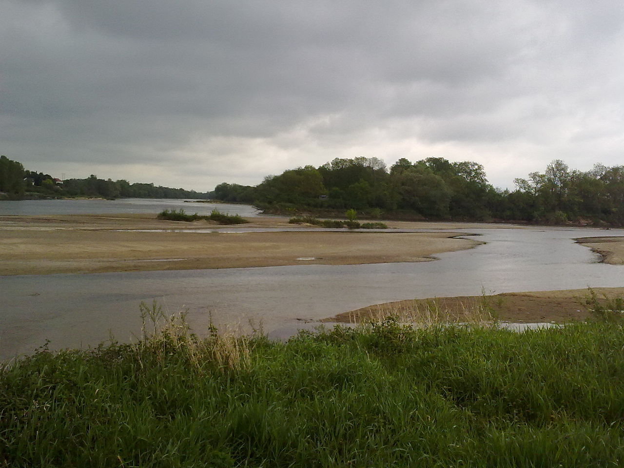
In the upper basin the river flows through a narrow, incised valley, marked by gorges and forests on the edges and a distinct low population. In the intermediate section, the alluvial plain broadens and the river meanders and forks into multiple channels. River flow is particularly high in the river area near Roanne and Vichy up to the confluence with the Allier. In the middle section of the river in the Loire Valley, numerous dikes built between the 12th and 19th century exist, providing mitigation against flooding. In this section the river is relatively straight, except for the area near Orléans, and numerous sand banks and islands exist. The lower course of the river is characterized by wetlands and fens, which are of major importance to conservation, given that they form unique habitats for migratory birds.
The Loire flows roughly northward through Roanne and Nevers to Orléans and thereafter westward through Tours to Nantes, where it forms an estuary. It flows into the Atlantic Ocean at 47°16′44″N 2°10′19″W between Saint-Nazaire and Saint-Brevin-les-Pins, connected by a bridge over the river near its mouth. Several départements of France were named after the Loire. The Loire flows through the following départements and towns:
Ardèche

Haute-Loire
Le Puy-en-Velay
Loire

Feurs
Roanne
Saône-et-Loire
Digoin
Allier
Nièvre
Decize
Nevers
La Charité-sur-Loire
Cosne-Cours-sur-Loire
Cher
Sancerre
Loiret
Briare
Gien
Orléans
Loir-et-Cher
Blois
Indre-et-Loire
Amboise
Tours
Maine-et-Loire:
Montsoreau
Saumur
Loire-Atlantique
Ancenis
Nantes
Saint-Nazaire
The Loire Valley in the Loire river basin, is a 300 km (190 mi) stretch in the western reach of the river starting with Orléans and terminating at Nantes, 56 km (35 mi) short of the Loire estuary and the Atlantic Ocean. The tidal stretch of the river extends to a length of 60 km (37 mi) and a width of 3 km (1.9 mi), which has oil refineries, the port of Saint-Nazaire and 40,000 hectares (99,000 acres) of wetland whose formation is dated to 7500 BC (caused by inundation by sea waters on the northern bank of the estuary), and the beaches of Le Croisic and La Baule along the coastline.
Tributaries
Its main tributaries include the rivers Maine, Nièvre and the Erdre on its right bank, and the rivers Allier, Cher, Indre, Vienne, and the Sèvre Nantaise on the left bank. The largest tributary of the river is the Allier, 410 km (250 mi) in length, which joins the Loire near the town of Nevers at 46°57′34″N 3°4′44″E. Downstream of Nevers lies the Loire Valley, a UNESCO World Heritage Site due to its fine assortment of castles. The second-longest tributary, the 372 km (231 mi) Vienne, joins the Loire at Candes-Saint-Martin at 47°12′45″N 0°4′31″E, followed by the 367.5 km (228.4 mi) Cher, which joins the Loire near Cinq-Mars-la-Pile at 47°20′33″N 0°28′49″E and the 287 km (178 mi) Indre, which joins the Loire near Néman at 47°14′2″N 0°11′0″E.
Geology
The geological formations in the Loire river basin can be grouped into two sets of formations, namely, the basement domain and the domain of sedimentary formations. The basement domain primarily consists of metamorphic and siliceous fragmented rocks with groundwater occurring in fissures. The sedimentary domain consists of limestone and carbonaceous rocks, that, where saturated, form productive aquifers. Rock outcrops of granite or basalt also are exposed in the river bed in several stretches.
The middle stretches of the river have many limestone caves which were inhabited by humans in the prehistoric era; the caves are several types of limestone formations, namely tuffeau (a porous type of chalk, not to be confused with tufa) and Falun (formed 12 million years ago). The coastal zone shows hard dark stones, granite, schist and thick soil mantle.
Discharge and flood regulation
The river has a discharge rate of 863 m3/s (30,500 cu ft/s), which is an average over the period 1967–2008.
The discharge rate varies strongly along the river, with roughly 350 m3/s (12,000 cu ft/s) at Orléans and 900 m3/s (32,000 cu ft/s) at the mouth. It also depends strongly on the season, and the flow of only 10 m3/s (350 cu ft/s) is not uncommon in August–September near Orléans. During floods, which usually occur in February and March but also in other periods, the flow sometimes exceeds 2,000 m3/s (71,000 cu ft/s) for the Upper Loire and 8,000 m3/s (280,000 cu ft/s) in the Lower Loire. The most serious floods occurred in 1856, 1866 and 1911. Unlike most other rivers in western Europe, there are very few dams or locks creating obstacles to its natural flow. The flow is no longer partly regulated by three dams: Grangent Dam and Villerest Dam on the Loire and Naussac Dam on the Allier. The Villerest dam, built in 1985 a few kilometres (a few miles) south of Roanne, has played a key-role in preventing recent flooding. As a result, the Loire is a very popular river for boating excursions, flowing through a pastoral countryside, past limestone cliffs and historic castles. Four nuclear power plants are located on the river: Belleville, Chinon, Dampierre and Saint-Laurent.
Navigation
In 1700 the port of Nantes numbered more inland waterway craft than any other port in France, testifying to the historic importance of navigation on France's longest river. Shallow-draught gabares and other river craft continued to transport goods into the industrial era, including coal from Saint-Étienne loaded on to barges in Orléans. However, the hazardous free-flow navigation and limited tonnages meant that railways rapidly killed off the surviving traffic from the 1850s. In 1894 a company was set up to promote improvements to the navigation from Nantes to Briare. The works were authorised in 1904 and carried out in two phases from Angers to the limit of tides at Oudon. These works, with groynes and submersible embankments, survive and contribute to the limited navigability under present-day conditions. A dam across the Loire at Saint-Léger-des-Vignes provides navigable conditions to cross from the Canal du Nivernais to the Canal latéral à la Loire.
As of 2017, the following sections are navigable: