
The National Weather Service (NWS) is an agency of the United States federal government that is tasked with providing weather forecasts, warnings of hazardous weather, and other weather-related products to organizations and the public for the purposes of protection, safety, and general information. It is a part of the National Oceanic and Atmospheric Administration (NOAA) branch of the Department of Commerce, and is headquartered in Silver Spring, Maryland, within the Washington metropolitan area. The agency was known as the United States Weather Bureau from 1891 until it adopted its current name in 1970.
The NWS performs its primary task through a collection of national and regional centers, and 122 local Weather Forecast Offices (WFOs). As the NWS is an agency of the U.S. federal government, most of its products are in the public domain and available free of charge.
History
1870–1899
Early attempts to record weather information can be traced back to Joseph Henry of the Smithsonian Institution, who, after a tornado in Jefferson, Illinois (modern-day Des Plaines, Illinois), in 1855, wrote to the Daily Democratic Press in Chicago for more information about the storm. Organized large-scale weather recording by the Smithsonian led to the creation of the U.S. Signal Service, the earliest predecessor of the modern-day National Weather Service. In 1869, Cleveland Abbe, then director of the Cincinnati Observatory, began developing and issuing public weather forecasts (which he called "probabilities") using daily weather observations collected simultaneously and sent via telegraph by a network of observers. This effort was undertaken in cooperation with the Cincinnati Chamber of Commerce and Western Union, which he convinced to back the collection of such information. Meanwhile, Increase A. Lapham of Wisconsin lobbied Congress to create a storm warning service, having witnessed the destructive power of storms in the Great Lakes region. Representative Halbert E. Paine introduced a bill authorizing the secretary of war to establish such a service. On February 9, 1870, the first official weather service of the United States was established through a joint resolution of Congress signed by President Ulysses S. Grant with a mission to "provide for taking meteorological observations at the military stations in the interior of the continent and at other points in the States and Territories... and for giving notice on the northern (Great) Lakes and on the seacoast by magnetic telegraph and marine signals, of the approach and force of storms." The agency was placed under the secretary of war as Congress felt "military discipline would probably secure the greatest promptness, regularity, and accuracy in the required observations." Within the Department of War, it was assigned to the U.S. Army Signal Service under the chief signal officer, Brigadier General Albert J. Myer. Myer gave the National Weather Service its first name: The Division of Telegrams and Reports for the Benefit of Commerce.

In November 1870, Myer hired Lapham as the first civilian assistant to the new service, but Lapham left less than two years later. Abbe joined as the second civilian assistant to Myer in January 1871 and began developing a system for national forecasts, based on his work in Cincinnati, which he began issuing the following month. Throughout his career with the weather service, which lasted 45 years, Abbe urged continued research in meteorology to provide a scientific basis for forecasting. While a debate went on between the Signal Service and Congress over whether the forecasting of weather conditions should be handled by civilian agencies or the Signal Service's existing forecast office, a Congressional committee was formed to oversee the matter, recommending that the office's operations be transferred to the Department of War following a two-year investigation.
The agency first became a civilian enterprise in 1891, when it became part of the Department of Agriculture and its name officially became the U.S. Weather Bureau. Under the oversight of that branch, the Bureau began issuing flood warnings and fire weather forecasts, and issued the first daily national surface weather maps; it also established a network to distribute warnings for tropical cyclones as well as a data exchange service that relayed European weather analysis to the Bureau and vice versa.
20th century
The first Weather Bureau radiosonde was launched in Massachusetts in 1937, which prompted a switch from routine aircraft observation to radiosondes within two years. The Bureau prohibited the word "tornado" from being used in any of its weather products out of concern for inciting panic (a move contradicted in its intentions by the high death tolls in past tornado outbreaks due to the lack of advanced warning) until 1938, when it began disseminating tornado warnings exclusively to emergency management personnel.

The Bureau would in 1940 be moved to the Department of Commerce. In 1941, Margaret Smagorinsky (née Knoepfel) was hired as the Weather Bureau's first female statistician. On July 12, 1950, Bureau chief Francis W. Reichelderfer officially lifted the agency's ban on public tornado alerts in a Circular Letter, noting to all first order stations that "Weather Bureau employees should avoid statements that can be interpreted as a negation of the Bureau's willingness or ability to make tornado forecasts", and that a "good probability of verification" exist when issuing such forecasts due to the difficulty in accurately predicting tornadic activity. After facing criticism for continuing to refuse to provide public tornado warnings and preventing the release of the USAF Severe Weather Warning Center's tornado forecasts (pioneered in 1948 by Air Force Capt. Robert C. Miller and Major Ernest Fawbush) beyond military personnel, the Bureau issued its first experimental public tornado forecasts in March 1952. In 1957, the Bureau began using radars for short-term forecasting of local storms and hydrological events, using modified versions of those used by Navy aircraft to create the WSR-57 (Weather Surveillance Radar, 1957), with a network of WSR systems being deployed nationwide through the early 1960s; some of the radars were upgraded to WSR-74 models beginning in 1974.
In August 1966, the Weather Bureau became part of the Environmental Science Services Administration when that agency was formed. The Environmental Science Services Administration was renamed the National Oceanic and Atmospheric Administration (NOAA) on October 1, 1970, with the enactment of the National Environmental Policy Act. At this time, the Weather Bureau became the National Weather Service.
At the beginning of the 1980s the NWS used the same radar equipment as in the 1950s, and teletype for communication. In 1983, NOAA administrator John V. Byrne proposed to auction off all of the weather satellites, to repurchase data from private buyers, outsourcing weather observation stations, NOAA Weather Radio and computerized surface analysis to private companies but the proposal failed in a Congressional vote.

NEXRAD (Next Generation Radar), a system of Doppler radars deployed to improve the detection and warning time of severe local storms, replaced the WSR-57 and WSR-74 systems between 1988 and 1997.
21st century
In 2025, the National Weather Service was deeply affected by cuts to NOAA under the second presidency of Donald Trump, including staff being laid off, contracts with universities being cancelled, and restrictions on exchanges with other national weather services. Entering hurricane season, 30 National Weather Service offices were without a chief meteorologist, in part due to Trump administration layoffs.
On August 28, 2025, President Trump signed an executive order, which dissolved the NWS Employee Union, and determined the National Weather Service "to have as a primary function intelligence, counterintelligence, investigative, or national security work". The White House justified this decision by stating that the National Weather Service provides "weather and climate data that inform the weather forecasting used to plan U.S. military deployments. Weather forecasts have long been critical factor [sic] in the success or failure of military operations."
Forecast sub-organizations
The NWS, through a variety of sub-organizations, issues different forecasts to users, including the general public. Although, throughout history, text forecasts have been the means of product dissemination, the NWS has been using more forecast products of a digital, gridded, image or other modern format. Each of the 122 Weather Forecast Offices (WFOs) send their graphical forecasts to a national server to be compiled in the National Digital Forecast Database (NDFD). The NDFD is a collection of common weather observations used by organizations and the public, including precipitation amount, temperature, and cloud cover among other parameters. In addition to viewing gridded weather data via the internet, users can download and use the individual grids using a GRIB2 decoder, which can output data as shapefiles, netCDF, GrADS, float files, and comma-separated value files. Specific points in the digital database can be accessed using an XML SOAP service.
Fire weather
The National Weather Service issues many products relating to wildfires daily. For example, a Fire Weather Forecast, which have a forecast period covering up to seven days, is issued by local WFOs daily, with updates as needed. The forecasts contain weather information relevant to fire control and smoke management for the next 12 to 48 hours, such as wind direction and speed, and precipitation. The appropriate crews use this information to plan for staffing and equipment levels, the ability to conduct scheduled controlled burns, and assess the daily fire danger. Once per day, NWS meteorologists issue a coded fire weather forecast for specific United States Forest Service observation sites that are then input into the National Fire Danger Rating System (NFDRS). This computer model outputs the daily fire danger that is then conveyed to the public in one of five ratings: low, moderate, high, very high, or extreme.
The local Weather Forecast Offices of the NWS also, under a prescribed set of criteria, issue Fire Weather Watches and Red Flag Warnings as needed, in addition to issuing the daily fire weather forecasts for the local service area. These products alert the public and other agencies to conditions which create the potential for extreme fires. On the national level, the NWS Storm Prediction Center issues fire weather analyses for days one and two of the forecast period that provide supportive information to the local WFO forecasts regarding particular critical elements of fire weather conditions. These include large-scale areas that may experience critical fire weather conditions including the occurrence of "dry thunderstorms", which usually occur in the western U.S., and are not accompanied by any rain due to it evaporating before reaching the surface.

State and federal forestry officials sometimes request a forecast from a WFO for a specific location called a "spot forecast", which are used to determine whether it will be safe to ignite a prescribed burn and how to situate crews during the controlling phase. Officials send in a request, usually during the early morning, containing the position coordinates of the proposed burn, the ignition time, and other pertinent information. The WFO composes a short-term fire weather forecast for the location and sends it back to the officials, usually within an hour of receiving the request.
The NWS assists officials at the scene of large wildfires or other disasters, including HAZMAT incidents, by providing on-site support through Incident Meteorologists (IMET). IMETs are NWS forecasters specially trained to work with Incident Management Teams during severe wildfire outbreaks or other disasters requiring on-site weather support. IMETs travel quickly to the incident site and then assemble a mobile weather center capable of providing continuous meteorological support for the duration of the incident. The kit includes a cell phone, a laptop computer, and communications equipment, used for gathering and displaying weather data such as satellite imagery or numerical forecast model output. Remote weather stations are also used to gather specific data for the point of interest, and often receive direct support from the local WFO during such crises. IMETs, approximately 70 to 80 of which are employed nationally, can be deployed anywhere a disaster strikes and must be capable of working long hours for weeks at a time in remote locations under rough conditions.
Aviation
The NWS supports the aviation community through the production of several forecasts. Each area's WFO has responsibility for the issuance of Terminal Aerodrome Forecasts (TAFs) for airports in their jurisdiction. TAFs are concise, coded 24-hour forecasts (30-hour forecasts for certain airports) for a specific airport, which are issued every six hours with amendments as needed. As opposed to a public weather forecast, a TAF only addresses weather elements critical to aviation; these include wind, visibility, cloud cover and wind shear.

Field offices
Weather Forecast Offices
The National Weather Service operates 122 local offices, known as Weather Forecast Offices (WFOs), to issue products specific to those areas. Each WFO maintains a specific area of responsibility spanning multiple counties, parishes or other jurisdictions within the United States – which, in some areas, cover multiple states – or individual possessions; the local offices handle responsibility of composing and disseminating forecasts and weather alerts to areas within their region of service. Some of the products that are only issued by the WFOs are severe thunderstorm and tornado warnings, flood, flash flood, and winter weather watches and warnings, some aviation products, and local forecast grids. The forecasts issued by a WFO are available on their individual pages within the Weather.gov website, which can be accessed through either forecast landing pages (which identify the office that disseminates the weather data) or via the alert map featured on the main page of the National Weather Service website.
River Forecast Centers
Daily river forecasts are issued by the thirteen River Forecast Centers (RFCs) using hydrologic models based on rainfall, soil characteristics, precipitation forecasts, and several other variables. The first such center was founded on September 23, 1946. Some RFCs, especially those in mountainous regions, also provide seasonal snow pack and peak flow forecasts. These forecasts are used by a wide range of users, including those in agriculture, hydroelectric dam operation, and water supply resources.
Center Weather Service Units
Twenty-one NWS Center Weather Service Units (CWSUs) are collocated with the Federal Aviation Administration (FAA) Air Route Traffic Control Centers (ARTCC). Their main responsibility is to provide up-to-the-minute weather information and briefings to the Traffic Management Units and control room supervisors. Special emphasis is given to weather conditions that could be hazardous to aviation or impede the flow of air traffic in the National Airspace System. Besides scheduled and unscheduled briefings for decision-makers in the ARTCC and other FAA facilities, CWSU meteorologists also issue two unscheduled products. The Center Weather Advisory (CWA) is an aviation weather warning for thunderstorms, icing, turbulence, and low cloud ceilings and visibilities. The Meteorological Impact Statement (MIS) is a two- to 12-hour forecast that outlines weather conditions expected to impact ARTCC operations.
National Centers for Environmental Prediction
Aviation Weather Center
The Aviation Weather Center (AWC), located in Kansas City, Missouri, is a central aviation support facility operated by the National Weather Service, which issues two primary products:
AIRMET (Airmen's Meteorological Information) – Information on icing, turbulence, mountain obscuration, low-level wind shear, instrument meteorological conditions, and strong surface winds.
SIGMETs (Significant Meteorological Information) – Issued for significant weather that may affect an airport of flight path in an area:
Convective – Issued for an area of thunderstorms affecting an area of 3,000 square miles (7,800 km2) or greater, a line of thunderstorms at least 60 nmi (110 km) long, or severe or embedded thunderstorms affecting any area that are expected to last 30 minutes or longer.
Non-convective – Issued for severe turbulence over a 3,000 square miles (7,800 km2) area, severe icing over a 3,000 square miles (7,800 km2), or instrument meteorological conditions over a 3,000 square miles (7,800 km2) area due to dust, sand, or volcanic ash.
Storm Prediction Center
The Storm Prediction Center (SPC) in Norman, Oklahoma issues severe thunderstorm and tornado watches in cooperation with local WFOs which are responsible for delineating jurisdictions affected by the issued watch, and SPC also issues mesoscale discussions focused upon possible convective activity. SPC compiles reports of severe hail, wind, or tornadoes issued by local WFOs each day when thunderstorms producing such phenomena occur in a given area, and formats the data into text and graphical products. It also provides forecasts on convective activity through day eight of the forecast period (most prominently, the threat of severe thunderstorms, the risk of which is assessed through a tiered system conveyed among six categories – general thunderstorms, marginal, slight, enhanced, moderate, or high – based mainly on the expected number of storm reports and regional coverage of thunderstorm activity over a given forecast day), and is responsible for issuing fire weather outlooks, which support local WFOs in the determination of the need for Red Flag Warnings.
Weather Prediction Center
The Weather Prediction Center in College Park, Maryland provides guidance for future precipitation amounts and areas where excessive rainfall is likely, while local NWS offices are responsible for issuing Flood Watches, Flash Flood Watches, Flood Warnings, Flash Flood Warnings, and Flood Advisories for their local County Warning Area, as well as the official rainfall forecast for areas within their warning area of responsibility. These products can and do emphasize different hydrologic issues depending on geographic area, land use, time of year, as well as other meteorological and non-meteorological factors (for example, during the early spring or late winter a Flood Warning can be issued for an ice jam that occurs on a river, while in the summer a Flood Warning will most likely be issued for excessive rainfall).
In recent years, the NWS has enhanced its dissemination of hydrologic information through the Advanced Hydrologic Prediction Service (AHPS). The AHPS allows anyone to view near real-time observation and forecast data for rivers, lakes and streams. The service also enables the NWS to provide long-range probabilistic information which can be used for long-range planning decisions.
Ocean Prediction Center
The National Weather Service Ocean Prediction Center (OPC) in College Park, Maryland issues marine products for areas that are within the national waters of the United States. NWS national centers or Weather Forecast Offices issue several marine products:
Coastal Waters Forecast (CWF) – a text product issued by all coastal WFOs to explicitly state expected weather conditions within their marine forecast area of responsibility through day five; it also addresses expected wave heights.
Offshore Waters Forecast (OFF) – a text product issued by the OPC that provides forecast and warning information to mariners who travel on the oceanic waters adjacent to the U.S. coastal waters through day five.
NAVTEX forecast – a text forecast issued by the OPC (combining data from the Coastal Waters and Offshore Waters Forecasts) designed to accommodate broadcast restrictions of U.S. Coast Guard NAVTEX transmitters.
High Seas Forecast (HSF) – routine text product issued every six hours by OPC to provide warning and forecast information to mariners who travel on the oceanic waters.
National Hurricane Center
The National Hurricane Center (NHC) and the Central Pacific Hurricane Center (CPHC), respectively based in Miami, Florida and Honolulu, Hawaii, are responsible for monitoring tropical weather in the Atlantic, and central and eastern Pacific Oceans. In addition to releasing routine outlooks and discussions, the guidance center initiates advisories and discussions on individual tropical cyclones, as needed. If a tropical cyclone threatens the United States or its territories, individual WFOs begin issuing statements detailing the expected effects within their local area of responsibility. The NHC and CPHC issue products including tropical cyclone advisories, forecasts, and formation predictions, and warnings for the areas in the Atlantic and parts of the Pacific.
Climate Prediction Center
The Climate Prediction Center (CPC) in College Park, Maryland is responsible for all of the NWS's climate-related forecasts. Their mission is to "serve the public by assessing and forecasting the impacts of short-term climate variability, emphasizing enhanced risks of weather-related extreme events, for use in mitigating losses and maximizing economic gains." Their products cover time scales from a week to seasons, extending into the future as far as technically feasible, and cover the land, the ocean and the atmosphere, extending into the stratosphere. Most of the products issued by the center cover the Contiguous U.S. and Alaska.
Additionally, Weather Forecast Offices issue daily and monthly climate reports for official climate stations within their area of responsibility. These generally include recorded highs, lows and other information (including historical temperature extremes, fifty-year temperature and precipitation averages, and degree days). This information is considered preliminary until certified by the National Climatic Data Center.
Space Weather Prediction Center
The Space Weather Prediction Center (SWPC), located in Boulder, Colorado, is responsible for monitoring and issuing forecasts, alerts, and warnings related to solar activity that may affect terrestrial activities. In particular, SWPC is concerned with how events such as coronal mass ejections (CMEs), geomagnetic storms, solar flares, and other phenomena can impact electric power transmission, GPS systems, HF radio and satellite communications, as well as other potential impacts.
SWPC also issues aurora forecasts for both the Northern Hemisphere and Southern Hemisphere.
Data acquisition
Surface observations
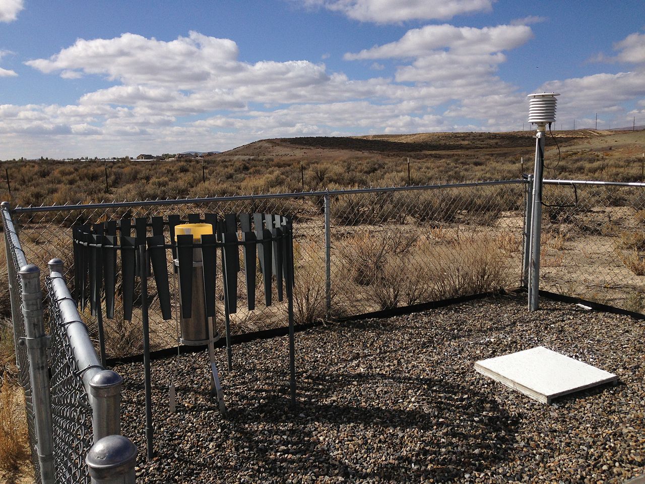
The primary network of surface weather observation stations in the United States is composed of Automated Surface Observing Systems (ASOS). The ASOS program is a joint effort of the National Weather Service (NWS), automatic weather station(AWS), the Federal Aviation Administration (FAA), and the Department of Defense (DOD). ASOS stations are designed to support weather forecast activities and aviation operations and, at the same time, support the needs of the meteorological, hydrological, and climatological research communities. ASOS was especially designed for the safety of the aviation community, therefore the sites are almost always located near airport runways. The system transmits routine hourly observations along with special observations when conditions exceed aviation weather thresholds (e.g. conditions change from visual meteorological conditions to instrument meteorological conditions). The basic weather elements observed are: sky condition, visibility, present weather, obstructions to vision, pressure, temperature, dew point, wind direction and speed, precipitation accumulation, and selected significant remarks. The coded observations are issued as METARs and look similar to this: