
Marin County ( mə-RIN) is a county located in the northwestern part of the San Francisco Bay Area of the U.S. state of California. As of the 2020 census, the population was 262,321. Its county seat and largest city is San Rafael. Marin County is across the Golden Gate Bridge from San Francisco, and is included in the San Francisco–Oakland–Berkeley, CA Metropolitan Statistical Area.
Marin County's natural sites include the Muir Woods redwood forest, the Marin Headlands, Stinson Beach, the Point Reyes National Seashore, and Mount Tamalpais. Marin is one of the highest-income counties by per capita income and median household income. The county is governed by the Marin County Board of Supervisors.
The Marin County Civic Center was designed by Frank Lloyd Wright and draws thousands of visitors a year to guided tours of its arch and atrium design. In 1994, a new county jail facility was embedded into the hillside nearby.

The United States' oldest cross country running event, the Dipsea Race, takes place annually in Marin County, attracting thousands of athletes. Modern mountain biking has many early origins on the slopes of Mount Tamalpais in Marin.
San Quentin State Prison is located in the county.
History
Native American settlement
Thousands of years ago, Coast Miwok people first populated the area today known as Marin County.

In 1770, Coast Miwok population ranged from 1,500 to 2,000, with about 600 village sites throughout the county.
In 1967, the Marin Museum of the American Indian was established, with exhibits focusing on Coast Miwok artifacts, crafts, and artwork. As of 2021, Indigenous-led events include healing drumming, dogbane cordage demonstrations, trade feasts, and traditional dancing.
History of Marin
During the Mexican-American war, areas of Marin County were seized by Americans as part of the conquest of California (1846–1847). Marin County is one of the original 27 counties of California, created February 18, 1850, following adoption of the California Constitution of 1849 and just months before the state was admitted to the Union.

According to General Mariano Vallejo, who headed an 1850 committee to name California's counties, the county was named for "Marin", great chief of the tribe Licatiut. Marin had been named "Huicmuse" until he was baptized as "Marino" at about age 20. Marin / Marino was born into the Huimen people, a Coast Miwok tribe of Native Americans who inhabited the San Rafael area. Vallejo believed that "Chief Marin" had waged several fierce battles against the Spanish. Marino definitely did reside at Mission Dolores (in modern San Francisco) much of the time from his 1801 baptism and marriage until 1817, frequently serving as a baptism witness and godfather; he may have escaped and been recaptured at some point during that time. Starting in 1817, he served as an alcalde (in effect, an overseer) at the San Rafael Mission, where he lived from 1817 off and on until his death. In 1821, Marino served as an expedition guide for the Spanish for a couple of years before escaping and hiding out for some months in the tiny Marin Islands (also named after him); his recapture resulted in a yearlong incarceration at the Presidio before his return to the Mission San Rafael area for about 15 years until his death in 1839. In 2009, a plaque commemorating Chief Marin was placed in Mill Valley.
Another version of the origin of the county name is that the bay between San Pedro Point and San Quentin Point was named Bahía de Nuestra Señora del Rosario la Marinera in 1775, and that Marin is simply an abbreviation of this name.
Francis Drake and the crew of the Golden Hind was thought to have landed on the Marin coast in 1579 claiming the land as Nova Albion. A bronze plaque inscribed with Drake's claim to the new lands, fitting the description in Drake's own account, was discovered in 1933. This so-called Drake's Plate of Brass was revealed as a hoax in 2003.

In 1595, Sebastian Cermeno lost his ship, the San Agustin, while exploring the Marin Coast. The Spanish explorer Vizcaíno landed about twenty years after Drake in what is now called Drakes Bay. However the first Spanish settlement in Marin was not established until 1817 when Mission San Rafael Arcángel was founded partly in response to the Russian-built Fort Ross to the north in what is now Sonoma County.
Mission San Rafael Arcángel was founded in what is now downtown San Rafael as the 20th Spanish mission in the colonial Mexican province of Alta California by four priests, Father Narciso Duran from Mission San Jose, Father Abella from Mission San Francisco de Asís, Father Gil y Taboada and Father Mariano Payeras, the President of the Missions, on December 14, 1817, four years before Mexico gained independence from Spain.
Geography
According to the U.S. Census Bureau, the county has a total area of 828 square miles (2,140 km2), of which 520 square miles (1,300 km2) is land and 308 square miles (800 km2), comprising 37.2%, is water. It is the fourth-smallest county in California by land area. According to the records at the County Assessor-Recorder's Office, as of June 2006, Marin had 91,065 acres (369 km2) of taxable land, consisting of 79,086 parcels with a total tax basis of $39.8 billion. These parcels are divided into the following classifications:

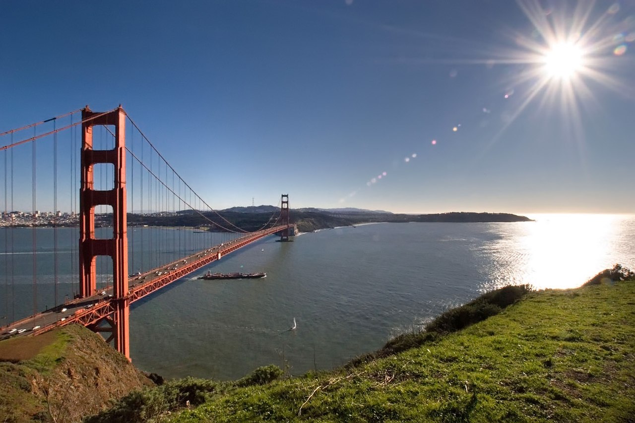
Geographically, the county forms a large, southward-facing peninsula, with the Pacific Ocean to the west, San Pablo Bay, and San Francisco Bay to the east, and – across the Golden Gate – the city of San Francisco to the south. Marin County's northern border is with Sonoma County.
Most of the county's population resides on the eastern side, with a string of communities running along U.S. Route 101 and the San Francisco Bay, from Sausalito to Tiburon to Corte Madera to San Rafael and Novato. The interior contains large areas of agricultural and open space; West Marin, through which State Route 1 runs alongside the California coast, contains many small unincorporated communities whose economies depend on agriculture and tourism. West Marin has beaches which are popular destinations for surfers and tourists year-round.
Notable features of the shoreline along the San Francisco Bay include the Sausalito shoreline, Richardson Bay, the Tiburon Peninsula, Ring Mountain, and Triangle Marsh at Corte Madera. Further north lies San Quentin State Prison along the San Rafael shoreline.
Adjacent counties
Sonoma County – north
San Francisco – south
National protected areas
Golden Gate National Recreation Area (part)
Marin Islands National Wildlife Refuge
Muir Woods National Monument
Point Reyes National Seashore
San Pablo Bay National Wildlife Refuge (part)
Gulf of the Farallones National Marine Sanctuary (part)
State and local protected areas
The Marin County Department of Parks and Open Space manages numerous county parks and open spaces, including Stafford Lake County Park. The Marin Municipal Water District has 130 mi (209 km) of trails.
State parks
Angel Island State Park
China Camp State Park
Mount Tamalpais State Park
Olompali State Historic Park
Samuel P. Taylor State Park
Tomales Bay State Park
Marine protected areas
Like underwater parks, these marine protected areas help conserve ocean wildlife and marine ecosystems:
Estero Americano State Marine Recreational Management Area
Estero de San Antonio State Marine Recreational Management Area
Point Reyes State Marine Reserve & Point Reyes State Marine Conservation Area
Estero de Limantour State Marine Reserve & Drakes Estero State Marine Conservation Area
Duxbury Reef State Marine Conservation Area
Ecology
Marin County is considered in the California Floristic Province, a zone of extremely high biodiversity and endemism. There are numerous ecosystems present, including Coastal Strand, oak woodland, mixed evergreen forest, and Coast Redwood Forests chaparral and riparian zones. There are also a considerable number of protected plant and animal species present: Fauna include the California red-legged frog (Rana draytonii) and California freshwater shrimp while flora include Marin Dwarf Flax, Hesperolinon congestum; Tiburon Jewelflower, Streptanthus niger; and Tiburon Indian paintbrush, Castilleja neglecta.
A number of watersheds exist in Marin County, including Walker Creek, Lagunitas Creek, Miller Creek, and Novato Creek.
Notably, the Lagunitas Creek Watershed is home to the largest remaining wild run of coho salmon (Oncorhynchus kisutch) in Central California. These coho are part of the "Central California Coast Evolutionarily Significant Unit, " or CCC ESU, and are listed as "endangered" at both the state and federal level.
Significant efforts to protect and restore these fish have been underway in the Watershed since the 1980s. Fifty percent of historical salmon habitat is now behind dams. Strong efforts are also being made to protect and restore undammed, headwater reaches of this Watershed in the San Geronimo Valley, where upwards of 40% of the Lagunitas salmon spawn each year and where as much as 1/3 of the juvenile salmon (or fry) spend their entire freshwater lives. The "Salmon Protection and Watershed Network" leads winter tours for the public to learn about and view these spawning salmon, and also leads year-round opportunities for the public to get involved in stream restoration, monitoring spawning and smolt outmigration, juvenile fish rescue and relocation in the summer, and advocacy and policy development. Around 490 different species of birds have been observed in Marin County.
Despite the lack of rain in the Marin County area due to historic drought levels, in 2014, an estimated 20,000 juvenile Coho salmon made the migration from their spawning grounds in the Lagunitas Creek area to the Pacific Ocean. This increase in migration was significantly up from the previous historic record for the same migration measured in 2006 at 11,000.
In 2010, all of the county's beaches were listed as the cleanest in the state.
When Richard Henry Dana Jr. visited San Francisco Bay in 1835, he wrote about vast tule elk (Cervus canadensis nannodes) herds near the Golden Gate on December 27: "...we came to anchor near the mouth of the bay, under a high and beautifully sloping hill, upon which herds of hundreds and hundreds of red deer [note: "red deer" is the European term for "elk"], and the stag, with his high branching antlers, were bounding about...," although it is not clear whether this was the Marin side or the San Francisco side.
Demographics
2020 census
As of the 2020 census, the county had a population of 262,321. The median age was 46.5 years. 20.2% of residents were under the age of 18 and 22.6% of residents were 65 years of age or older. For every 100 females there were 96.2 males, and for every 100 females age 18 and over there were 93.9 males age 18 and over.
The racial makeup of the county was 68.4% White, 2.4% Black or African American, 1.5% American Indian and Alaska Native, 6.3% Asian, 0.2% Native Hawaiian and Pacific Islander, 9.9% from some other race, and 11.3% from two or more races. Hispanic or Latino residents of any race comprised 18.8% of the population.