
The Jordan River or River Jordan (Arabic: نَهْر الْأُرْدُنّ, Nahr al-ʾUrdunn; Hebrew: נְהַר הַיַּרְדֵּן, Nəhar hayYardēn), also known as Nahr Al-Sharieat (Arabic: نهر الشريعة), is a 251-kilometre-long (156 mi) endorheic river in the Levant that flows roughly north to south through the Sea of Galilee and drains to the Dead Sea. The river passes by or through Jordan, Syria, Israel, and Palestine.
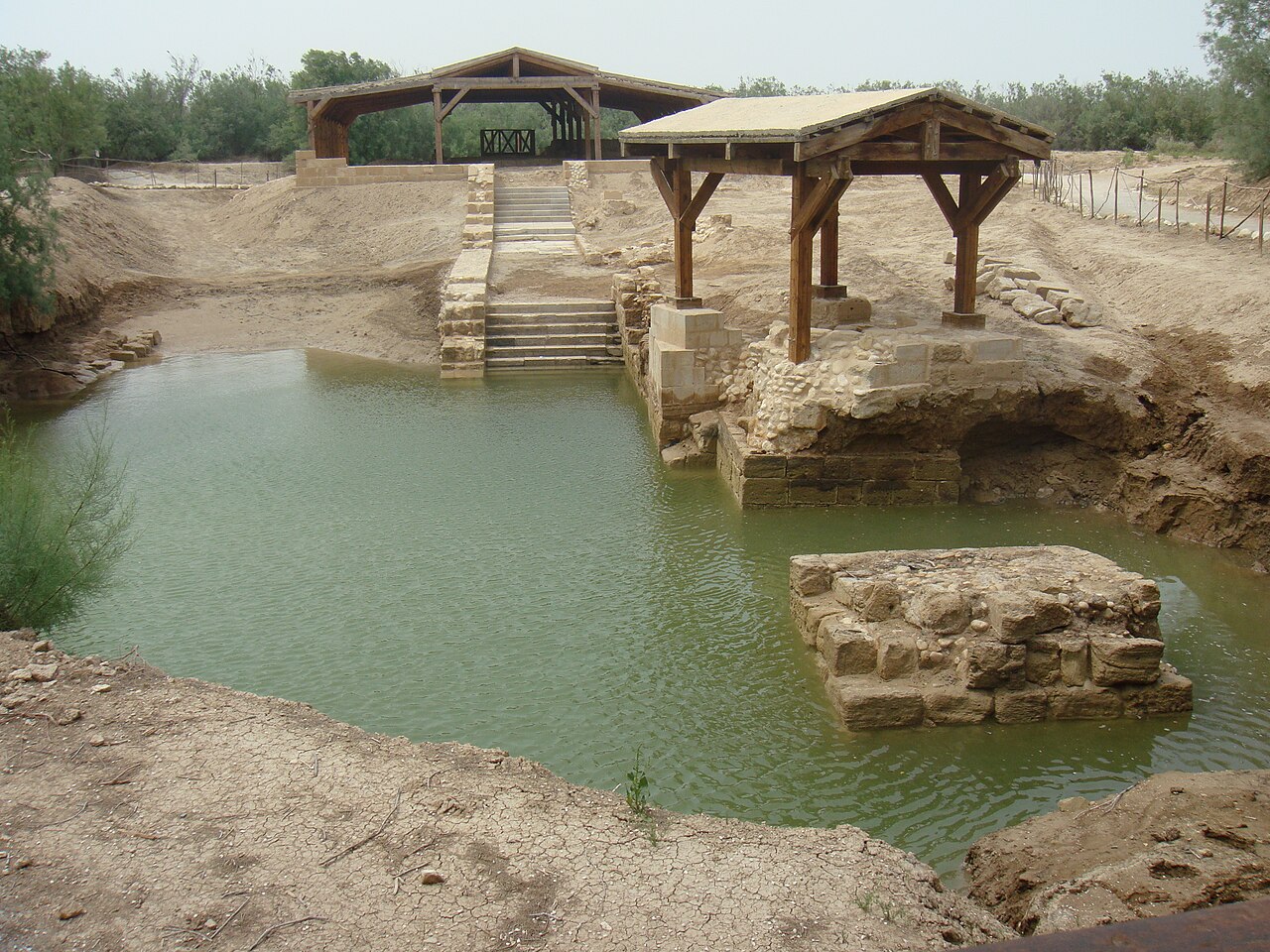
Jordan and the Israeli-occupied Golan Heights border the river to the east, while Israel and the Israeli-occupied West Bank lie to its west. Both Jordan and the West Bank derive their names in relation to the river. The river holds major significance in Islam, Judaism, and Christianity. According to the Bible, the Israelites crossed it into the Promised Land and Jesus of Nazareth was baptized by John the Baptist in it. Some of the companions of Muhammad are thought to have been buried along its banks.
Etymology
Several hypotheses for the origin of most of the river's names in modern languages (e.g., Jordan, Yarden, Urdunn), one is that it comes from Semitic 'Yard|on' 'flow down' <√ירד reflecting the river's declivity, possibly appearing also in other river names in the region such as Yarkon and Yarmouk, or it may be related to the Egyptian loanword 'yǝʾor' ('big river', the Nile). According to this hypothesis, "Den" might be linked to the Akkadian word dannum for "powerful". Cognates of the word are found in Aramaic, Hebrew, Mandaic, and other Semitic languages. The first recorded use of the name appears as Yārdon in Anastasi I, an ancient Egyptian papyrus that probably dates to the time of Rameses II (c. 1303 BC – 1213 BC). Early Arab chronicles referred to the river as Al-Urdunn.
In Mandaic, the etymologically related term Yardena (Classical Mandaic: ࡉࡀࡓࡃࡍࡀ) can refer not only to the Jordan River, but also any other body of flowing water that can be used for Mandaean baptismal rituals (masbuta).
After the Crusades, the Arabic name Nahr Al Sharieat (Arabic: نهر الشريعة), literally "the watering place" began to be used, and was recorded by medieval geographers such as Abu'l-Fida and Al-Dimashqi. The name was shown in various forms on most notable 19th century maps of the region and is described by Edward Robinson in his Biblical Researches in Palestine. Although historical sources do not appear to make this distinction, it is described in some modern sources as the name for the part of the river before it flows into the Sea of Galilee.
Geography
Upper course (Hula Valley)
The Jordan River has an upper course from its sources to the Sea of Galilee (via the Bethsaida Valley) and a lower course south of the Sea of Galilee down to the Dead Sea. In traditional terminology, the upper course (or most of it) is commonly referred to as passing through the "Hula Valley", as opposed to "Upper Jordan Valley"; the Sea of Galilee through which the river passes is a separate entity, and the term Jordan Valley is reserved for the lower course.

Over its upper course (fed by the Hasbani River, Banias River, Dan River, and the Iyyon Stream), the river drops rapidly in a 75-kilometre (47 mi) run to the once large and swampy Lake Hula, which is slightly above sea level. Exiting the now much-diminished lake, it goes through an even steeper drop over the 25 kilometres (16 mi) down to the Sea of Galilee, which it enters at its northern end. The Jordan deposits much of the silt it is carrying within the lake, which it leaves again near its southern tip at Degania Dam.
Its section north of the Sea of Galilee is within the boundaries of Israel and forms the western boundary of the Golan Heights. South of the lake, it forms the border between the Kingdom of Jordan (to the east), and Israel (to the west).
Lower course
South of the Sea of Galilee, the river is situated about 210 metres (690 ft) below sea level. The last 120-kilometre-long (75 mi) section follows what is commonly termed the "Jordan Valley", which has less gradient (the total drop is another 210 metres) so that the river meanders before entering the Dead Sea, a terminal lake about 422 metres (1,385 ft) below sea level with no outlet. The river is fed by two major tributaries, the Yarmouk and Zarqa. The Yarmouk, the largest tributary of the lower course, forms the border between Syria and Jordan and then Jordan and Israel.

Smaller tributaries or "side wadis" / "side streams" in this segment are, north to south
from the east (6–10 in total)
Wadi al-'Arab

Wadi Ziqlab
Wadi al-Yabis
Wadi Kafranja or Kufrinjah passing near Ajloun
Wadi Rajib, the last before Wadi Zarqa
Wadi Nimrin
from the west

Nahal Yavne'el
Nahal Tavor (Tabor Stream)
Nahal Yissakhar
Nahal Harod
Nahal Bezeq, on the border between Israel and the West Bank, between Mount Gilboa and the Samaria Mountains
Wadi el Maleh from the Samaria Mountains
Wadi al-Far'a coming from the Nablus area
Wadi Auja (Arabic) or Nahal Yitav (Hebrew)
Wadi Qelt coming down from the Judean mountains and passing through Jericho
History
In the 19th century the River Jordan and the Dead Sea were explored by boat primarily by Christopher Costigan in 1835, Thomas Howard Molyneux in 1847, William Francis Lynch in 1848, and John MacGregor in 1869. The full text of W. F. Lynch's 1849 book Narrative of the United States' Expedition to the River Jordan and the Dead Sea is available online.
In 1964, Israel began operating a pumping station that diverts water from the Sea of Galilee to the National Water Carrier. Also in 1964, Jordan constructed a channel that diverted water from the Yarmouk to the East Ghor Canal. Syria has also built reservoirs that catch the Yarmouk's waters. Environmentalists blame Israel, Jordan and Syria for extensive damage to the Jordan River ecosystem.
Environment
Ecology
The Jordan River basin has a unique ichthyofauna as it serves as the meeting point for several different biogeographic regions, including the northern Palearctic, the Afrotropics, East & South Asia, and the Mediterranean. Native fish include cyprinids such as the Jordan bream (Achanthobrama lissneri), Jordan himri (Carasobarbus canis), Jordan barbel (Luciobarbus longiceps), Levantine scraper (Capoeta damascina; the most common native fish in the basin), red garra (Garra rufa), & Damascus garra (Garra nana), hillstream loaches such as the Palestine loach (Oxynoemacheilus insignis), catfish such as the African sharptooth catfish (Clarias gariepinus), cichlids such as the blue tilapia (Oreochromis aureus), redbelly tilapia (Coptodon zillii), & mango tilapia (Sarotherodon galilaeus), and blennies such as the freshwater blenny (Salariopsis fluviatilis). The Jordan bream and Jordan barbel are thought to be endemic to the Jordan River basin. The Jordan basin may have also served as the center of diversification for several now-widespread Palearctic fish groups.
A native freshwater reptile is the Balkan terrapin (Mauremys rivulata), which is thought to have also been a food source for the earliest Neanderthal residents of the region.
Several introduced species of fish are known from the region, including common carp (Cyprinus carpio), grass carp (Ctenopharyngodon idella), black carp (Hypophthalmichthys molitrix), rainbow trout (Oncorhynchus mykiss), Nile tilapia (Oreochromis niloticus), and sea mullet (Mugil cephalus). Many of these introduced fish either prey on or outcompete native fish and threaten their populations, especially the more endangered species.
Flow
In modern times, up to 95% of the water is diverted for human purposes, and the flow is less than 10% of the past average. Because of this and the high evaporation rate of the Dead Sea, as well as industrial extraction of salts through evaporation ponds, the Dead Sea is rapidly shrinking. The flow rate of the Jordan River once was 1.3 billion cubic metres per year; as of 2010, just 20 to 30 million cubic metres per year flow into the Dead Sea.
Pollution
A small section of the northernmost portion of the Lower Jordan, the first ca. 3-kilometre (1.9 mi) below the Sea of Galilee, has been kept pristine for baptism and local tourism. Most polluted is the 100-kilometre (62 mi) downstream stretch—a meandering stream from above the confluence with the Yarmouk to the Dead Sea. Environmentalists say the practice of letting sewage and brackish water flow into the river has almost destroyed its ecosystem. Rescuing the Jordan could take decades, according to environmentalists. In 2007, FoEME named the Jordan River as one of the world's 100 most endangered ecological sites, due in part to lack of cooperation between Israel and neighboring Arab states.
Roads, border crossings, and bridges
Roads
Route 90, part of which is named after Rehavam Zeevi, connects the northern and southern tips of the Israeli-occupied West Bank and parallels the Jordan River on the western side.
Border crossings (open bridges)
There are two border crossings between Israel and Jordan which cross the river over bridges. The northern one, Jordan River Crossing or Sheikh Hussein Bridge, is near Beit She'an; the southern one, Allenby Bridge (also King Hussein Bridge), is near Jericho.
Bridges (historical; modern: open and closed)
North to south:
Daughters of Jacob Bridge (Hebrew: Gesher Bnot Ya'akov, "Daughters of Jacob Bridge") is the most famous one within Israel
Arik Bridge at the northern end of the Sea of Galilee; allows access to the central Golan Heights, was crucial in the 1967 and 1973 wars
Al-Sinnabra, at the spot where the river used to exit the Sea of Galilee in the past; few remains excavated by archaeologists
Jisr el-Majami' north of Beit She'an/Beisan; closed
Damiya or Adam Bridge halfway between Jericho and Beit She'an; closed
King Abdullah Bridge south of the Allenby Bridge; closed.
Importance as a water source
Until the first decade of the 21st century, the waters of the Jordan River had been the largest water resource for Israel; lately, desalinated sea water from the Mediterranean has taken over this role. Israel's National Water Carrier, completed in 1964, has delivered water from the Sea of Galilee to the Israeli coastal plain for over four decades, until prolonged drought led to abandoning this solution in favour of desalination.
Jordan receives 50,000,000 m3 (1.8 billion cu ft) of water from the river, a quantity which is regulated by the 1994 peace treaty with Israel. In the past, one of the main water resources in Jordan was the Jordan River, with a flow of 1.3 billion m3 per year (BCM/yr). However, after Israel built the National Water Carrier in 1953 and diverted water from the Sea of Galilee to Israel's coastal plains and southern desert, the flow of the Lower Jordan River dropped significantly. The 50 MCM/yr that Israel provides from the Sea of Galilee as part of the 1994 peace treaty was meant to compensate for this loss. A 2010 study found that the Lower Jordan River has been reduced to 2% of its historic flow. Water quality has also deteriorated sharply, with high levels of salinity and pollution from agricultural fertilizer and untreated wastewater upstream in Israel and the West Bank.
Conflict about the waters of the Jordan River was a contributing factor to the Six-Day War when, starting in 1965, Syria attempted to divert some of its headwaters in collaboration with Lebanon and Jordan. The diversion works would have reduced the water availability for Israel's carrier by about 35%, and Israel's overall water supply by about 11%.