
Toronto, Canada's largest city, was founded as the Town of York and capital of Upper Canada in 1793 after the Mississaugas sold the land to the British in the Toronto Purchase. For over 12,000 years, Indigenous People have lived in the Toronto area. The ancestors of the Huron-Wendat were the first known groups to establish agricultural villages in the area about 1,600 years ago.
In the 17th century, the Toronto Carrying-Place Trail along the Humber River became a strategic site for controlling the fur trade farther north. The Seneca people established a village of about 2,000 people known as Teiaiagon along the trail. The French set up trading posts in the area, including Fort Rouillé in 1751, which they abandoned as the British conquered French North America in the Seven Years' War.
In the 1790s the British began to settle Toronto and built the garrison which became Fort York at the entrance to Toronto Harbour. The Americans attacked the village and garrison during the War of 1812. In the decades after the war, tensions between the colony's conservative elite, the Family Compact and the democratic Reformers grew and culminated in the Rebellions of 1837-1838.

After the failed rebellion, the Orange Order, a conservative Protestant fraternal organization, became the dominant power in local politics in a city intensely dedicated to Britishness. However, the city was not exclusively British. Many Irish Catholics settled in the city following the Great Irish Famine. The city was also a terminus of the Underground Railroad. Thousands of Black Americans who escaped slavery settled in Toronto before the American Civil War.
In the second half of the 19th century, Toronto grew into an important regional centre, linked to the rest of Ontario by a growing railway network and American and British markets by its port. By 1914, the city's financial sector, profiting from a mining boom in northern Ontario, was competing nationally with Montreal, while American corporations were increasingly choosing Toronto for branch offices.
World War I and World War II tremendously impacted the city, with tens of thousands of residents volunteering to fight and participating locally in a "total war" effort.
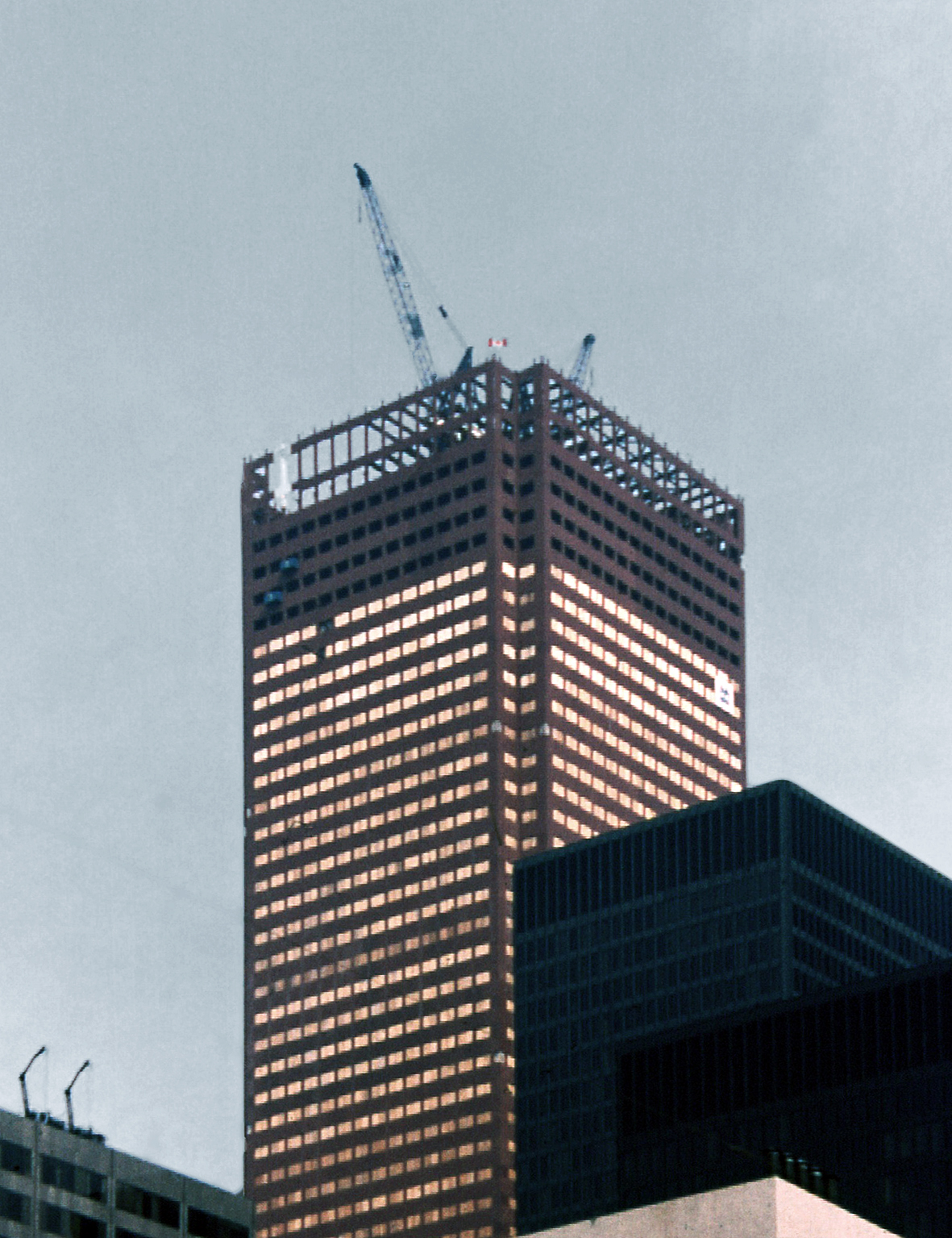
After World War II, another major influx of immigrants came to the region. The Province of Ontario formed a regional government, Metropolitan Toronto, encompassing Toronto and its suburbs in 1954. The Governments invested heavily in infrastructure facilitating a boom in population and industry. In the second half of the 20th century, Toronto surpassed Montreal as Canada's largest city and became the economic capital of Canada and one of the most multicultural cities in the world. In 1998, the Province of Ontario amalgamated the metropolitan governments and its suburbs into one unified municipality.
Etymology
"Toronto" was originally used on maps dating to the late 17th and early 18th century to refer to Lake Simcoe and the portage route to it. Eventually, the name was brought down to the mouth of the Humber River, which is where the present City of Toronto is situated. The bay serves as the end of the Toronto Carrying-Place Trail portage route from Lake Simcoe and Georgian Bay.
The word is likely derived from the Mohawk word Tkaronto, meaning "where there are trees standing in the water", which originally referred to The Narrows, near present-day Orillia. People who had lived there prior to the Mohawk drove stakes into the water to create fishing weirs. French maps from the 1680s to 1760s identify present-day Lake Simcoe as "Lac de Taronto". The spelling changed to "Toronto" during the 18th century. As the portage route grew in use, the name became more widely used and was eventually attached to a French trading fort just inland from Lake Ontario on the Humber.

Confusion about the name of location may also be attributed to the succession of First Nations peoples who lived in the area, including the Neutral, Seneca, Mohawk, Cayuga and Wendat nations. It has also been speculated that the name origin is the Seneca word Giyando, meaning "on the other side", which was the place where the Humber River narrows at the foot of the pass to the village of Teiaiagon.
From August 1793 to March 1834, the settlement was known as "York", sharing the same name as the county it was situated in. The settlement was renamed when Lieutenant Governor John Graves Simcoe called for the town to be named after the Prince Frederick, Duke of York and Albany. To differentiate from York in England and New York, the town was informally known as "Little York". In 1804, settler Angus MacDonald petitioned the Parliament of Upper Canada to restore the original name of the area, but this was rejected. The town changed its name back to "Toronto" when it was incorporated into a city.
Early history
Lithic and Archaic periods (9,000 BCE to 1000 BCE)
Toronto remained under glacial ice throughout the Last Glacial Period, with the glacial ice retreating from the area during the Late Glacial warming period approximately 13,000 BCE. Following the Last Glacial Period, Toronto's waterfront shifted with the growth, and later contraction of glacial Lake Iroquois. The area saw its first human settlers around 9000 BCE to 8,500 BCE. These settlers traversed large distances in family-sized bands, sustaining themselves on caribou, mammoths, mastodons, and smaller animals in the tundra and Boreal forest. Many of their archaeological remains lie in present-day Lake Ontario, with the historic coastline of Lake Iroquois situated 12 miles (20 km) south of Toronto during this period.

As the climate warmed in 6,000 BCE, the environment of Toronto shifted from subarctic to a temperate continental climate. The Toronto waterfront also changed dramatically during this period, with erosion from the Scarborough Bluffs accumulating, and rising water levels from Lake Ontario creating a peninsula that would later become the Toronto Islands.
Formative to Classic stage (1000 BCE to 1200)
First Nations fishing camps were established around the waterways of Toronto as early as 1,000 BCE. By 500 CE, up to 500 people lived along each of the three major rivers of Toronto (Don, Humber, and Rouge River). Early on, First Nations communities had developed trails and water routes in the Toronto area. These led from northern and western Canada to the Gulf of Mexico. One trail, known as the "Toronto Passage", followed the Humber River northward as an important overland shortcut between Lake Ontario and the upper Great Lakes.
New crops, including corn, sunflowers, and tobacco, were introduced into the area from the south around 600 CE. The introduction of these crops saw large societal shifts in the area; including a change in diet, and the formation of semi-permanent villages, in order to farm these crops. Inhabitants of these semi-permanent villages moved out during parts of the year to hunt, fish, and gather other goods to supplement their farming. The earliest known Iroquoian semi-permanent settlement of this nature dates to around 900 CE. Iroquoian villages during this period were located on high, fortified grounds, with access to wetlands and waterways to facilitate hunting, fishing, trade, and military operations. Their villages typically stood in place for around 10 to 20 years, before the inhabitants relocated to a new site. Typically these villages would cycle through a number of sites but return to the same areas repeatedly. This lessened the impact on surrounding flora and fauna, allowing hunting and agriculture to be utilized in a sustainable fashion.
Post-classic stage (1200–1700)
Several Iroquoian villages dating back to the 1200s have been excavated in Toronto, including an ossuary in Scarborough. From the 1300s to the 1500s, the Iroquoian inhabitants of the area migrated north of Toronto, joining the developing Huron-Wendat Confederacy. During this period, the Huron-Wendat confederacy used Toronto as a hinterland for hunting, with the Toronto Passage continuing to see use as a north–south route. The northeast portion of Toronto also held two 14th-century Iroquoian burial mounds, known today as Taber Hill.
Although Europeans did not visit Southern Ontario in the 16th century, European goods had begun to make its way into the region as early as the late-1500s. During the 17th century, nearly half of Southern Ontario's First Nations population was wiped out from as a result of the transmission of communicable diseases between Europeans and First Nations groups. The population loss, along with the desire to secure furs for trade, saw the Haudenosaunee Confederacy to the south invade the area and attack the Huron-Wendat Confederacy. The Haudenosaunee ultimately defeated the Huron-Wendat in the mid-1600s, and the Huron-Wendat fled as refugees, were killed or were forcibly adopted into the Haudenosaunee. After the Haudenosaunee secured the region, they established several settlements on the north shore of Lake Ontario. The Seneca (one of the five Haudenosaunee nations), established two settlements in present-day Toronto, Teiaiagon, near the Humber River, and Ganatsekwyagon near the Rouge River. The two communities provided the Haudenosaunee control of the north–south passage in Toronto. Roman Catholic missionaries visited the two settlements in the 1660s and 1670s. The two Seneca settlements were abandoned by 1687.
After the Haudenosaunee left, the Mississaugas moved in and established villages in the area in the late 17th century.

Early European settlement (1600s–1793)
French explorers and traders
The first European to set foot on the shores of Lake Ontario in the vicinity of what is now Toronto may have been French explorer Étienne Brûlé, taking the Toronto Passage from Huronia in 1615; although the claim is disputed by several scholars, who suggest that Brûlé took a more westerly route and reached Lake Erie, as opposed to Lake Ontario. However, Europeans were active in the Toronto area by the 1660s, with missionaries visiting First Nations settlements in the area.
By the 18th century, Toronto became an important location for French fur traders, given its proximity to the Toronto Passage. In 1720, Captain Alexandre Dagneau established Fort Douville on the Humber River, near the shore of Lake Ontario. The trading post was built to divert First Nations traders from British trading posts to the south of Toronto. The success of Fort Douville prompted the British to build a larger trading post in Oswego, New York. The completion of Fort Oswego in 1726 led the French to abandon their first trading post in Toronto.
The French established another trading post in 1750 on the Humber River. It was successful enough to encourage the French to establish Fort Rouillé, at present-day Exhibition Place in 1751. After the British captured Fort Niagara in July 1759, Fort Rouillé was destroyed by its French occupants, who withdrew to Montreal. In 1760, Robert Rogers, with an armed force of two hundred men and a flotilla of fifteen whaleboats came to secure the Toronto area for the British. The Treaty of Paris of 1763 formally ended the Seven Years' War and saw New France ceded to the British. This included the Pays d'en Haut region of New France, the area containing present-day Toronto.
Influx of loyalist settlers
European settlement in the western half of the colony of Quebec was limited before 1775, amounting to only a few families in the area. However, in the aftermath of the American Revolutionary War, the area saw an influx of settlers, known as the United Empire Loyalists; American colonists who either refused to accept being divorced from the Crown, or who felt unwelcome in the new republic of the United States. A number of loyalists fled from the United States to the mostly unsettled lands north of Lake Erie and Lake Ontario; some had fought in the British Army and were paid with land in the region.
These early immigrants originated from the midland region of the United States. They valued pluralism, were organized around the middle class, were suspicious of top-down government interventions, and were politically moderate. It has been argued that these immigrants' attitudes laid the foundation for Southern Ontario's (and by extension Toronto's) existing pluralistic and politically moderate culture.
In 1786, Lord Dorchester arrived in Quebec City as Governor-in-Chief of British North America. His mission was to solve the problems of the newly landed Loyalists from the United States after the US War of Independence. At first, Dorchester suggested opening the new Canada West as districts under the Quebec government, but the British Government made known its intention to split the Province of Quebec into Upper and Lower Canada. Dorchester began organizing for the new province of Upper Canada, including a capital. Dorchester's first choice was Kingston, but was aware of the number of Loyalists in the Bay of Quinte and Niagara areas, and chose instead the location north of the Bay of Toronto, midway between the settlements and 30 miles (48 km) from the US.
Under the Imperial policy of the time, namely the Royal Proclamation of 1763, which was rooted in Roman Law, Dorchester arranged to purchase more than 1,000 square kilometres (250,000 acres) of land from the Mississaugas in 1787. After surveying the land, the Mississaugas objected to the purchase and it was declared invalid. A revision to the Toronto Purchase was made in 1805, but this agreement too fell into dispute and was only eventually settled two centuries later in 2010 for CA$145 million. A townsite was surveyed in 1788 by Captain Gother Mann, and laid out in a gridiron, with government and military buildings around a central square. The purchase did not include the Rouge River valley, yet to be settled.
The influx of loyalist settlers to the western portions of the Province of Quebec, including the Toronto area, led to the passage of the Constitutional Act 1791. The Act split the colony into two. The eastern portion of Quebec became the Province of Lower Canada, and the western portion of Quebec (including Toronto) became the Province of Upper Canada. A provisional Upper Canada government was set up in Newark (today's Niagara-on-the-Lake) in 1791.
Town of York (1793–1834)
In May 1793, Lieutenant-Colonel John Graves Simcoe, the first lieutenant-governor of the newly organized province of Upper Canada, visited Toronto for the first time. Simcoe was unhappy with the then-capital of Upper Canada Newark, and proposed moving it to the site of present-day London, Ontario but was dissuaded by the difficulty of building a road to the location. Rejecting Kingston, the choice of British Governor Lord Dorchester, the Toronto purchase site was then chosen by Simcoe on July 29, 1793, as the temporary capital of Upper Canada. Simcoe and his wife set up in a large tent at the water's edge near the foot of today's Bathurst Street. Toronto would remain "temporary" in status until 1796.
The town, which Simcoe named "York", rejecting the aboriginal name, was built within a large protected bay formed by the Toronto Islands. At that time, the eventual Toronto Islands were a long sandy peninsula, which formed a large natural harbour. The harbour included a great wetland marsh, fed by the Don River, at the eastern end, which has since been filled in. In 1793 the only opening to the lake was at the western end; only later, in 1858, the "Eastern Gap", was punched through the peninsula by a storm, creating the current Toronto Islands. The large natural harbour of 1793 was defended with the construction of a garrison, later to be known as Fort York, guarding the entrance on what was then a high point on the water's edge, with a small river on the inland side (Garrison Creek). Rejecting Mann's town plan, Simcoe had another town plan set up. This was a more compact plan, a gridiron settlement of ten square blocks, closer to the eastern end of the harbour, entirely behind the peninsula, near what is now Parliament Street. The ten blocks are known today as the "Old Town" neighbourhood.
During Simcoe's time in Toronto, two main roads were laid out in the city: Dundas Street, named after Henry Dundas and Yonge Street, named after Sir George Yonge, the British Secretary of State for War. The Queen's Rangers and conscripted German settlers hacked out the wagon path of Yonge Street as far north as the Holland River. Government buildings were erected near Parliament and Front Street. Simcoe had hoped to found a university in York during his time but was successful in establishing law courts in York. Labour was in short supply, and slaves were still allowed at this time, but Simcoe arranged for the gradual abolition of slavery, passing legislation banning any further slaves, and the children of slaves would be freed when they reached their 25th birthday. Due to ill health, Simcoe returned to England in July 1796 on leave but did not return and he gave up his position in 1799. By this time, York was estimated to have a population of 240 persons.
Peter Russell was named administrator by Simcoe. Between 1799 and 1800, a road was constructed east of Toronto to the mouth of the Trent River by Asa Danforth. This was the making of today's Kingston Road. Russell established the first jail. He expanded the town westward and northward and during his term, the first St. Lawrence Market was built in 1803. The first church of what was to become today's St. James Cathedral was built in 1807. When Russell died in 1808, the town's population was now up to 500.
War of 1812
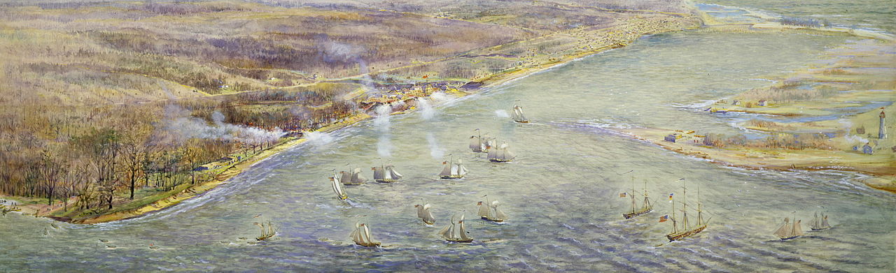
On 27 April 1813, American forces led by Zebulon Pike attacked York. After the British-Native force failed to prevent the American landings (in present-day Parkdale), British forces ordered a withdrawal, realizing that defence was impossible. Upon their departure, British forces rigged Fort York's gunpowder magazine to explode. The blast, powerful enough to perforate eardrums and hemorrhage the lungs of some American soldiers massed outside the Fort was said to have rattled windows 50 kilometres across the lake in Niagara. It exploded as the American forces were about to enter the fort, killing Pike and a contingent of his men. In the following days, American forces sacked the town and burned a number of properties including the Parliament Buildings. The town remained occupied until May 8, when American forces departed the settlement.
In addition to the Battle of York, two other American incursions occurred in the town during the war. The second incursion occurred several months later, on 31 July. An American squadron originally planned to attack British forces at Burlington Heights, although opted to raid York after finding the British at the Heights too well-entrenched. The landings at York were unopposed, with most York's garrison moving west to defend Burlington Heights. American forces raided the town's food and military stores, as well as destroyed several military structures before departing the same night.
The third incursion at York occurred a year later, in August 1814. On 6 August 1814, an American naval squadron arrived outside of York's harbour, dispatching USS Lady of the Lake to enter the town's harbour in an effort to gauge its defences. After the ship briefly exchanged fire with the improved Fort York, built several hundred metres to the west from its original position, the USS Lady of the Lake withdrew and returned to the American squadron outside the harbour. American forces did not attempt a landing during this incursion, although remained outside the town's harbour for the following three days before departing.
Post-War of 1812
After the Napoleonic Wars, York experienced an influx of poor immigrants from the United Kingdom, which was in a depression. The area to the northeast of St. James' became a slum. York had a red-light district on Lombard Street, and numerous taverns sprang up around St. Lawrence Market.
City of Toronto (1834–1997)
The town was incorporated as a city on March 6, 1834, reverting to the name of "Toronto" to distinguish it from New York City, as well as about a dozen other localities named "York" in the province (including York County in which Toronto was situated), and to disassociate itself from the negative connotation of dirty Little York, a common nickname for the town by its residents. William Lyon Mackenzie was its first mayor.
The new Reform-dominated municipal council quickly set to work to correct the problems left unchecked by the old Court of Quarter Sessions. Unsurprisingly for "Muddy York", the new civic corporation made roads a priority. This ambitious road improvement scheme put the new council in a difficult position; good roads were expensive, yet the incorporation bill had limited the ability of the council to raise taxes. An inequitable taxation system placed an unfair burden on the poorer members of the community.
Mackenzie decided to take the matter directly to the citizens and called a public meeting at the Market Square on July 29, 1834 "for six, that being the hour at which the Mechanicks and labouring classes can most conveniently attend without breaking on a day's labour." Mackenzie met with organized resistance, as the newly resurrected "British Constitutional Society", with William H. Draper as president, Tory aldermen Carfrae, Monro and Denison as vice-presidents, and common councilman and newspaper publisher George Gurnett as secretary, met the night before, and "from 150 to 200 of the most respectable portion of the community assembled and unanimously resolved to meet the Mayor upon his own invitation." Sheriff William Jarvis took over the meeting and interrupted Mayor Mackenzie "to propose to the Meeting a vote of censure on his conduct as Mayor." In the resulting pandemonium, the two sides agreed that they would hold a second meeting the next day.
The Tories called the meeting for three in the afternoon so that the working class "mechanics" would be unable to attend. The inability of the mechanics to attend was their saving grace, for the meeting ended in a terrible tragedy when the packed gallery overlooking Market Square collapsed, pitching the onlookers into the butcher's stalls below, killing four and injuring dozens. The Tory press immediately placed the blame on Mackenzie, even though he did not attend. The Toronto mechanics, ironically spared the carnage because of the hour at which the meeting was appointed, did not appear to be swayed by the Tory press. In the October 1834 provincial elections, Mackenzie was overwhelmingly elected in the second riding of York; Sheriff William Jarvis, running in the city of Toronto, lost to reformer James Edward Small by the slim margin of 252 to 260 votes. Toronto was the site of the key events of the Upper Canada Rebellion in 1837, led by Mackenzie.
In 1841, the first gas street lamps appeared in Toronto. Over 100 were installed that year, in time for author Charles Dickens' visit in May 1842. Dickens described Toronto as "full of life, motion, business and improvement. The streets are well-paved and lighted with gas." Dickens was on a North American tour.
During the Typhus epidemic of 1847, 863 Irish immigrants died of typhus at fever sheds built at the Toronto Hospital at the northwest corner of King Street and John Street. The epidemic also killed the first Roman Catholic Bishop of Toronto, Michael Power, while providing care and ministering to Irish immigrants fleeing the Great Famine.
The April 7, 1849 Cathedral Fire destroyed the "Market Block" north of Market Square and St. Lawrence Market, as well as the first St. James' Cathedral and a portion of Toronto's first City Hall. While Toronto had a firefighting brigade and two fire halls, the force could not stop the large fire and many businesses were lost. A period of rebuilding followed.
After the Upper Canada Rebellion, resentments between the ruling factions of the Family Compact and the Reform elements in Toronto continued. As Irish and other Catholics migrated to Toronto and became a larger part of the population, the Orange Order representing Protestant elements loyal to the British Crown fought to keep control of the ruling government and civil services. The police constabulary and the fire departments were controlled through patronage and were under Orange control. Orange elements were known to use violence against Catholics and Reformers and were immune to prosecution. It would not be until the 20th century that Toronto would have its first Catholic mayor.
Later 19th century
Toronto's population grew rapidly in the late 19th century, increasing from 30,000 in 1851 to 56,000 in 1871, 86,400 in 1881 and 181,000 in 1891. The total urbanized population was not counted as it is today to include the greater area; those just outside the city limits made for a significantly higher population. The 1891 figure also included population counted after recent annexations of many smaller, adjacent towns such as Parkdale, Brockton Village, West Toronto, East Toronto, and others. Immigration, high birth rates and influx from the surrounding rural population accounted for much of this growth, although immigration had slowed substantially by the 1880s if compared to the generation prior.
Rail lines came to the waterfront harbour area in the 1850s. A planned "Esplanade" land-fill project to create a promenade along the harbour, instead became a new right-of-way for the rail lines, which extended to new wharves on the harbour. Three railway companies built lines to Toronto: the Grand Trunk Railway, (GTR) the Great Western Railway and Northern Railway of Canada. The GTR built the first Union Station in 1858 in the downtown area. The advent of the railway dramatically increased the numbers of immigrants arriving and commerce, as had the Lake Ontario steamers and schooners entering the port. The railway lands would dominate the central waterfront for the next 100 years. In 1873, GTR built a second Union Station at the same location.
New rail transportation networks were built in Toronto, including an extensive streetcar network in the city (still operational), plus long-distance railways and radial lines. One radial line ran mostly along Yonge Street for about 80 km to Lake Simcoe, and allowed day trips to its beaches. At the time, Toronto's own beaches were far too polluted to use, largely a side effect of dumping garbage directly in the lake. Other radial lines connected to suburbs.
As the city grew, it became bounded by the Humber River to the west and the Don River to the east. Several smaller rivers and creeks in the downtown area were routed into culverts and sewers and the land filled in above them, including both Garrison Creek and Taddle Creek, the latter running through the University of Toronto. Much of Castle Frank Brook became covered during this time. At the time, they were being used as open sewers and were becoming a serious health problem. The re-configuration of the Don River mouth to make a ship channel and lakeshore reclamation project occurred in the 1880s, again largely driven by sanitary concerns and establishing effective port commerce.
Toronto had two medical schools, both independent: Trinity Medical School and the Toronto School of Medicine (TSM). During the 1880s, the TSM added instructors, expanded its curriculum, and focused on clinical instruction. Enrollments grew at both schools. Critics found proprietary schools lacking especially for their failure to offer sufficient instruction in the basic sciences. In 1887, the TSM became the medical faculty of the University of Toronto, increasing its emphasis on research within the medical curriculum. Trinity realized that its survival depended as well on close ties to basic science, and in 1904 it also merged into the University of Toronto Faculty of Medicine.