Augusta County, Virginia, is one of the oldest and largest counties in the Commonwealth, established by the Virginia General Assembly on November 1, 1738, from Orange County. Located in the heart of the Shenandoah Valley, it covers approximately 971 square miles and is home to around 80,000 residents today. Named after Princess Augusta of Saxe-Gotha, mother of King George III, the county played a pivotal role in colonial expansion westward and in the Civil War era.
How Was Augusta County Founded and Why Was It Important?
Augusta County was carved out of Orange County in 1738 at a time when Virginia's colonial government needed administrative control over a rapidly expanding frontier. At its original formation, Augusta County's territory was staggeringly vast — it legally encompassed land stretching as far west as the Mississippi River and northwest into present-day Pennsylvania, Ohio, and beyond. Staunton, established in 1747, became the county seat and was named after Lady Rebecca Staunton, wife of colonial Governor William Gooch. The county attracted large waves of Scots-Irish and German settlers moving down the Great Wagon Road from Pennsylvania, and by 1750 it was one of the most populous frontier regions in British North America. The county court in Staunton served as the governmental hub for this enormous territory, making decisions that affected thousands of settlers across what would eventually become multiple U.S. states.
What Role Did Augusta County Play in the Civil War?
Augusta County held tremendous strategic importance during the Civil War (1861–1865). The Shenandoah Valley, often called the 'breadbasket of the Confederacy,' produced vital grain and livestock that fed Confederate armies. Staunton served as a major Confederate supply and railroad hub, connected via the Virginia Central Railroad. General Stonewall Jackson's famous Valley Campaign of 1862 swept through Augusta County as he outmaneuvered Union forces to protect this critical corridor. In 1864, Union General Philip Sheridan's scorched-earth campaign devastated the valley, burning farms and destroying supplies to cripple Confederate logistics. Augusta County residents endured significant hardship, and the county's agricultural economy took years to recover after the war ended in April 1865.

What Is Augusta County Like Today?
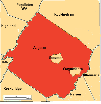
Modern Augusta County is a largely rural locality surrounding but politically separate from the independent city of Staunton and the independent city of Waynesboro. The county's economy blends agriculture — particularly poultry, cattle, and apple farming — with manufacturing and a growing tourism sector built around the Blue Ridge Mountains, Skyline Drive, and Shenandoah National Park on its eastern border. The county is governed by a six-member Board of Supervisors and consistently ranks among Virginia's most agriculturally productive localities. Its population of roughly 80,000 reflects steady growth driven by residents seeking lower costs of living within commuting distance of Charlottesville and the broader I-81 corridor.
| Fact | Detail |
|---|---|
| Founded | November 1, 1738 |
| Named After | Princess Augusta of Saxe-Gotha |
| County Seat | Staunton (independent city) |
| Area | ~971 square miles |
| Population (est.) | ~80,000 (2020s) |
| Key Industry | Agriculture, manufacturing, tourism |
| Major Landmark | Shenandoah National Park (eastern border) |