
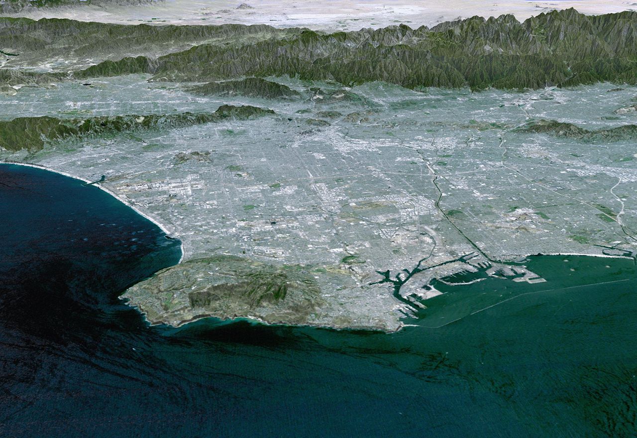
Palmdale is a suburban city in northern Los Angeles County, California, United States. The city lies in the Antelope Valley of Southern California. The San Gabriel Mountains separate Palmdale from the Los Angeles Basin to the south.
On August 24, 1962, Palmdale became the first city in Antelope Valley. Forty-seven years later, in November 2009, voters approved making it a charter city. Palmdale's population was 169,450 at the 2020 census, up from 152,750 at the 2010 census. Palmdale is the 33rd most populous city in California. Together with its immediate northern neighbor, the city of Lancaster, the Palmdale–Lancaster urban area had a population of 359,559 in 2020.
History
Palmdale was first inhabited by various tribal pre-Americans. Populated by different groups for an estimated 11,000 years, the Antelope Valley was a trade route for nomadic pre-Americans traveling from what is now Arizona and New Mexico to California's coast. Before the arrival of Europeans, the Palmdale area had been occupied by the Kitanemuk. The Yokuts, Chumash people and Shoshone may have also been present in the area.
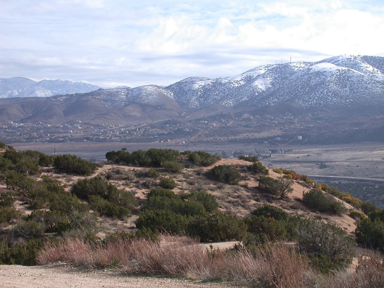
Spanish soldier Captain Pedro Fages explored the Antelope Valley in 1772. The opening of California to overland travel through the forbearing desert was due to Captain Juan Bautista de Anza and Father Francisco Garcés, a Spanish priest. They led a colonizing expedition, which included 136 settlers, across the Mojave Desert from Mexico to Monterey in 1773.
Later in 1776 while exploring the Valley, Garces, with several Indian guides from the San Gabriel Mission, recorded viewing the vast expanse of what was the El Tejon Rancheria (the Badger Ranch) of the Cuabajoy Indians. After the Shoshone Indians left the valley, new immigrants from Spain and Mexico established large cattle ranches there. In the late 1880s, the ranches were divided into smaller homesteads and farmed by settlers from Germany, France and the state of Nebraska.
Palmenthal, 1886–1913
"Palmenthal", the first permanent settlement within the limits of Palmdale, was established as a village on April 20, 1886, by westward Lutheran travelers from the American Midwest, mostly of German and Swiss descent. According to area folklore, the travelers had been told they would know they were close to the ocean when they saw palm trees. They took the local Joshua trees for palms and named their settlement after them. (Palmenthal is German for Palm Valley.) According to David L. Durham, Joshua trees were sometimes called yucca palms at the time, which was the reason for the name. The village was officially established upon the arrival of a post office on June 17, 1888.
By the 1890s (soon after the last of the indigenous antelopes, which the valley was named after, had been hunted to extinction), farming families continued to migrate to Palmenthal and nearby Harold to grow grain and fruit. Most of these settlers were unfamiliar with farming in a desert climate, so when the drought years occurred, most abandoned their settlement.
By 1899, only one family was left in the original village. The rest of the settlers, along with the post office, moved closer to the Southern Pacific railroad tracks. This new community was renamed Palmdale and was located where the present-day civic center is. A railroad station was built along the tracks there. This railroad was operated by Southern Pacific and traveled between Los Angeles and San Francisco. The Wells Fargo stagecoach line that ran between San Francisco and New Orleans stopped there as well.
The only remaining pieces of evidence of the original settlements of Palmenthal and Harold are the old Palmdale Pioneer cemetery located on the northeast corner of Avenue S and 20th Street East, acquired and restored by the city as part of a future historical park, and the old schoolhouse, now relocated to McAdam Park.

Palmdale's modern development commenced in the mid-1800s due to the influence of the gold rush, cattle ranching, the introduction of stagecoaches, and the establishment of the Southern Pacific Railroad line in 1876. Significant population expansion only took place after the completion of the California aqueduct in 1913, drawing in a considerable influx of farmers.
First two decades of the Town of Palmdale, 1913–1933
As the population of Palmdale began to increase after relocation, water became scarce, until November 5, 1913, when the California – Los Angeles Aqueduct system was completed by William Mulholland, bringing water from the Owens Valley into Los Angeles County. During this period, crops of apples, pears and alfalfa became plentiful.
In 1915, Palmdale's first newspaper, the Palmdale Post, was published. Today it is called the Antelope Valley Press.
In 1921, the first major motor vehicle link between Palmdale and Los Angeles was completed, Mint Canyon/Lancaster Road, later designated U.S. Route 6. Completion of this road caused the local agricultural industry to flourish and was the first major step towards defining the metropolis that exists today. Presently this road is known as Sierra Highway.
In 1924, the Little Rock Dam and the Harold Reservoir, present day Lake Palmdale, were constructed to assist the agricultural industry and have enough water to serve the growing communities.
Next three decades of the Town of Palmdale, 1933–1962
Agriculture continued to be the foremost industry for Palmdale and its northern neighbor Lancaster until the outbreak of World War II. In 1933, the United States government established Muroc Air Base (from an original founder's name, Effie Corum, spelled backwards) six miles (9.7 km) north of Lancaster in Kern County, now known as Edwards Air Force Base.
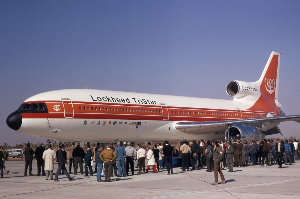
They also bought Palmdale Airport in 1952 and established an aerospace development and testing facility called United States Air Force Plant 42. One year later, in 1953, Lockheed established a facility at the airport. After this time, the aerospace industry took over as the primary local source of employment. The city has been referred to as the "Aerospace Capital of America" because of its heritage in being the home of many of the aircraft used in the United States military.
In August 1956, an unpiloted out-of-control Navy drone flew over Palmdale while Air Force Interceptor aircraft tried to shoot it down with unguided rockets. Many rockets landed in and around the city, starting fires and damaging property.
In 1957, Palmdale's first high school, Palmdale High School, was established, making it easier to not have to travel to Antelope Valley High School in nearby Lancaster.

Incorporation, 1962–1980
In August 1962, the township of Palmdale officially became the city of Palmdale with the incorporation of 2 square miles (5 km2) of land around the present day civic center.
In 1964, the Antelope Valley Freeway, or State Highway 14, was completed as a link between Palmdale and Los Angeles. The freeway at this time ran all the way to present-day Technology Drive. It was at this time that talk about the future Palmdale Intercontinental Airport was seen as the way of the future. By 1965, the new city had annexed an additional 20 square miles (52 km2) of land and industry was thriving. Talk of the future commercial airport had many investors buying up large quantities of land.
In 1970, the city of Los Angeles went forward with buying 17,750 acres (71.8 km2) of land east of the city for its proposed intercontinental commercial airport. However, the United States Air Force desired to put construction of this new facility on hold until the existing airport reached its commercial capacity. So, under a joint-use agreement with the military, the Los Angeles Department of Airports, now called Los Angeles World Airports, built a 9,000 square-foot (800 m2) terminal (on leased land) that opened in 1971, creating present-day LA/Palmdale Regional Airport, which the City of Palmdale has taken control of in an effort to establish reliable air service in the region.
By 1974, the Antelope Valley Freeway construction ended at the southern border of Mojave in Kern County. In 1977, Palmdale built its first municipal building, the Palmdale City Library. This was the same year that its northern neighbor Lancaster incorporated as a city. Since the 1920s, Lancaster had been the much larger and principal community of the Antelope Valley, as well as the rest of California's Mojave Desert.
First housing market growth and recession, 1980–1990
The 1980s and 1990s were the decades that started to define the two Antelope Valley cities. Affordable housing in the area caused a dramatic spike in the population. The city, like its northern neighbor Lancaster, became a bedroom community for those employed in Los Angeles. In 1980, Palmdale's population was 12,227.
Geography
Palmdale is located in Los Angeles County, and the urbanized centers of Palmdale and Los Angeles are separated by the San Gabriel mountain range, which is about 40 miles (64 km) wide. This range forms the southern edge of the Antelope Valley portion of the Mojave Desert. Palmdale is the second-most populous city in the Antelope Valley, and fifth overall in the Mojave Desert, after Las Vegas, Henderson, North Las Vegas, Nevada; and Lancaster. Palmdale is part of a twin-city complex with its northern neighbor Lancaster and together they are the principal cities within the Antelope Valley region and California's High Desert.
Downtown Palmdale is located at 34°34′46″N 118°07′00″W, at an elevation of 2,655 feet (809 m) above sea level.
According to the United States Census Bureau the city has a total area of 106.2 square miles (275 km2), of which, 106.0 square miles (275 km2) of it is land and 0.3 square miles (0.78 km2) of it is water (including man-made Lake Palmdale, the most visible and scenic part of the municipal water supply system). The total area is 0.24% water.
The city lies in proximity to the San Andreas Fault, making it prone to severe earthquakes. This fault cuts across the Antelope Valley Freeway just north of the Avenue S off-ramp; running westward along the old Butterfield Stage Line (now Elizabeth Lake Road) into Leona Valley.
Climate
Typical of the High Desert, Palmdale has a desert climate (Köppen climate classification BWk), and it is part of USDA Plant Hardiness Zone 8b. Winters are cool to mild, with daily normal minimum temperatures at or just below freezing from late November until late January, and the coolest month, December, having a normal mean temperature of 44.4 °F (6.9 °C). Summers are hot and nearly rainless, with July and August, tied for the hottest month, having a normal mean temperature of 81.2 °F (27.3 °C). On average, annually there are 52 mornings with a minimum at or below freezing, and 35 afternoons with a maximum at or above 100 °F (37.8 °C). The normal annual rainfall is 5.90 inches (150 mm), occurring on an average of only 27 days.
Record temperatures range from 3 °F (−16.1 °C) on January 13, 1963, to 126 °F (52.2 °C) on August 5, 1990. The "rain year" from July 1940 to June 1941 had the highest annual precipitation on record, at 18.41 inches (467.6 mm), whilst the most precipitation in a calendar month was in December 1943 at 7.55 inches (191.8 mm), as well as the most in one calendar day on December 11, 1943, at 3.43 inches (87.1 mm); conversely, the lowest annual precipitation was 1.15 inches (29.2 mm) from July 2012 to June 2013.
Notes:
Flora and fauna
Plants native to Palmdale are big berry manzanita, fremont cottonwood, California aster, White Sage, Giant wildrye, Deerbrush, California buckwheat, Black Sage, California Goldfields, Antelope Bitterbrush, Golden Yarrow, Desert Globemallow and more. Animals in the area are golden mantled ground squirrel, Beechey ground squirrel, red-tailed hawk, Cooper's hawk, Stellar's jay, leopard frog and rattlesnake. Coyotes are found throughout Palmdale. The California condor, a rare species of bird occupies Palmdale. Palmdale was a juniper berry processing area. California poppies are grown near Palmdale.
Demographics
2020
The 2020 United States census reported that Palmdale had a population of 169,450. The population density was 1,597.6 inhabitants per square mile (616.8/km2). The racial makeup of Palmdale was 26.6% White, 13.6% African American, 2.1% Native American, 4.4% Asian, 0.2% Pacific Islander, 35.8% from other races, and 17.3% from two or more races. Hispanic or Latino residents of any race were 61.8% of the population.
The census reported that 99.88% of the population lived in households, 0.12% lived in non-institutionalized group quarters, and 0.01% were institutionalized.
There were 48,355 households, out of which 46.0% included children under the age of 18, 51.3% were married-couple households, 7.2% were cohabiting couple households, 26.3% had a female householder with no partner present, and 15.2% had a male householder with no partner present. 14.9% of households were one person, and 6.0% were one person aged 65 or older. The average household size was 3.5. There were 39,149 families (81.0% of all households).
The age distribution was 27.8% under the age of 18, 11.0% aged 18 to 24, 26.1% aged 25 to 44, 24.6% aged 45 to 64, and 10.5% who were 65 years of age or older. The median age was 33.1 years. For every 100 females, there were 95.2 males.
There were 49,686 housing units at an average density of 468.5 units per square mile (180.9 units/km2), of which 48,355 (97.3%) were occupied. Of these, 66.5% were owner-occupied, and 33.5% were occupied by renters.
In 2023, the US Census Bureau estimated that the median household income was $81,151, and the per capita income was $28,767. About 11.9% of families and 14.6% of the population were below the poverty line.
2010
The 2010 United States census reported that Palmdale had a population of 152,750. The population density was 1,438.1 inhabitants per square mile (555.3/km2). The racial makeup of Palmdale was 74,901 (49.0%) White, (24.5% Non-Hispanic White), 22,677 (14.8%) African American, 1,316 (0.9%) Native American, 6,548 (4.3%) Asian (2.2% Filipino, 0.4% Indian, 0.4% Korean, 0.3% Chinese, 0.3% Vietnamese, 0.2% Japanese,
0.16% Cambodian, 0.11% Thai and
0.07% Pakistani), 335 (0.2%) Pacific Islander, 38,773 (25.4%) from other races, and 8,200 (5.4%) from two or more races. There were 83,097 Hispanic or Latino residents (54.4%). 38.1% of Palmdale residents were of Mexican ancestry; 6.2% Salvadoran; 2.4% of Guatemalan heritage; 0.79% Honduran, 0.76% Puerto Rican, 0.69% Nicaraguan, 0.50% Cuban, 0.47% Colombian and 0.34% Argentinian ancestry. Spanish is spoken by 36.4% of the population and Tagalog by 1.3%. The most common ancestries are German 5.2%, Irish 4.1%, English 2.9%, Italian 2.7%, French 1.1%, Polish 1.0%, Norwegian 0.7%, Scottish 0.6%, Dutch 0.6%, Russian 0.6%, Swedish 0.5%, Belizean 0.4%, Armenian 0.4% and Danish, Welsh and Greek 0.3%.
According to the 2000 Census, Mexican and German were the most common ancestries in Palmdale. Mexico and El Salvador were the most common foreign places of birth.
The Census reported that 152,551 people (99.9% of the population) lived in households, 158 (0.1%) lived in non-institutionalized group quarters, and 41 (0%) were institutionalized.
There were 42,952 households, out of which 23,345 (54.4%) had children under the age of 18 living in them, 24,199 (56.3%) were opposite-sex married couples living together, 7,821 (18.2%) had a female householder with no husband present, 3,318 (7.7%) had a male householder with no wife present. There were 2,998 (7.0%) unmarried opposite-sex partnerships, and 316 (0.7%) same-sex married couples or partnerships. 5,828 households (13.6%) were made up of individuals, and 1,880 (4.4%) had someone living alone who was 65 years of age or older. The average household size was 3.55. There were 35,338 families (82.3% of all households); the average family size was 3.87.
The age distribution of the population included 50,514 people (33.1%) under the age of 18, 17,089 people (11.2%) aged 18 to 24, 40,077 people (26.2%) aged 25 to 44, 34,963 people (22.9%) aged 45 to 64, and 10,107 people (6.6%) who were 65 years of age or older. The median age was 29.7 years. For every 100 females, there were 95.3 males. For every 100 females age 18 and over, there were 91.3 males.
There were 46,544 housing units at an average density of 438.2 units per square mile (169.2 units/km2), of which 29,167 (67.9%) were owner-occupied, and 13,785 (32.1%) were occupied by renters. The homeowner vacancy rate was 3.2%; the rental vacancy rate was 9.4%. 102,444 people (67.1% of the population) lived in owner-occupied housing units and 50,107 people (32.8%) lived in rental housing units. According to US Census Population Estimates, July 1, 2022: 15.8% of the population was living below the federal poverty line.
Religion
37.0% of people are Catholic in Palmdale. 53.4% in the city are religious.
Homelessness
In 2022, Los Angeles Homeless Services Authority's Greater Los Angeles Homeless Count counted 309 homeless individuals in Palmdale.