
Katsina State
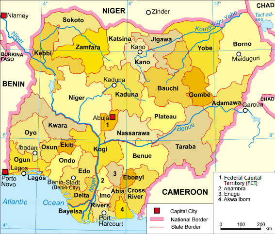
(Hausa: Jihar Katsina; Hausa Ajami: جِىهَرْ کَڟِࢽَ) is a state in the northwestern geopolitical zone of Nigeria. It is bordered to the west by Zamfara State, to the east by Kano and Jigawa states, and to the south by Kaduna State, while its northern border forms part of the national border with Niger. The state capital is the city of Katsina, and the state is divided into 34 local government areas. The state is nicknamed the "Home of Hospitality".
With an estimated population of 9.3 million residents as of 2023, Katsina State is the third most populous state in the country, despite the fact that it only ranks 17th out of 36 states in terms of area. Geographically, Katsina is primarily located within the West Sudanian savanna, although parts of the north of the state transition into the semi-desert Sahelian savanna. Major rivers in the state include the Bunsuru, Gada, and Sokoto rivers, which provide water for agriculture and settlements.

Demographically, the Hausa people are the largest ethnic group in the state with minorities of Fulani and other groups. In terms of religion, Islam (79%) is the most practised faith with minorities of adherents of Christianity (20%) and traditionalist religions (~1%), particularly Maguzawa groups.
In the pre-colonial period, much of Katsina State was part of the Hausa Bakwai states, with the cities of Daura and Katsina emerging as a major centers of trade and Islamic learning during the fifteenth and sixteenth centuries. In the early nineteenth century, the Fulani jihad led to the establishment of Daura and Katsina as emirates within the Sokoto Caliphate. During the British colonial era, Katsina was incorporated into the Northern Nigeria Protectorate which later merged into British Nigeria. Upon Nigeria's independence in 1960, Katsina was part of the Northern Region until the region was divided in 1967, and it became part of the North-Central State (later renamed Kaduna State). In 1987, Katsina State was created from the northern portion of Kaduna State. Since the mid-2010s, Katsina has been one of the Nigerian states hit hardest by local banditry and terrorism. In 2020, over 300 children were kidnapped by the terrorist group Boko Haram in the town of Kankara.
Economically, Katsina State is largely reliant on agriculture, with key crops including millet, sorghum, maize, rice, groundnuts, and cotton. Livestock farming and herding is also significant, with cattle, goats, and sheep widely reared. Katsina has the fourth lowest Human Development Index and ranks in the mid-range of GDPs in the country.

Demography
Hausa are the largest ethnic group in the state.
Religion
The state is predominantly Muslim and the Gobarau Minaret is an important building therein. Sharia is valid in the entire state but mainly for the Muslims. The Church of Nigeria has a Diocese of Katsina. The Redeemed Christian Church of God, the Roman Catholic Church and many other churches are present in the state.
History
Geography
Katsina State is about 23,938 square kilometres (9,243 sq mi). It is situated between latitude 11°07'49" and 13°22' 57" N and longitude 6°52'03" E and 9°9'02" E. The state is located in the tropical grassland known as savannah and has two major seasons which are the rainy season and the dry season.

Climate
Katsina has a tropical steppe climate, bordering on a tropical savanna climate. The city's yearly temperature is 30.89 °C (87.6 °F) and it is 1.43% higher than Nigeria's averages. Katsina typically receives about 791.61 millimeters (31.1 inches) of precipitation and has 54.63 rainy days (14.97% of the time) annually.
Local government areas
Katsina State comprises 34 local government areas:
Education
Katsina State is a centre of both formal and informal education. Umaru Musa Yar'adua University is a public university owned by the state government. Al-Qalam University, the first Islamic university in Nigeria is community owned. Federal University, Dutsin-Ma and Federal University of Transportation, Daura are owned by the federal government as well as Federal College of Education, Katsina (affiliated to Bayero University Kano). National Open University of Nigeria, Isa Kaita College of Education Dutsinma (affiliated to Ahmadu Bello University, Zaria), a state-owned college of education. Cherish Institute Batsari is a privately owned university awarding degrees in health courses.

Transport
Federal highways
A2 (part of the African Unity Road or Trans-Sahara Highway or Trans-African Highway 2: TAH 2) north from Jigawa State via Daura to RN10 in Niger
A9 (part of the Dakar-Ndjamena Trans-Sahelian Highway or Trans-African Highway 5: TAH 5) north from Kano State near Gidan Mutum Daya as the Kano-Karkia-Katsina Rd via Gaci, Charanchi, Rimi and Katsina to RN9 in Niger
A126 north from Kaduna State via Kwatangiri, Funtua, Galadima, Daudawa and Shemi to Zamfara State at Yankara

Eight roads to the Republic of Niger
from Jiba to RN18
A9 (TAH5) at Jibiya to RN9
the Kaita Rd north from Katsina Ring Rd at Shinkafi via Dan Kabba at Dankama to Magami
northwest from A2 at Kongodumm via Mefaru to N20
A2 (TAH 2) to RN10 at Kongodumm, Zango to Farwa via Beridji
the Rahamawa-Yardaji Rd east from Baure to RN12
north from the Birnin Mutum-Kanya Baba Miltara Rd in Mutum to RN11
Other major roads
the Katsina-Gusau Rd west from A9 to Zamfara State at Gidan Baure
the Daura-Katsina Rd east from Katsina
the Safana-Karida-Dishi Rd east from A2 at Sandamu to Rogogo Cidari
the Zango-Baure Rd northwest via Rogogo Massabka
the Baure-Tumfushi-Birnin Mutum Rd east
the Yashi-Daya Rd south from A9 at Gidan Mutum Daya via Jikamshi, Dan Janku, and Malumfashi to Mararraba Kankaro as the Furtua-Gobirawa Rd
the Gwarzo-Gangara-Dayi Rd east from Dan Tatashi to Kano State at Gangara
the Katsina-Kurfi Rd south from Katsina via Tsanni, Kurfi, Bichi, Dutsin Wai, Safana, Yan Tumaki, Kankara and Yargoje to Mararraba Kankaro as the Kankara-Sulubawa Rd
the Bakori-Funtua Rd northeast from A126 at Funtua via Bakori and Dutsin Makurdi Fore to Mararraba Kankaro as the Malumfashi Rd
the Funtua-Dan Dume Rd east from A126 at Sa Adu via Mahuta, Gyazama, Dan Dume and Mahazu to Zamfara State as the Bakin Dutsi-Farin Ruwa-Birnin Gwari Rd near Ungwan Kimba
Airport
Katsina State is serviced by the Katsina Airport which has regular services to Abuja and Lagos.
Notable people
Abba Musa Rimi, Governor of Kaduna State 1980–1983
Abdulmuminu Kabir Usman, Emir of Katsina
Aminu Bello Masari, former speaker house of representatives 2003 to 2007 and former Governor of the State
Faruk Umar Faruk CON, current and 60th Emir of Daura
Habu Daura, Commissioner of Police; acting Administrator of Bayelsa State from February to June 1997
Hadiza Bala Usman, former managing director of Nigerian Ports Authority
Hamza Rafindadi Zayyad, former head of the Technical Committee on Privatization and Commercialization
Hassan Katsina, military governor of the northern region 1966–1967
Ibrahim Coomassie, Inspector General of Police 1993–1999
Ibrahim M. Ida, Senator for Katsina Central constituency of Katsina State, Nigeria, taking office on 29 May 2007; member of All Progressive Congress APC
Ibrahim Shema, Governor of Katsina State 2007–2015
Isa Kaita, first northern Nigeria minister of education and speaker of the house of parliament
Sheikh Ja'afar Mahmud Adam, Salafist Islamic scholar aligned with the Izala Society
Lawal Kaita, Governor of Kaduna State 1983