
The Capricorn Coast is a stretch of coastline in Central Queensland, Australia and is part of the Shire of Livingstone (formerly part of Rockhampton Region).
Geography
The Capricorn Coasts takes its name from Cape Capricorn (23.4856°S 151.2356°E / -23.4856; 151.2356 (Cape Capricorn (namesake))) on Curtis Island, which in turn takes its name from the Tropic of Capricorn (approx 23.4364°S 150.83036°E / -23.4364; 150.83036 (Tropic of Capricorn (at the coast))) which passes through roughly through the cape. The Tropic also passes through Capricorn Coast.
The Capricorn Coast is officially defined as "the coastal area between the mouth of Water Park Creek and the mouth of the Fitzroy River", which establishes its boundaries as 22°56′41″S 150°47′11″E and 23°32′07″S 150°52′35″E, i.e. from Farnborough to Thompson Point. The Capricorn Coast is approximately 75 km (47 mi) from end to end with dozens of towns and islands scattered along its length.

Governance
In 1879, the Gogango Divisional Board was established as one of 74 divisions in Queensland under the Divisional Boards Act 1879. The Gogango Divisional Board's scope of authority comprised a large area north and east of Rockhampton. While the Division was administered in Rockhampton, a locally appointed body, the Yeppoon Progress Association met once a month to look after the minor requirements of the town.
The discovery of gold brought a huge influx of people to the region, and the various Boards broke up into smaller administrative bodies to better service the growing population. In 1903, the Gogango Divisional Board was renamed Shire of Livingstone.
The boundaries of the new shire remained largely unchanged until 1984, when outlying districts including the suburbs of Nerimbera and Parkhurst were ceded to Livingstone's larger neighbour, City of Rockhampton. Continued growth in both Local Government Authorities became a contentious subject from then on, which caused much political tension, until finally in 2007, the conflict gained new pace with the tabling before the Parliament of Queensland of the proposed Local Government (Reform Implementation) Act 2007.
The Act passed, and on 15 March 2008, Livingstone Shire merged with Fitzroy Shire, Mount Morgan Shire, and City of Rockhampton to form the new LGA Rockhampton Region. This forced amalgamation caused political tension. In 2012, a proposal was made to de-amalgamate the Shire of Livingstone from the Rockhampton Region. On 9 March 2013, the citizens of the former Livingstone shire voted in a referendum to de-amalgamate. The Shire of Livingstone was re-established on 1 January 2014. Nerimbera was returned to the Shire of Livingstone but Parkhurst remains within the Rockhampton Region.
Towns and localities
The following is a list of coastal towns and localities of the Capricorn Coast (from north to south):
Farnborough including Bangalee

Yeppoon
Cooee Bay
Lammermoor

Rosslyn
Mulambin
Causeway Lake

Kinka Beach
Emu Park
Zilzie

Keppel Sands
Joskeleigh
Thompson Point
Geography
The Capricorn Coast features long sweeping beaches with shallow seas, dotted with rocky outcrops, the remnants of long-extinct volcanoes. The soil inland is red which is well suited to the many fruit crops growing in the area, while pockets of darker soils and clays are more suitable for grazing. In the north, the hills rise to form the Byfield Range which is home to stands of virgin rainforest.
Most of the population of the Capricorn Coast is centred in and around Yeppoon and Emu Park. The two towns are joined by the coastal Scenic Highway The two towns are also linked by Tanby Road which is an inland route.
Sub-regions
Due to the size of the Capricorn Coast, its geography and demographics are diverse, however the region has four distinct sections within it:
Northern – From Stanage Bay to Bungundarra; very low population, areas of wetlands, rainforests, and large swathes of protected areas;
Central – South of Bungundarra to Zilzie; major population areas, beaches, urban, and semi-rural;
Southern – South and inland from Zilzie to the Fitzroy River; low population, beaches, tidal flats, rural, village-type communities;
Offshore – Islands beyond the mainland coves in Keppel and Shoalwater Bays; very low population, tourist and conservation areas.
Northern section
Towns, suburbs, and localities in the northern section of the Capricorn Coast are: Barmaryee, Byfield, Byfield National Park, Cooberie, Corio Bay, Farnborough, Five Rocks, Inverness, Red Rock Forest, Shoalwater Bay, Stanage Bay, Stockyard, Upper Stoney Creek, Waterpark Creek.
Just north of Yeppoon, the geography subtly begins to change. Beyond the beaches and bays, flat pastures give way to rolling hillocks, mountains, ranges and the streams of the Byfield township and Byfield National Park.
Red Rock, Waterpark Creek, and Upper Stoney Creek are popular camping grounds. Byfield also features Fern's Hideaway, a holiday retreat and restaurant set on the forested banks of Waterpark Creek. On the coast, sweeping beaches interspersed with coral cays back onto the world-heritage Iwasaki and Shoalwater Wetlands. Regardless of the risks, Stockyard, Corbett's Landing, and Sandfly Creek are popular fishing locations.
Further north, and despite its remoteness, Five Rocks is a popular camping and 4WD destinations. Beyond are the pristine wilderness areas of Shoalwater Bay, Townshend Island, and Stanage.
Central section
Towns, suburbs, and localities in the central section of the Capricorn Coast are: Adelaide Park, Bangalee, Barlows Hill, Bluff Rock, Capricorn Coast National Park, Causeway Lake, Cooee Bay, Creek Rock, Emu Park, Kemp Beach, Keppel Bay Estate, Kinka Beach, Lammermoor, Meikleville Hill, Mulambin, Mulambin Waters, Ocean View, Pacific Heights, Rosslyn, Statue Bay, Taranganba, Yeppoon, Wreck Point, Zilzie.
Forty kilometres of long beaches and shallow coves grace the Central Capricorn Coast from Farnborough in the north to Zilzie in the south. Dotted along the way are a dozen seaside communities, and the major towns of Yeppoon and Emu Park. Clearly visible from every beach along the way is Great Keppel Island, thirty minutes away by boat.
Yeppoon and Emu Park are connected by the Scenic Highway. Adjoining Yeppoon to the south are the seaside communities of Cooee Bay and Taranganba, and then the tourist beach, Lammermoor, popular for its clean sands and beach rock formations. Continuing on southward is the fishing beach, Statue Bay, and then the Keppel Bay Marina, a 400 berth marina at Rosslyn Bay. Around the corner, the long stretch of shallow coves continue; Kemp Beach with Bluff Rock just a ten-minute kayak offshore, and then the picturesque Mulambin Beach. A few minutes further is Causeway Lake with hire boats and stores. Across the bridge, is Kinka Beach, and then Emu Park and Zilzie.
Southern section
Towns, suburbs, and localities in the southern section of the Capricorn Coast are Coowonga, Girt Island, Joskeleigh, Keppel Sands, Long Beach (or Joskeleigh Beach), Quartz Rock, Thompson's Point.
Often referred to as the "forgotten" end of the Capricorn Coast, the rural and seaside communities south of the major population centres have two principal commons; they are centred on the life-giving waterways in the area, such as Coorooman Creek and the Fitzroy River.
Fishing and boating are popular pursuits, with community festivals well frequented, and local support groups such as the Rural Fire Brigade well attended.
Offshore islands
Islands, atolls, and localities in the bays of the Capricorn Coast are: Arch Rock, Conical Rocks, Corroberee Island, Entrance Rocks, Flat Rock, Great Keppel Island, Half Tide Rocks, Keppel Bay Islands National Park including Pelican Island, Divided Island, Conical Island, Halfway Island, Humpy Island, Miall Island, North Keppel Island, Middle Island, Peak Island, Man and Wife Rocks, Mother Macgregor Island, Outer Rocks, Pelican Rock, Pumpkin Island, Round Rock, Sloping Island, Split Rock, Square Rocks, Wedge Island.
Climate
The Capricorn Coast experiences a humid subtropical climate (Köppen climate classification Cfa/Cwa).
Due to its location in the southern tropics, the Capricorn Coast experiences hot summers without the extreme humidity of Far North Queensland, and mild winters without the freezing temperatures of the south. The year round temperate climate lends itself well to a relaxed lifestyle, which has proven popular with new families moving to the Capricorn Coast on the back of the mining boom.
History
Indigenous history
The Capricorn Coast and indeed the area that comprises most of the Rockhampton Region is the traditional land of the Darumbal Aboriginal peoples. Offshore, the Keppel Bay Islands National Park is home to the Kanomi-Woppaburra people (The Keppel Islanders).
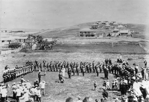
On the coast, alliances existed between tribes, and clans within tribes. The Kuinmurrburra nation had six allied tribes within it; the Kutuburra, Ristebura, Wanuburra, Wuruburra, Pukanburra, and Muinburra, which existed in relative harmony to allow for nature's swinging moods. The island natives did not interact with the mainland Darumbals, for they feared each other and spoke a much different dialect. With the settlement of Yeppoon in the late 1860s, the principal landholder on the Capricorn Coast, Robert Ross, removed the Kanomi population from North Keppel because they were disturbing his cattle.
The last of the Keppel Islanders were forcibly removed by the Queensland Government in 1912. The Darumbal Dreamtime Centre in Rockhampton, adjacent to the Yeppoon turnoff, is the largest Aboriginal cultural centre in Australia.
European settlement
Discovery and exploration
The Capricorn Coast was first explored by James Cook in 1770. He did not make landing in the area however he named several islands and land forms; Cape Capricorn, Keppel Isles, Keppel Bay, Cape Many Fold (later Cape Manifold), and Shoal Water Bay (later Shoalwater Bay).
Matthew Flinders explored the Capricorn Coast in great detail in 1804. Flinders spent the best part of a month in the shallow bays, making landings at Curtis Island, Port Clinton, Shoalwater Bay and Percy Island. Matthew Flinders Drive, a scenic cliffside road that winds through Cooee Bay and up over the top of Wreck Point, is named in his honour.