There are two international borders between Canada and the United States: Canada's border with the northern tier of the contiguous United States to its south (6,416 kilometres or 3,987 miles), and with the U.S. state of Alaska to its northwest (2,475 kilometres or 1,538 miles). The section between Canada and the contiguous United States is the second-longest continuous international border in the world after the Kazakhstan–Russia border, and the two sections together form the longest border by total length.
The boundary (including boundaries in the Pacific coasts, Great Lakes, and Atlantic coasts) is 8,891 kilometres (5,525 mi) long. The bi-national International Boundary Commission deals with matters relating to marking and maintaining the boundary, and the International Joint Commission deals with issues concerning boundary waters. The agencies responsible for facilitating legal passage through the international boundary are the Canada Border Services Agency (CBSA) and U.S. Customs and Border Protection (CBP).
History
18th century
The Treaty of Paris of 1783 ended the American Revolutionary War between Great Britain and the United States. In the second article of the Treaty, the parties agreed on all boundaries of the United States, including, but not limited to, the boundary to the north along what was then British North America. The agreed-upon boundary included the line from the northwest angle of Nova Scotia to the northwesternmost head of the Connecticut River and proceeded down along the middle of the river to the 45th parallel of north latitude.
The parallel had been established in 1763 by King George III as the boundary between the provinces of Quebec and New York (including what would later become the State of Vermont). It was surveyed and marked by John Collins and Thomas Valentine from 1771 to 1773. The St. Lawrence River and the Great Lakes became the boundary further west, between the United States and what is now Ontario. Northwest of Lake Superior, the boundary followed rivers to the Lake of the Woods. From the northwesternmost point of the Lake of the Woods, the boundary was agreed to go straight west until it met the Mississippi River. That line never meets the river, for the river's source is farther south, so the border was eventually drawn from the lake's northwestern point south to the 49th Parallel.
Reading level
Audio Summary
Played with your browser's voice. Studio-quality audio can be added with a text-to-speech service.
Ask about this article
📝 Quick Quiz1 / 4
What is "Canada–United States border" primarily known for?
Vocix Daily — In Your Inbox
Top stories, deep-dive articles, and "On This Day" history — one crisp digest delivered every morning.
Sources & references
Reference material for this entry is drawn from the open encyclopedic record, including Wikipedia , available under the CC BY-SA 4.0 license. Images are credited individually beside each photo.
Jay Treaty (1794)
The Jay Treaty of 1794 (effective 1796) created the International Boundary Commission, which was charged with surveying and mapping the boundary. It also provided for the removal of British forces from Detroit, as well as other frontier outposts on the U.S. side. The Jay Treaty was superseded by the Treaty of Ghent (effective 1815), concluding the War of 1812, which included pre-war boundaries.
19th century
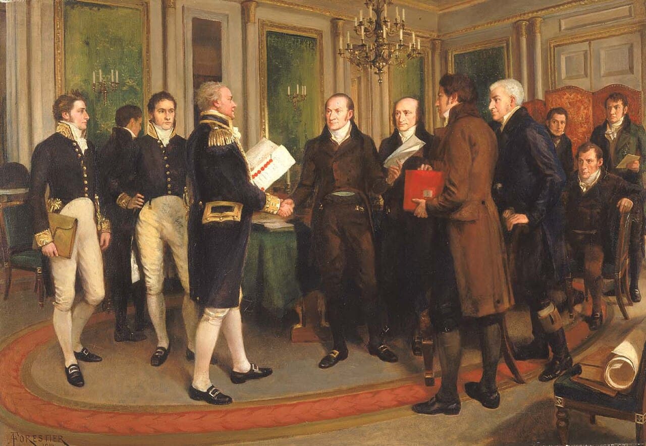
Signed in December 1814, the Treaty of Ghent ended the War of 1812, returning the boundaries of British North America and the United States to the state they were before the war. In the following decades, the United States and the United Kingdom concluded several treaties that settled the major boundary disputes between the two, enabling the border to be demilitarized. The Rush–Bagot Treaty of 1817 provided a plan for demilitarizing the two combatant sides in the War of 1812 and also laid out preliminary principles for drawing a border between British North America and the United States.
The Treaty of 1818 saw the expansion of both British North America and the United States, with their boundary extending westward along the 49th parallel, from the Northwest Angle at Lake of the Woods to the Rocky Mountains. While the Laurentian Divide had previously been agreed to as a border, the flatness of the terrain made it difficult to locate this line. The treaty extinguished British claims to the south of the 49th in the Red River Valley, which was part of Rupert's Land. The treaty also extinguished U.S. claims to land north of the 49th in the watershed of the Missouri River, which was part of the Louisiana Purchase. The border vista theoretically follows the 49th parallel, but in practice, the 19th-century surveyed border markers vary by several hundred feet in spots.
Webster–Ashburton Treaty (1842)
Disputes over the interpretation of the border treaties and mistakes in surveying required additional negotiations, which resulted in the Webster–Ashburton Treaty of 1842. The treaty resolved the Aroostook War, a dispute over the boundary between Maine, New Brunswick, and the Province of Canada. The treaty redefined the border between New Hampshire, Vermont, and New York on the one hand, and the Province of Canada on the other, resolving the Indian Stream dispute and the Fort Blunder dilemma at the outlet to Lake Champlain.
The part of the 45th parallel that separates Quebec from the U.S. states of Vermont and New York had first been surveyed from 1771 to 1773 and markers placed (the Collins–Valentine line) after it had been declared the boundary between New York (including what later became Vermont) and Quebec. It was surveyed again after the War of 1812. The U.S. federal government began to construct fortifications just south of the border at Rouses Point, New York, on Lake Champlain. After a significant portion of the construction was completed, measurements revealed that at that point, the actual 45th parallel was three-quarters of a mile (1.2 km) south of the surveyed line. The fort, which became known as "Fort Blunder", was in Canada, which created a dilemma for the U.S. that was not resolved until a provision of the treaty left the border on the meandering line as surveyed. The border along the Boundary Waters in present-day Ontario and Minnesota between Lake Superior and the Northwest Angle was also redefined.
An 1844 boundary dispute during the Presidency of James K. Polk led to a call for the northern boundary of the U.S. west of the Rockies to be 54°40′N related to the southern boundary of Russia's Alaska Territory. However, the United Kingdom wanted a border that followed the Columbia River to the Pacific Ocean. The dispute was resolved in the Oregon Treaty of 1846, which established the 49th parallel as the boundary through the Rockies.
Boundary surveys (mid–19th century)
The Northwest Boundary Survey (1857–1861) laid out the land boundary. However, the water boundary was not settled for some time. After the Pig War in 1859, arbitration in 1872 established the border between the Gulf Islands and the San Juan Islands.
The International Boundary Survey (or the "Northern Boundary Survey" in the U.S.) began in 1872. Its mandate was to establish the border as agreed to in the Treaty of 1818. Archibald Campbell led the way for the United States, while Donald Cameron, supported by chief astronomer Samuel Anderson, headed the British team. This survey focused on the border from the Lake of the Woods to the summit of the Rocky Mountains.
In 1903, following a dispute that arose because of the Klondike Gold Rush, a joint United Kingdom–Canada–U.S. tribunal established the boundary of southeast Alaska.
On April 11, 1908, it was agreed under Article IV of the "Treaty Between the United States of America and the United Kingdom Concerning the Boundary Between the United States and the Dominion of Canada from the Atlantic Ocean to the Pacific Ocean" to survey and delimit the boundary between Canada and the U.S. through the St. Lawrence River and Great Lakes by modern surveying techniques, which accomplished several changes to the border. In 1925, the International Boundary Commission's temporary mission became permanent for maintaining the survey and mapping of the border, maintaining boundary monuments and buoys, and keeping the border clear of brush and vegetation for 6 m (20 ft), establishing a "border vista" extending for 3 m (10 ft) on each side of the line.
In 1909, under the Boundary Waters Treaty, the International Joint Commission was established for Canada and the U.S. to investigate and approve projects that affect the waters and waterways along the border.
21st century
As a result of the 2001 September 11 attacks, the U.S. declared a level 1 alert at its borders, which required intrusive inspections of all crossing vehicles and passengers, resulting in considerable border congestion. Canada's Chrétien administration worked with the U.S. Bush administration to make the border both more secure and less of an impediment for high-value goods and low-risk travellers; and on December 12, 2001, the Smart Border Declaration was signed. The agreement pioneered border innovations that have become common worldwide, such as cargo and passenger preclearance, the Free and Secure Trade (FAST) program, and the NEXUS trusted traveller program. The cooperation established by the Smart Border initiative made it easier to restrict border traffic during the COVID-19 pandemic in 2020.
2020–2021 closure
On March 21, 2020, in response to the COVID-19 pandemic in Canada and United States, the governments of both nations agreed to close the border for "non-essential" travel for an initial period of 30 days.
The closure was extended 15 times. In mid-June 2021, the Canadian government announced it would ease some entry requirements for fully vaccinated foreign nationals', permanent residents, and Canadian citizens starting on July 5.
The closure finally expired on July 21. In mid-July, the Canadian government announced that fully vaccinated American citizens and permanent residents could visit Canada starting August 9. The American government reopened its land border to fully vaccinated Canadian citizens effective November 8. The 2020–21 closure was reportedly the first long-term blanket closure of the border since the War of 1812.
Business advocacy groups, noting the substantial economic impact of the closure on both sides of the border, called for more nuanced restrictions in place of the blanket ban on non-essential travel. The Northern Border Caucus, a group in the U.S. Congress composed of members from border communities, made similar suggestions to the governments of both countries. Beyond the closure itself, US President Donald Trump also initially suggested the idea of deploying United States military personnel near the border with Canada in connection with the pandemic. He later abandoned the idea following vocal opposition from Canadian officials.
Security
Law enforcement approach
The International Boundary is commonly said to be the world's "longest undefended border"—it is not militarized, although civilian law enforcement is present. It is illegal to cross the border outside border controls, as anyone crossing the border must be checked under immigration and customs laws. The relatively low level of security measures contrasts with the United States–Mexico border, one-third as long as the Canada–U.S. border, which is actively patrolled by U.S. Customs and Border Protection personnel to prevent drug trafficking and illegal immigration.
Parts of the International Boundary cross through mountainous terrain or heavily forested areas, but significant portions also cross remote prairie farmland and the Great Lakes and Saint Lawrence River, in addition to the maritime components of the boundary at the Atlantic, Pacific, and Arctic Ocean. The border runs through the middle of the Mohawk Nation at Akwesasne and even divides some buildings in communities in New England and Quebec. The US Customs and Border Protection identifies the chief issues along the border as domestic and international terrorism, smuggling of illegal drugs and products such as tobacco to evade customs duties, and illegal immigration. A June 2019 U.S. Government Accountability Office report identified specific staffing and resource shortfalls faced by the CBP on the Northern border that adversely affect enforcement actions; the U.S. Border Patrol and CBP Air and Marine Operations identified an insufficient number of agents along the northern border for land, air, and maritime missions. There are eight U.S. Border Patrol sectors, on the Canada–U.S. border, each covering a designated "area of responsibility"; the sectors, from west to east, are based in Blaine, Washington, Spokane, Washington, Havre, Montana, Grand Forks, North Dakota, Detroit, Michigan, Buffalo, New York, Swanton, Vermont, and Houlton, Maine.
Following the September 11 attacks in the United States, security along the border was dramatically tightened by the two countries in both populated and rural areas. Both nations are also actively involved in detailed and extensive tactical and strategic intelligence sharing. In December 2010, Canada and the United States were negotiating an agreement titled "Beyond the Border: A Shared Vision for Perimeter Security and Competitiveness" which would give the U.S. more influence over Canada's border security and immigration controls, and more information would be shared by Canada with the U.S.
Security measures
Residents of both nations who own property adjacent to the border are forbidden to build within the 6-metre-wide (20 ft) boundary vista without permission from the International Boundary Commission. They are required to report such construction to their respective governments.
All persons crossing the border are required to report to the customs agency of the country they have entered. Where necessary, fences or vehicle blockades are used. In remote areas, where staffed border crossings are not available, there are hidden sensors on roads, trails, railways, and wooded areas, which are located near crossing points. There is no border zone; the U.S. Customs and Border Protection routinely sets up checkpoints as far as 100 miles (160 km) into U.S. territory.
In August 2020, the United States constructed 3.8 km (2.4 mi) of short cable fencing along the border between Abbotsford, British Columbia, and Whatcom County, Washington.
Identification
Before 2007, American and Canadian citizens were only required to produce a birth certificate and a driver's license/government-issued identification card when crossing the Canada–United States border.
However, in late 2006, the U.S. Department of Homeland Security (DHS) announced the final rule of the Western Hemisphere Travel Initiative (WHTI), which pertained to new identification requirements for travelers entering the United States. This rule, which marked the first phase of the initiative, was implemented on January 23, 2007, specifying six forms of identification acceptable for crossing the U.S. border (depending on mode):
a valid passport—required to enter by air;
a United States passport card;
an enhanced driver's license—issued by the U.S. States of Michigan, Minnesota, New York, Vermont, and Washington, as well as the Canadian Provinces of British Columbia, Manitoba, Ontario, and Quebec;
a trusted traveler program card (i.e. NEXUS, FAST, or SENTRI);
a valid Merchant Mariner Credential—to be used when traveling in conjunction with official maritime business; and
a valid U.S. military identification card—to be used when traveling on official orders.
The requirement of a passport or an enhanced form of identification to enter the United States by air went into effect in January 2007, and went into effect for those entering the U.S. by land and sea in January 2008. Although the new requirements for land and sea entry went into legal effect in January 2008, their enforcement did not begin until June 2009. Since June 2009, every traveler arriving via a land or sea port-of-entry (including ferries) has been required to present one of the above forms of identification to enter the United States.
Conversely, to cross into Canada, a traveler must also carry identification, as well as a valid visa (if necessary) when crossing the border. Forms of identification include a valid passport, a Canadian Emergency Travel Document, an enhanced driver's license issued by a Canadian province or territory, or an enhanced identification/photo card issued by a Canadian province or territory. Several other documents may be used by Canadians to identify their citizenship at the border, although such documents must be supported with additional photo identification.
Canadian and American citizens who are members of a trusted traveler program such as FAST or NEXUS, may present their FAST or NEXUS card as an alternate form of identification when crossing the international boundary by land or sea, or when arriving by air from only Canada or the United States. Although permanent residents of Canada and the United States are eligible for FAST or NEXUS, they are required to travel with a passport and proof of permanent residency upon arrival at the Canadian border. American permanent residents who are NEXUS members also require an Electronic Travel Authorization when crossing the Canadian border.
Security issues
Smuggling
Smuggling of alcoholic beverages ("rum running") was widespread during the 1920s, when Prohibition was in effect nationally in the United States and parts of Canada.
In more recent years, Canadian officials have brought attention to drug, cigarette, and firearm smuggling from the United States, while U.S. officials have made complaints of drug smuggling via Canada. In July 2005, law enforcement personnel arrested three men who had built a 110-metre (360 ft) tunnel under the border between British Columbia and Washington, intended for the use of smuggling marijuana, the first such tunnel known on this border. From 2007 to 2010, 147 people were arrested for smuggling marijuana on the property of a bed-and-breakfast in Blaine, Washington, but agents estimate that they caught only about 5% of smugglers.
Because of its location, Cornwall, Ontario, experiences ongoing smuggling—mostly of tobacco and firearms from the United States. The neighboring Mohawk territory of Akwesasne straddles the Ontario–Quebec–New York borders, where its First Nations sovereignty prevents Ontario Provincial Police, Sûreté du Québec, Royal Canadian Mounted Police, Canada Border Services Agency, Canadian Coast Guard, United States Border Patrol, United States Coast Guard, and New York State Police from exercising jurisdiction over exchanges taking place within the territory.
2009 border occupation
In May 2009, the Mohawk people of Akwesasne occupied the area around the Canada Border Services Agency port of entry building to protest the Canadian government's decision to arm its border agents while operating on Mohawk territory. The north span of the Seaway International Bridge and the CBSA inspection facilities were closed. During this occupation, the Canadian flag was replaced with the flag of the Mohawk people. Although U.S. Customs remained open to southbound traffic, northbound traffic was blocked on the U.S. side by both American and Canadian officials. The Canadian border at this crossing remained closed for six weeks. On July 13, 2009, the CBSA opened a temporary inspection station at the north end of the north span of the bridge in the city of Cornwall, allowing traffic to once again flow in both directions.
The Mohawk people of Akwesasne have staged ongoing protests at this border. In 2014, they objected to a process that made their crossing more tedious, believing it violated their treaty rights of free passage. When traveling from the U.S. to Cornwall Island, they must first cross a second bridge into Canada for inspection at the new Canadian border station. Discussions between intergovernmental agencies were being pursued on the feasibility of relocating the Canadian border inspection facilities on the U.S. side of the border.