
The Nile is a major north-flowing river in northeast Africa which empties into the Mediterranean Sea. At 7,088 kilometers (4,404 mi) long, it is the longest river in the world, although the volume of water it carries is much smaller than other major rivers such as the Amazon or the Congo. The Nile has played a central role in the environmental, economic, and cultural history of Africa for millennia.
The Nile has two major tributaries: the White Nile and the Blue Nile. The White Nile is longer and is considered to be the headwaters, yet the Blue Nile contributes over twice the volume of the White Nile. The White Nile begins near Lake Victoria and flows through Uganda and South Sudan; while the Blue Nile begins near Lake Tana in Ethiopia and flows into Sudan from the southeast. The two rivers meet at the Sudanese capital of Khartoum. From there, the Nile flows north through the Nubian Desert to Egypt's capital, Cairo, and finally empties into the Mediterranean Sea near Alexandria, where it has formed a large river delta.
Geologically, the Nile is a young river and has followed its present course for about 15,000 years. Its drainage basin extends across eleven countries. Most of the water in the Nile comes from rainfall in the upstream countries Ethiopia, Kenya, Tanzania, and Uganda. Downstream countries – Egypt, Sudan, and South Sudan – are primarily desert, and withdraw river water for irrigation. Other countries that lie wholly or partly in the Nile Basin are Burundi, the Democratic Republic of the Congo, Eritrea, and Rwanda.
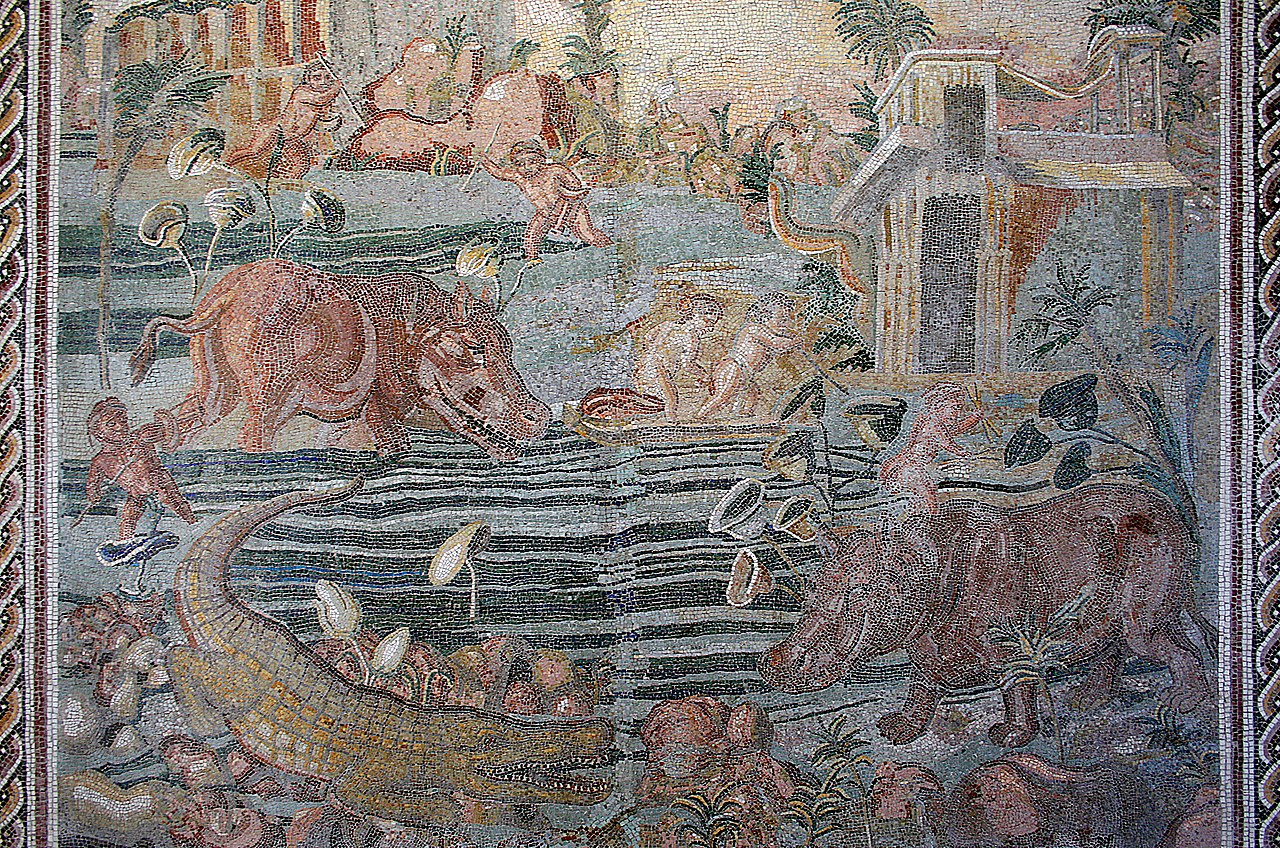
The Nile was the foundation of the Ancient Egyptian civilization, which relied on the river for nearly every aspect of life. The annual flooding of the river deposited nutrient-rich silt along the riverbanks. This soil supported crops that enabled a sophisticated society to thrive in an otherwise inhospitable desert. The Nile facilitated trade, communication, transportation, and governance. South (upstream) of the second Nile cataract lay Nubia, the historical home of the ancient Kerma culture and the Kushite Empire. Many Europeans were fascinated by the Nile, and their explorations around Lake Victoria in the late 19th century located the source of the river. Among the cultures that live along the Nile in the modern era are the Nilotic peoples, semi-nomadic cattle herders who practice nomadic pastoralism, moving their cattle seasonally in response to the Nile's floods.
In the modern era, the Nile plays a critical role in the economies of Egypt and Sudan, which rely on it to irrigate extensive croplands. Since the late 20th century, over a dozen dams have been built in the Nile Basin to provide for irrigation and to generate electricity. The dams have altered the river's annual flood cycle and restricted the transport of silt downstream, causing the Nile Delta to shrink. Some dams – such as the Aswan High Dam and Grand Ethiopian Renaissance Dam – have been the source of international political disputes about water scarcity, safety, food security, and forced displacement of peoples.
Names and etymology
The English word "Nile" is derived from the Latin Nilus and the Ancient Greek Νεῖλος (Neilos), which possibly originated from the Semitic term naḥal, meaning 'river'.

In the ancient Egyptian language, the same word was used for 'Nile' and 'river': jtrw. Egyptians called their country kmt meaning 'black', in reference to the dark color of the Nile floodwaters as they carried sediment from upriver. The English name "Blue Nile" is a translation of the Arabic name Al-Baḥr Al-Azraq.
In the modern era, the river goes by several names within the Nile Basin. In Egypt, it is referred to as Al-Nīl, Baḥr Al-Nīl or Nahr Al-Nīl. In South Sudan, it is sometimes referred to by the Arabic Baḥr el-Jebel, بحر الجبل, literally 'Mountain River'. In Uganda, the speakers of Luganda use the name Kiyira. Some Nubian peoples of Egypt and Sudan use the Nobiin name Áman Dawū ('Great Water').
Several tributaries (smaller rivers that merge into the Nile) and segments of the river incorporate "Nile" in their names, including:

Albert Nile – Segment of the White Nile flowing north from Lake Albert to Nimule
Black Nile – An alternate name for the Atbarah River
Blue Nile – One of the two major tributaries of the Nile

Kyoga Nile – Segment of White Nile from Lake Kyoga to Lake Albert
Main Nile – Segment of the Nile downstream from the confluence of Blue Nile and White Nile
Mountain Nile – Segment of the White Nile from the mountains of Uganda to the plains of South Sudan

Victoria Nile – Segment of White Nile from Lake Victoria to Lake Kyoga
White Nile – One of the two major tributaries of the Nile
Yellow Nile – The Wadi Howar, remnant of an ancient tributary that dried up several thousand years ago

Geography
The Nile is a major river in northeast Africa which flows into the Mediterranean Sea. The Nile Basin is all land that drains into the Nile, and it covers 2,927,843 km2 – about 10% of the African continent (see adjacent map). Eleven countries are wholly or partially within the basin: Burundi, Democratic Republic of the Congo, Egypt, Eritrea, Ethiopia, Kenya, Rwanda, South Sudan, Sudan, Tanzania, and Uganda. The basin covers a wide variety of climates, ecosystems, and topographies – ranging from arid, sandy deserts in the north, to flat, swampy wetlands in the middle, to rainy, forested mountains in the south.
The basin can be divided into seven regions; five of these regions encompass the longest course of the Nile. Proceeding in a downstream sequence, these five regions are: the African Great Lakes, the Mountain Nile, the White Nile, the main Nile, and the Nile Delta. Two additional regions encompass major tributaries: the Blue Nile and the Atbarah River.
African Great Lakes
The African Great Lakes region contains the source of the Nile as well as several large lakes that are part of the Nile River system: Lake Victoria, Lake Albert, Lake George, and Lake Edward. The source of the Nile is the Rukarara River within Rwanda's Nyungwe National Park, and it leads to the Kagera River which drains into Lake Victoria. Although it is a large lake – the second-largest freshwater lake in the world – Lake Victoria is relatively shallow, with an average depth of 40 meters (130 ft). The Nile River first assumes the name "Nile" where Lake Victoria empties on its north side: the stretch from there to Lake Albert is called the Victoria Nile. A pair of waterfalls – Ripon Falls and Owen Falls – were located where the Nile exits Lake Victoria, but have both been submerged by the construction of the Nalubaale dam. After Bujagali Falls and Bujagali Power Station, the Victoria Nile empties into Lake Kyoga. After exiting Lake Kyoga, the river is joined by the River Kafu tributary, then passes over Murchison Falls and flows into Lake Albert. Unlike Lake Victoria, Lake Albert is a deep lake surrounded by mountains. The river exits Lake Albert on its north shore, where it is called the Albert Nile; this stretch of the river is relatively flat and broad, and suitable for navigation by steamboats.
Mountain Nile
The second region of the Nile Basin, proceeding downstream, is the Mountain Nile (Arabic: Bahr al Jabal). This region begins near the town of Nimule, extends to Lake No, and is entirely within South Sudan. After passing through Nimule, the river goes through the Fula Rapids and on to Juba – the capital of South Sudan. After Juba, the Nile passes through the town of Bor, then enters the Sudd, a large swamp located in a flat plain. The incline of the ground in the Sudd is only 1:13,000 rise over run, so the river slows down and widens. Lush vegetation, including sedges, papyrus, and common water hyacinth (an invasive species) clog the waterways and make navigation difficult. At the north edge of the Sudd swamp, the Nile passes through Lake No, a small lake where the Nile is joined by the Bahr el Ghazal River (Arabic: 'gazelle river') – a tributary from the west.
A major tributary in the Mountain Nile region is Bahr el Ghazal which arrives from west Sudan and joins the White Nile at Lake No. The drainage basin of the Bahr el Ghazal River is large – about 860,000 square km – and receives a relatively large amount of rain, but its contribution to the Nile is small compared to other tributaries. Its basin includes Lake Kundi and Lake Keilak. The Bahr el Ghazal passes through the city of Wau, South Sudan: it is a permanent stream east of Wau, but a seasonal stream to the west.
White Nile region
Continuing downstream, the third region of the Nile Basin is the White Nile region which includes an 800 kilometers (500 mi) stretch of river from near Malakal to Khartoum, the capital of Sudan. There it is joined by the Blue Nile. This portion of the river is a wide, calm stream with a fringe of swamps on both banks. The river here is shallow and undergoes significant losses due to evaporation.
Where the White Nile merges with the Blue Nile, they are noticeably distinct colors. The White Nile is a lighter shade because the sediment it carries includes a significant amount of quartz and feldspar. This is in contrast to the Blue Nile which carries dark clay sediments originating from Ethiopia's basaltic rocks.
The Sobat River is a tributary which joins the White Nile near the town of Malakal (after the Bahr el Ghazal confluence, before the Blue Nile). Its basin – which includes the Machar Marshes – covers about 225,000 square km. The Sobat floods between July and December.
Main Nile
The fourth region of the Nile Basin – the main Nile – extends from Khartoum to Cairo, the capital of Egypt. This stretch has a relatively uniform width and depth: about 500 meters (1,600 ft) wide and 10 meters (33 ft) deep at its deepest point (when not in flood). Soon after leaving Khartoum, the river enters the Sabaloka Game Reserve and goes through large, powerful rapids that are impassable by boat. This is the sixth (and furthest upstream) of the six cataracts of the Nile. The Atbarah River – a major tributary – joins the Nile, which then follows a large S-shaped curve to the west. Four more cataracts (numbered 5, 4, 3, and 2) are encountered in this large S-curve, which render the river unnavigable; although ships may travel in certain calm stretches between the cataracts. The river then enters a reservoir: Lake Nasser. This lake – the world's second-largest human-made lake – was formed when the Aswan High Dam was built in Egypt, and inundates more than 480 kilometers (300 mi) of the Nile. The Aswan Low Dam – older and smaller than the High Dam – lies beneath the Aswan High Dam, near the location of the first Nile cataract (now submerged). From these dams, the Nile flows about 800 kilometers (500 mi) through a limestone plateau, bordered by large amounts of irrigated farmland, until it reaches Cairo.
Nile Delta
The fifth, and final, region encompassing the Nile River is the Nile Delta, a large triangular river delta (about 22,000 km2) that extends from Cairo to the Mediterranean Sea. The river splits into two major distributaries (channels) within the delta: the Rosetta branch and the Damietta branch. The total volume of the delta (including the submerged portions) is about 150,000 km3. The delta was created over several million years, built-up from sediment carried down the river from upstream. Since the Aswan High Dam was completed in 1970, the delta has begun to shrink because of erosion from currents in the Mediterranean Sea. In the past, erosion was balanced by new soils arriving in the form of sediment carried by the river; but the dam traps sediment in its reservoir, preventing new soil from reaching the delta.
Blue Nile tributary
The longest course of the Nile – which includes the White Nile tributary – has several other tributaries. The drainage basins of the Blue Nile and the Atbarah comprise the final two regions of the Nile Basin.
The Blue Nile springs from hills in Ethiopia where it originates as a stream named Abay near the town of Gish Abay: Gish is an Amharic word meaning 'source', and Abay is the name of the stream. Gish Abay flows into Lake Tana, a large, shallow lake, which has a single outflow where it adopts the "Blue Nile" name. The river then makes a wide loop: first south, then west through a spectacular gorge 2 kilometers (6,600 ft) deep, then north passing through South Sudan into Sudan, where it joins with the White Nile at Khartoum to form the main Nile. Along its course, the Blue Nile generates electricity at several hydropower plants, including the Tis Abay hydropower project at the Blue Nile Falls, the Grand Ethiopian Renaissance Dam near the border between Ethiopia and South Sudan, the Roseires Dam near the town of Ad Damazin, and the Sennar Dam. The size of the Blue Nile's drainage basin is over 306,000 square km.
Atbarah tributary
The Atbarah River is a tributary of the Nile which arises in northern Ethiopia, and joins the Nile about 320 kilometers (200 mi) north of Khartoum. Its drainage basin covers over 204,000 square km. The Atbarah has a heavy flow during and following the monsoon season in Ethiopia (summer and fall), but can dry up in the winter and spring. Despite the intermittent nature of the river, it provides more than 10% of the total annual flow of the Nile. Dams on the Atbarah include the Khashm el-Girba Dam, the Upper Atbara and Setit Dam Complex, and the Tekezé Dam (on the Tekezé River tributary).
Hydrology
Flow and floods
Although the Nile is the longest river in the world, it does not have the largest discharge. Its flow – about 87 km3 per year – is small compared to other major rivers. The Nile's discharge is only about 1% of the Amazon, 6% of the Congo, and 12% of the Yangtze.
The annual contributions to the main Nile from the three primary tributaries are: 54% from the Blue Nile, 32% from the White Nile (including contributions from the Bahr el Ghazal and Sobat tributaries), and 14% from the Atbarah.
The highlands of the White Nile and Blue Nile both experience seasonal rain, but the White Nile's flow into the main Nile is much more constant than the Blue Nile. This is due to the many lakes and wetlands on the White Nile, which moderate the cyclic effects of seasonal rainfall. As the White Nile passes through the Sudd swamps about half the water is lost to evaporation.
In contrast, the flow of the Blue Nile varies widely through the year: it floods between July and October, due to summer monsoon rains. The waters of the Blue Nile are so substantial during the summer that the White Nile backs up during this time at the confluence. During the summer floods, the contributions to the main Nile are about 70% from the Blue Nile, about 20% from the Atbarah, and about 10% from the White Nile. At the peak of the flood, the daily flow into Lake Nasser is about 0.71 km3, about three times the annual daily average of 0.23 km3 per day.
Prior to the construction of dams on the Nile, the flow of the Nile in Egypt varied seasonally: higher in the summer/fall; lower in the winter/spring. However, following the construction of the Aswan High Dam – which created a reservoir that can hold about two years of river flow – the flow downstream from that dam is now more constant year-round.
Sediment transport
The Nile carries sediment downstream. The movement of sediment is classified as suspended sediment (particles suspended in the water) or bedload (sediment on the river bottom that rolls or tumbles downstream). Ninety-seven percent of the transported sediment carried by the Nile comes from the Atbarah and Blue Nile, both of which originate in Ethiopia. The erosion and transportation of silt only occurs during the Ethiopian rainy season when rainfall is especially high in the Ethiopian Highlands; the rest of the year, the major rivers draining Ethiopia into the Nile have a weaker flow. The soil in the Nile Delta originated as rocks in Ethiopia. The cumulative amount of rock eroded in the past 30 million years from the Ethiopia headwaters of the Nile is about 102,000 km3, which is roughly comparable to the volume of the soil in the Nile Delta (including the underwater portion) which is about 150,000 km3.
Sediment carried by a river into a reservoir can settle in the reservoir and reduce its storage capacity. Sediment accumulated behind the Sennar Dam, Roseires Dam (on the Blue Nile), and Khashm el Girba Dam (on the Atbarah) has significantly reduced the storage capacity of their reservoirs since they were built.
Annual sediment transport measured at several locations are listed below. The bedload percentages are the ratio of bedload sediment to total (bedload and suspended) sediment. This data was collected before the construction of the Grand Ethiopian Renaissance Dam, which has a significant impact on sediment loads downstream of the dam.
Gilgel Abay, Ethiopia : 7.6 million tonnes of suspended, and an additional 0.7% of bedload
El Deim (at the border of Ethiopia and Sudan): 140 million tonnes
Aswan, Egypt: 0.14 million tonnes of suspended, and an additional 28% of bedload
Beni Sweif, Egypt: 0.5 million tonnes of suspended, and an additional 20% of bedload
Qena, Egypt: 0.27 million tonnes of suspended, and an additional 27% of bedload
Sohag, Egypt: 1.5 million tonnes of suspended, and an additional 13% of bedload
Water sources and sinks
As the river moves downstream, it gains volume in some regions and loses volume in other regions. A region is a "source" if the region contributes water; conversely, a region is a "sink" if the region removes water. Identifying sources and sinks is important to scientists who study water movement (hydrology), as well as policy makers who negotiate water sharing issues.
The regions of the Nile Basin that are water sources are the upstream areas including the Ethiopian Highlands and the African Great Lakes region. The water sink areas are generally found in the downstream regions, including South Sudan, Sudan, and Egypt.