
Port Phillip (Kulin: Narm-Narm Naarm Woiwurrung Boonwurrung ) or Port Phillip Bay is a horsehead-shaped enclosed bay on the central coast of southern Victoria, Australia. The bay opens into the Bass Strait via a short, narrow channel known as The Rip, and is completely surrounded by localities of Victoria's two largest cities — metropolitan Greater Melbourne in the bay's main eastern portion north of the Mornington Peninsula, and the city of Greater Geelong in the much smaller western portion (known as the Corio Bay) north of the Bellarine Peninsula. Geographically, the bay covers 1,930 km2 (750 mi2) and the shore stretches roughly 264 km (164 mi), with the volume of water around 25 km3 (6.0 cu mi). Most of the bay is navigable, although it is extremely shallow for its size — the deepest portion is only 24 m (79 ft) and half the bay is shallower than 8 m (26 ft). Its waters and coast are home to seals, whales, dolphins, corals and many kinds of seabirds and migratory waders.
Before European settlement, the area around Port Phillip was divided between the territories of the Wathaurong (west), Wurundjeri (north) and Boonwurrung (south and east) people, all part of the indigenous Kulin nation. The first Europeans to enter the bay were the crews of HMS Lady Nelson, commanded by John Murray and, ten weeks later, HMS Investigator commanded by Matthew Flinders, in 1802. Subsequent expeditions into the bay took place in 1803 to establish the first settlement in Victoria, near Sorrento, but was abandoned in 1804. Thirty years later, settlers from Tasmania returned to establish Melbourne (now Victoria's capital city) at the mouth of the Yarra River in 1835, and Geelong at Corio Bay in 1838. Today, Port Phillip is the most densely populated catchment in Australia with an estimated 5.5 million people living around the bay; Melbourne's suburbs extend around much of the northern and eastern shorelines, and the city of Geelong sprawls around Corio Bay in the bay's western arm.
History
Prehistory
Port Phillip formed between the end of the last Ice Age around 8000 BCE and around 6000 BCE, when the sea-level rose to drown the vast river plains, wetlands and lakes at what was then the lower reaches of the Yarra River. The ancient Yarra and its tributaries (the other present-day rivers of the Port Phillip catchment) flowed down what is now the middle of the bay, formed a coastal lake in the southern reaches of the bay dammed by The Heads, and subsequently pouring out into a closed bay that formed over the western portion of the prehistoric Bassian Plain, which was later completely flooded and became Bass Strait.

The Aboriginal people inhabited the area long before the bay was formed, with evidence of occupation dating at least 40,000 years ago. Settler records indicate an oral history with at least 18,000 years of linearity when Boonwurrung Elder Ningerranarro spoke of his ancestors hunting kangaroo and possum where the Bay now lies. Large piles of semi-fossilised seashells known as middens can still be seen in places around the shoreline, marking the spots where Aboriginal people held feasts. They made a good living from the abundant sea-life, which included penguins and seals. In the cold season, they wore possum-skin cloaks and intricate feathered head-dresses.
A dry period combined with sand bar formation, may have dried the bay out as recently as between 800 BCE and 1000 CE.
Seismicity has been observed around the bay continually since the 1800s with earlier earthquakes recorded in local newspaper reports.

An earthquake that occurred in July 1885 was described in a newspaper.
"The earth-quake appears to have been confined to the southern portion of the colony, and principally to those places bordering on Bass's Straits and Port Phillip Bay. Telegrams to the Argus from Cowes, Flinders, Kangaroo Grounds, Mornington, Queenscliff, Eltham, Lilydale, Shoreham, and Cape Schanck, all mention the earthquake."
Anthonys Nose is an escarpment landform of Devonian granite on the Mornington Peninsula that is located where Arthurs Seat ends as the mountain falls steeply towards Port Phillip and is part of the Selwyn Fault.
European exploration
In 1800, Lieutenant James Grant was the first known European to pass through Bass Strait from west to east in HMS Lady Nelson. He was also the first to see, and crudely chart, the south coast from Cape Banks in South Australia to Wilsons Promontory in Victoria. Grant gave the name "Governor King's Bay" to the body of water between Cape Otway and Wilsons Promontory, but did not venture in and discover Port Phillip.
The first Europeans to find and enter Port Phillip, were the crew of the Lady Nelson, commanded by John Murray, which entered the bay on 15 February 1802. The bay was then known as Narm-Narm by the people of the Kulin tribe, and Murray called the bay Port King after the Governor of New South Wales, Philip Gidley King. On 4 September 1805, King formally renamed it Port Phillip, in honour of his predecessor Arthur Phillip. Murray chose to base the Lady Nelson off what is now known as Sorrento Beach.
During this voyage, Murray records in his journal his first encounter with local Aboriginal peoples. This initially friendly encounter started with trading, eating, and gifting, and was suddenly interrupted by a violent ambush by a large group of Aboriginal people.

"They were all clothed in opossum skins and in each basket a certain quantity of gum was found. ... if we may judge from the number of their fires and other marks this part of the country is not thin of inhabitants. Their spears are of various kinds and all of them more dangerous than any I have yet seen."
The crew in response shot at the Aboriginal people, and continued to shoot at them as they fled, inflicting likely mortal wounds on two of the Aboriginal people. Watching from the boat, Murray ordered grapeshot and round shot to be fired from the carronades aboard the ship at the fleeing Aboriginal people. Murray said "Thus did this treachery and unprovoked attack meet with its just punishment and at the same time taught us a useful lesson to be more cautious in future." After exploring the southern part of the bay, Murray formally took possession of the area on 8 March 1802 for King George III of Great Britain in a small ceremony at a place now known as the Point King Foreshore Reserve in Sorrento. A few days later Murray sailed out of the heads and returned to Sydney.
About ten weeks after Murray, Matthew Flinders in HMS Investigator also found and entered the bay, unaware Murray had been there. The official history of Nicholas Baudin's explorations in Le Géographe claimed they too had sighted the entrance at that time (30 March 1802) but this is almost certainly a later embellishment or error, being absent from the ship's logs and Baudin's own accounts. As a result of Murray's and Flinders' reports, King sent Lieutenant Charles Robbins in HMS Cumberland to explore Port Phillip fully. This surveying party, which included Charles Grimes, produced a mostly complete chart of Port Phillip including the mouth of the Yarra River, which they visited on 2 February 1803. Robbins found Aboriginal habitations and groups of Aboriginal people at Tootgarook, Carrum Carrum, on the banks of the Yarra and at Geelong.

British settlement
King decided to place a convict settlement at Port Phillip, mainly to stake a claim to southern Australia ahead of the French. On 10 October 1803 a convoy of two ships HMS Calcutta and Ocean led by Captain David Collins carrying 402 people (5 Government officials, 9 officers of marines, 2 drummers, and 39 privates, 5 soldiers' wives and a child, and 307 convicts with 17 convicts' wives and 7 children) entered Port Phillip. After some investigation it was decided to establish the settlement at a spot known as Sullivan Bay, very close to where Sorrento now exists. The expedition landed at Sullivan Bay on 17 October 1803, and the first of the "orders" issued by Collins bears that date. On 25 October, the King's birthday, the British flag was hoisted over the tiny settlement and a little salvo of musketry celebrated the royal occasion.
On 25 November the first white child was born in Victoria and was baptised on Christmas Day, receiving the name of William James Hobart Thorne. The first marriage took place on 28 November, when a free woman, Hannah Harvey was wedded to convict Richard Garrett. Small exploratory groups from this settlement surveyed a land route to Western Port and also sailed to the northwest shore of Port Phillip. On this latter journey, a large group of about 200 Aboriginal people came to meet the Britishers with "hostile intentions", and "with the application of fire-arms absolutely necessary to repel them", several Aboriginal people were shot. Lack of fresh water and good timber led this first British attempt at settlement in the region later known as Victoria to be abandoned on 27 January 1804. When Collins left Port Phillip, the Calcutta proceeded to Sydney, and the Ocean to Risdon Cove in Tasmania, where they arrived on 15 February 1804. Prior to abandonment, a group of convicts including William Buckley, escaped from the settlement. Buckley took up residence in a cave near Point Lonsdale on the western side of the bay's entrance, The Rip, and later lived with an Aboriginal Australian group for many years, being given up for dead.
Port Phillip was then left mostly undisturbed until 1835, when settlers from Tasmania led by John Batman and John Pascoe Fawkner (who had been at the Sorrento settlement as a child) established Melbourne on the lower reaches of the Yarra. John Batman encountered William Buckley who then became an important translator in negotiations with the local Aboriginal tribesmen. In 1838 Geelong was founded, and became the main port serving the growing wool industry of the Western District. For a time Geelong rivalled Melbourne as the leading settlement on the bay, but the Gold Rush which began in 1851 gave Melbourne a decisive edge as the largest town in Victoria.

Growth and development of Melbourne
As Melbourne prospered, its wealthy classes discovered the recreational uses of Port Phillip. Bayside suburbs such as St Kilda and Brighton were established on the east shore of the bay. Later, resorts further south such as Sorrento and Portsea became popular. The more swampy western shores of the bay were not so favoured, and have been used mainly for non-residential purposes such as agriculture, the Point Cook Royal Australian Air Force base and the Werribee Sewage Farm, and significant nature reserves. In recent decades the population along the western side of the bay has grown more rapidly.
In the 21st century, property along the Port Phillip coastline continues to be highly sought after. Port Phillip continues to be extensively used for recreational pursuits such as swimming, cycling, boating, and fishing. The bay also features a number of historical walks and fauna reserves. The traditional land owners of the area have also been acknowledged at a number of sites.
Geography
Port Phillip lies in southern Victoria, separated from Bass Strait by the Bellarine Peninsula to the southwest and Mornington Peninsula to the southeast. It is the largest bay in Victoria and one of the largest inland bays in Australia. The narrow entrance to the bay, called the Rip, between Point Lonsdale and Point Nepean, features strong tidal streams made turbulent by the uneven contours of the seabed. The best time for small craft to enter the Rip is at slack water. Large ships require expert local guidance to enter and exit, provided by the Port Phillip maritime pilots. Work has begun to deepen the channel entrance, to allow newer, larger container ships to access Melbourne's docks.
The eastern side of the bay is characterised by sandy beaches extending from St Kilda, Sandringham, Beaumaris, Carrum, and down the Mornington Peninsula to Frankston, Safety Beach/Dromana and Rye to Portsea. Longshore drift carries sand from south to north during winter and from north to south during summer. Cliff erosion control has often resulted in sand starvation, necessitating offshore dredging to replenish the beach. On the western side of the bay there is a greater variety of beach types, including both sandy and sandstone rock beaches, seen at Queenscliff, St Leonards, Indented Head, Portarlington, Altona and Geelong's Eastern Beach. Numerous sandbanks and shoals occur in the southern section of the bay, and parts of the South Channel require occasional maintenance dredging.
Climate
The region has an oceanic climate (Köppen Cfb) with warm summers possessing occasional very hot days due to northerly winds and mild winters. Annual rainfall, which is evenly distributed over the year, shows considerable variation due to the Otway Ranges to the southwest: the northwestern shore of the bay is the driest part of southern Victoria and almost approaches a semi-arid climate (BSk) with a mean annual rainfall as low as 425 millimetres (17 in) (comparable to Nhill or Numurkah), whilst the eastern shores less shielded by the Otways receive as much as 850 millimetres (33 in). Summer temperatures average around 25 °C (77 °F) during the day and 14 °C (57 °F) at night, but occasional northerly winds can push temperatures over 40 °C (104 °F), whilst in winter a typical day will range from 6 °C (43 °F) to 14 °C (57 °F).
Port Phillip is often warmer than the surrounding oceans and/or the land mass, particularly in spring and autumn; this can set up a "bay-effect rain", similar to the "lake effect snow" seen in colder climates, where showers are intensified leeward of the bay (particularly in Melbourne's eastern suburbs).
Beaches
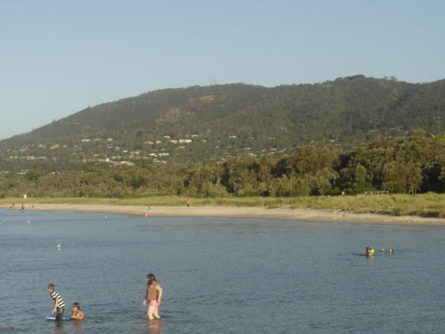
Port Phillip hosts many beaches, most of which are flat, shallow and long, with very small breaks making swimming quite safe. This attracts many tourists, mostly families, to the beaches of Port Phillip during the summer months and school holidays. Water sports such as body boarding and surfing are difficult or impossible, except in extreme weather conditions. However, stand up paddle boarding (SUP), kite surfing and wind surfing are very popular. Most sandy beaches are located on the bay's northern, eastern and southern shorelines, while the western shorelines host a few sandy beaches, there mostly exists a greater variety of beaches, swampy wetlands and mangroves. The occasional pebble beach and rocky cliffs can also be found, mostly in the southern reaches.
Major beaches include: St. Kilda Beach, Brighton Beach, Sandringham Beach, Dromana Beach
Rivers and creeks
Rivers: Yarra River, Maribyrnong River, Patterson River, Little River, Werribee River.
Creeks: Elwood Canal, Mordialloc Creek, Kananook Creek, Sweetwater Creek, Balcombe Creek, Chinamans Creek, Cowies Creek, Hovells Creek, Kororoit Creek.
Islands
Due to its shallow depth, several artificial islands and forts have been built; however, despite the depth, it only hosts a few true islands. Many sandy, muddy banks and shallows exist in its southern reaches, such as Mud Islands, but most islands are located in the marshy shallows of Swan Bay. Some of the bay's major islands include:
Swan Island
Mud Islands
Duck Island
South Channel Fort (artificial)
Pope's Eye (artificial)
Surrounding mountains and hills
Arthurs Seat 314 m
Mount Martha 160 m
Mount Eliza
Olivers Hill
Flinders Peak (You Yangs) 364 m
Surrounding lakes
Albert Park Lake
Cherry Lake
Lake Borrie
Lake Carramar, Lake Illawong and Lake Legana of Patterson Lakes
Lake Connewarre
Lake Victoria
RAAF Lake
Sanctuary Lakes (artificial)
Salt Lagoon